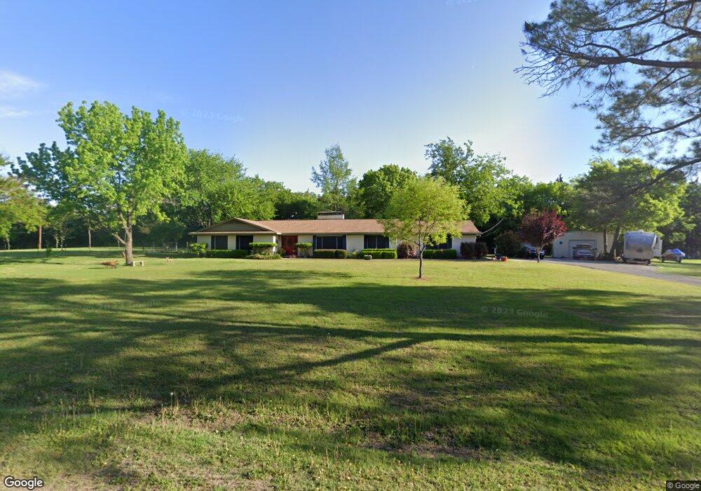
329 Tejas Dr Denison, TX 75020
Estimated Value: $439,879 - $532,000
3
Beds
3
Baths
2,157
Sq Ft
$228/Sq Ft
Est. Value
About This Home
This home is located at 329 Tejas Dr, Denison, TX 75020 and is currently estimated at $491,970, approximately $228 per square foot. 329 Tejas Dr is a home located in Grayson County with nearby schools including Mayes Elementary School, Scott Middle School, and Denison High School.
Ownership History
Date
Name
Owned For
Owner Type
Purchase Details
Closed on
May 30, 2017
Sold by
Mcalister Eldon R
Bought by
Magouirk David and Magouirk Deborah
Current Estimated Value
Purchase Details
Closed on
Feb 18, 2015
Sold by
Abel Gary Curtis
Bought by
Magouirk David E and Magouirk Deborah L
Home Financials for this Owner
Home Financials are based on the most recent Mortgage that was taken out on this home.
Original Mortgage
$168,000
Interest Rate
3.78%
Mortgage Type
New Conventional
Create a Home Valuation Report for This Property
The Home Valuation Report is an in-depth analysis detailing your home's value as well as a comparison with similar homes in the area
Home Values in the Area
Average Home Value in this Area
Purchase History
| Date | Buyer | Sale Price | Title Company |
|---|---|---|---|
| Magouirk David | -- | None Available | |
| Magouirk David E | -- | Red River Title Co |
Source: Public Records
Mortgage History
| Date | Status | Borrower | Loan Amount |
|---|---|---|---|
| Previous Owner | Magouirk David E | $168,000 |
Source: Public Records
Tax History Compared to Growth
Tax History
| Year | Tax Paid | Tax Assessment Tax Assessment Total Assessment is a certain percentage of the fair market value that is determined by local assessors to be the total taxable value of land and additions on the property. | Land | Improvement |
|---|---|---|---|---|
| 2025 | $2,064 | $445,672 | -- | -- |
| 2024 | $6,528 | $405,156 | $0 | $0 |
| 2023 | $2,041 | $368,324 | $0 | $0 |
| 2022 | $5,772 | $334,840 | $0 | $0 |
| 2021 | $5,692 | $304,400 | $90,560 | $213,840 |
| 2020 | $6,105 | $307,454 | $90,560 | $216,894 |
| 2019 | $6,102 | $288,047 | $70,420 | $217,627 |
| 2018 | $5,671 | $264,882 | $63,367 | $201,515 |
| 2017 | $5,297 | $255,918 | $63,367 | $192,551 |
| 2016 | $4,433 | $205,761 | $47,815 | $157,946 |
| 2015 | $2,348 | $202,305 | $45,297 | $157,008 |
| 2014 | $2,460 | $144,489 | $45,303 | $99,186 |
Source: Public Records
Map
Nearby Homes
- 106 Glenwood Dr
- 4135 Helen Dr
- Lot 6, 1088 Waters Edge Dr
- Lot 7, 1070 Waters Edge Dr
- Lot 9, 1036 Waters Edge Dr
- Lot 10, 1014 Waters Edge Dr
- TBD Highland Dr
- 20 Golf Walk Cir
- 334 Golf Walk Cir
- 000 TBD Golf Walk Cir
- Lot 3, 1055 Waters Edge Dr
- Lot 4, 1069 Waters Edge Dr
- Lot 2, 1037 Waters Edge Dr
- Lot 1, 1015 Waters Edge Dr
- Lot 5, 1087 Waters Edge Dr
- 3906 Highland Dr
- 1240 Carla St
- 193 Eisenhower Rd
- 2923 W Parnell St
- 2912 W Elm St