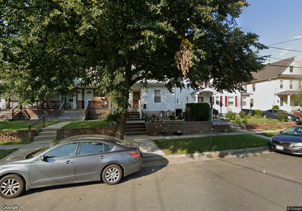
329 Watson Ave Plainfield, NJ 07062
Estimated Value: $323,395 - $465,000
--
Bed
--
Bath
1,081
Sq Ft
$385/Sq Ft
Est. Value
About This Home
This home is located at 329 Watson Ave, Plainfield, NJ 07062 and is currently estimated at $416,599, approximately $385 per square foot. 329 Watson Ave is a home located in Union County with nearby schools including Emerson Community School, Maxson Middle School, and Plainfield High School.
Ownership History
Date
Name
Owned For
Owner Type
Purchase Details
Closed on
Mar 28, 2002
Sold by
Wright Lottie
Bought by
Muir Michael and Muir Audrey
Current Estimated Value
Home Financials for this Owner
Home Financials are based on the most recent Mortgage that was taken out on this home.
Original Mortgage
$127,940
Outstanding Balance
$53,188
Interest Rate
6.85%
Mortgage Type
FHA
Estimated Equity
$363,411
Purchase Details
Closed on
Nov 8, 2001
Sold by
Smith Elsie Wiggins
Bought by
Wright Lottie
Create a Home Valuation Report for This Property
The Home Valuation Report is an in-depth analysis detailing your home's value as well as a comparison with similar homes in the area
Home Values in the Area
Average Home Value in this Area
Purchase History
| Date | Buyer | Sale Price | Title Company |
|---|---|---|---|
| Muir Michael | $129,000 | Chicago Title Insurance Co | |
| Wright Lottie | $75,000 | -- |
Source: Public Records
Mortgage History
| Date | Status | Borrower | Loan Amount |
|---|---|---|---|
| Open | Muir Michael | $127,940 |
Source: Public Records
Tax History Compared to Growth
Tax History
| Year | Tax Paid | Tax Assessment Tax Assessment Total Assessment is a certain percentage of the fair market value that is determined by local assessors to be the total taxable value of land and additions on the property. | Land | Improvement |
|---|---|---|---|---|
| 2025 | $5,685 | $65,100 | $19,600 | $45,500 |
| 2024 | $5,629 | $65,100 | $19,600 | $45,500 |
| 2023 | $5,629 | $65,100 | $19,600 | $45,500 |
| 2022 | $5,507 | $65,100 | $19,600 | $45,500 |
| 2021 | $5,459 | $65,100 | $19,600 | $45,500 |
| 2020 | $5,443 | $65,100 | $19,600 | $45,500 |
| 2019 | $5,443 | $65,100 | $19,600 | $45,500 |
| 2018 | $5,329 | $65,100 | $19,600 | $45,500 |
| 2017 | $5,199 | $65,100 | $19,600 | $45,500 |
| 2016 | $5,093 | $65,100 | $19,600 | $45,500 |
| 2015 | $4,942 | $65,100 | $19,600 | $45,500 |
| 2014 | $4,808 | $65,100 | $19,600 | $45,500 |
Source: Public Records
Map
Nearby Homes
- 1107 North Ave Unit 11
- 1107-11 North Ave
- 343 Netherwood Ave Unit 45
- 1255 Columbia Ave Unit 57
- 258 Netherwood Ave Unit 60
- 1123 E 3rd St Unit 25
- 213 Netherwood Ave Unit 15
- 1206 E 2nd St Unit 8
- 1138-40 Gresham Rd
- 225 Sumner Ave Unit 27
- 823 E 3rd St Unit 25
- 153-55 Leland Ave
- 358-400 E 2nd St
- 1365 Columbia Ave Unit 69
- 836 E 2nd St Unit 38
- 1364 George St
- 808 E 3rd St
- 812 E 6th St
- 633 Woodland Ave Unit 37
- 125 Leland Ave Unit 27
- 331 Watson Ave Unit 33
- 331-33 Watson Ave
- 323 Watson Ave Unit 27
- 335 Watson Ave
- 321 Watson Ave
- 317 Watson Ave Unit 19
- 320 Leland Ave Unit 22
- 332 Leland Ave Unit 332
- 315 Watson Ave
- 343 Watson Ave Unit 45
- 332 Watson Ave Unit 34
- 328 Watson Ave Unit 30
- 313 Watson Ave Unit 13
- 313 Watson Ave
- 336 Watson Ave Unit 38
- 311 Watson Ave Unit 313
- 311 Watson Ave Unit 13
- 324 Watson Ave Unit 26
- 322 Watson Ave
- 310-12 Leland Ave