Estimated Value: $47,000 - $73,000
Studio
--
Bath
--
Sq Ft
10,019
Sq Ft Lot
About This Home
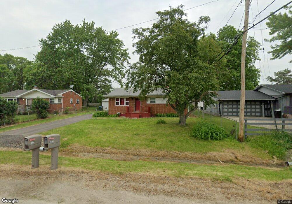
This home is located at 3290 Windland Dr, Flint, MI 48504 and is currently estimated at $62,015. 3290 Windland Dr is a home located in Genesee County with nearby schools including Col. Donald McMonagle Elementary School, Hamady Community Middle/High School, and Eagle's Nest Academy.
Ownership History
Date
Name
Owned For
Owner Type
Purchase Details
Closed on
Oct 15, 2013
Sold by
Bowen April
Bought by
Johnson Tommie
Current Estimated Value
Purchase Details
Closed on
Feb 25, 2009
Sold by
Rayford Johnny L
Bought by
Bowen April and Johnson Tommie
Purchase Details
Closed on
Mar 23, 2001
Sold by
Avery Betty Jean
Bought by
Rayford Johnny L and Rayford Gloria L
Create a Home Valuation Report for This Property
The Home Valuation Report is an in-depth analysis detailing your home's value as well as a comparison with similar homes in the area
Home Values in the Area
Average Home Value in this Area
Purchase History
| Date | Buyer | Sale Price | Title Company |
|---|---|---|---|
| Johnson Tommie | -- | None Available | |
| Bowen April | -- | None Available | |
| Rayford Johnny L | $43,000 | Metropolitan Title Company |
Source: Public Records
Tax History
| Year | Tax Paid | Tax Assessment Tax Assessment Total Assessment is a certain percentage of the fair market value that is determined by local assessors to be the total taxable value of land and additions on the property. | Land | Improvement |
|---|---|---|---|---|
| 2025 | $1,171 | $35,600 | $0 | $0 |
| 2024 | $265 | $26,700 | $0 | $0 |
| 2023 | $253 | $22,000 | $0 | $0 |
| 2022 | $1,167 | $22,500 | $0 | $0 |
| 2021 | $1,184 | $24,800 | $0 | $0 |
| 2020 | $273 | $24,800 | $0 | $0 |
| 2019 | $269 | $24,200 | $0 | $0 |
| 2018 | $1,094 | $22,600 | $0 | $0 |
| 2017 | $1,059 | $23,700 | $0 | $0 |
| 2016 | $1,055 | $23,400 | $0 | $0 |
| 2015 | $906 | $22,000 | $0 | $0 |
| 2014 | $262 | $22,800 | $0 | $0 |
| 2012 | -- | $24,400 | $24,400 | $0 |
Source: Public Records
Map
Nearby Homes
- 3302 Windland Dr
- 3299 W Ridgeway Ave
- 4039 Oconner Rd
- 0 Gracelawn Ave
- 3289 W Hobson Ave
- 4203 Minerva Dr
- 5106 Cloverlawn Dr
- 1909 Cherrylawn Dr
- 3213 N Jennings Rd
- 5905 Cloverlawn Dr
- 2013 Canniff St
- 4184 W Pierson Rd
- 5620 Marlowe Dr
- 3095 Maywood Dr
- 6310 Valorie Ln
- 4702 Warrington Dr
- 1720 Marlowe Dr
- 6414 Valorie Ln
- 3271 W Carpenter Rd
- 1709 W Home Ave
- 3296 Windland Dr
- 3284 Windland Dr
- 3509 Minerva Dr
- 3291 W Pierson Rd
- 3299 W Pierson Rd
- 3515 Minerva Dr
- 3305 W Pierson Rd
- 3316 Windland Dr
- 3310 Windland Dr
- 3281 Windland Dr
- 3291 Windland Dr
- 3297 Windland Dr
- 3311 W Pierson Rd
- 3303 Windland Dr
- 3479 Minerva Dr
- 3311 Windland Dr
- 3319 W Pierson Rd
- 3504 Minerva Dr
- 3290 Spring Valley Dr
- 3296 Spring Valley Dr
Your Personal Tour Guide
Ask me questions while you tour the home.