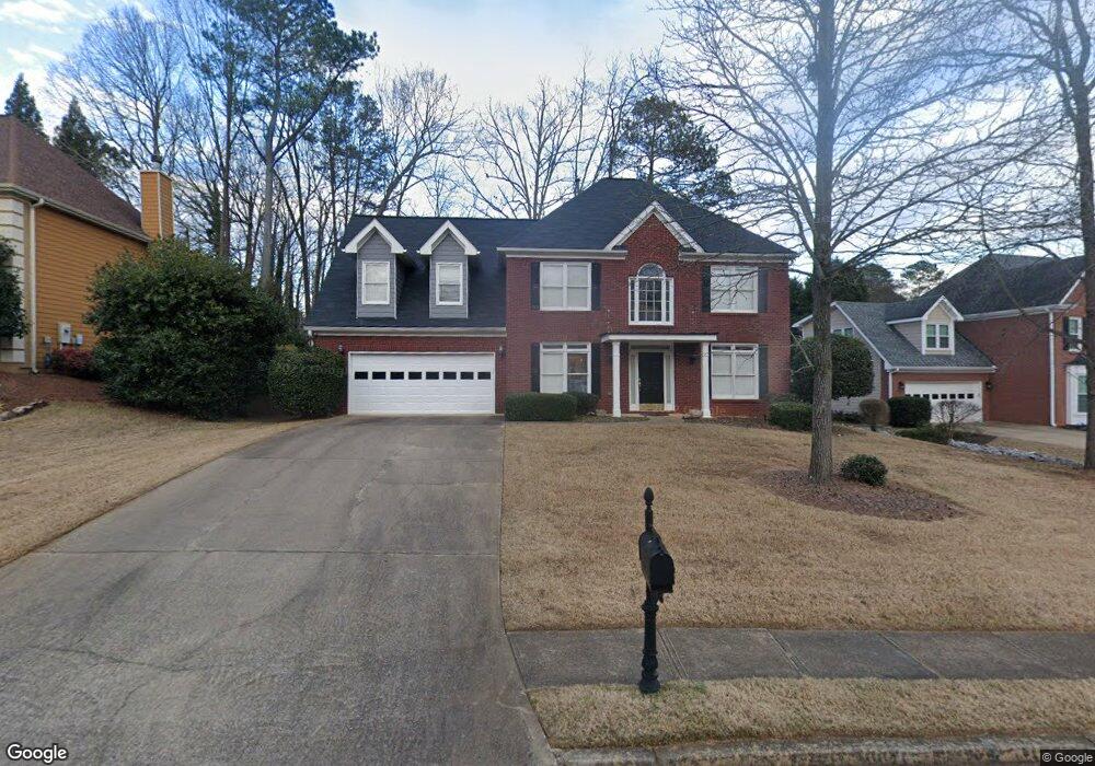
3291 Amesbury Way Unit 2 Duluth, GA 30096
Estimated Value: $548,000 - $594,000
3
Beds
3
Baths
2,972
Sq Ft
$190/Sq Ft
Est. Value
About This Home
This home is located at 3291 Amesbury Way Unit 2, Duluth, GA 30096 and is currently estimated at $565,966, approximately $190 per square foot. 3291 Amesbury Way Unit 2 is a home located in Gwinnett County with nearby schools including B.B. Harris Elementary School, Duluth Middle School, and Duluth High School.
Ownership History
Date
Name
Owned For
Owner Type
Purchase Details
Closed on
May 24, 2005
Sold by
Stanfield Frederick and Stanfield Laurie
Bought by
Sol Justin
Current Estimated Value
Home Financials for this Owner
Home Financials are based on the most recent Mortgage that was taken out on this home.
Original Mortgage
$38,900
Interest Rate
5.24%
Mortgage Type
Unknown
Purchase Details
Closed on
Oct 30, 1997
Sold by
Brentwood Homes Inc
Bought by
Stanfield Frederick and Stanfield Laurie
Home Financials for this Owner
Home Financials are based on the most recent Mortgage that was taken out on this home.
Original Mortgage
$172,900
Interest Rate
7.31%
Mortgage Type
New Conventional
Create a Home Valuation Report for This Property
The Home Valuation Report is an in-depth analysis detailing your home's value as well as a comparison with similar homes in the area
Home Values in the Area
Average Home Value in this Area
Purchase History
| Date | Buyer | Sale Price | Title Company |
|---|---|---|---|
| Sol Justin | $259,900 | -- | |
| Stanfield Frederick | $182,100 | -- |
Source: Public Records
Mortgage History
| Date | Status | Borrower | Loan Amount |
|---|---|---|---|
| Closed | Sol Justin | $38,900 | |
| Open | Sol Justin | $207,900 | |
| Previous Owner | Stanfield Frederick | $172,900 |
Source: Public Records
Tax History Compared to Growth
Tax History
| Year | Tax Paid | Tax Assessment Tax Assessment Total Assessment is a certain percentage of the fair market value that is determined by local assessors to be the total taxable value of land and additions on the property. | Land | Improvement |
|---|---|---|---|---|
| 2025 | $5,544 | $203,560 | $43,880 | $159,680 |
| 2024 | $5,759 | $206,480 | $42,000 | $164,480 |
| 2023 | $5,759 | $193,760 | $38,000 | $155,760 |
| 2022 | $5,116 | $176,800 | $34,000 | $142,800 |
| 2021 | $4,339 | $135,840 | $26,000 | $109,840 |
| 2020 | $4,306 | $132,840 | $26,000 | $106,840 |
| 2019 | $4,188 | $132,840 | $26,000 | $106,840 |
| 2018 | $3,841 | $116,520 | $22,800 | $93,720 |
| 2016 | $3,543 | $101,800 | $20,000 | $81,800 |
| 2015 | $3,576 | $101,800 | $20,000 | $81,800 |
| 2014 | -- | $97,280 | $18,000 | $79,280 |
Source: Public Records
Map
Nearby Homes
- 3056 Oak Hampton Ct
- 3289 Davenport Park Ln
- 2623 Davenham Ln
- 3059 Gavin Place NW
- 3215 Oxwell Dr Unit 1B
- 2678 Hummingbird Dr NW
- 3412 Davenport Park Ln
- 2648 Irene Cir
- 2995 Oxwell Dr Unit 1
- 2702 Davenport Rd
- 2644 Davenport Rd
- 3053 Hartright Bend Ct
- 2829 Cardinal Trace
- 2822 Salem Oak Way
- 2830 Meadow Lark Trail
- 3576 Randy Place
- 2818 Willowstone Dr
- 2888 Cardinal Trace
- 2741 Willowstone Dr
- 2938 Willowstone Dr
- 3301 Amesbury Way Unit 2
- 3281 Amesbury Way Unit 2
- 3212 Oaktree Ct
- 3261 Amesbury Way
- 3320 Oak Hampton Way Unit 1
- 3321 Amesbury Way
- 3207 Oaktree Ct
- 3296 Amesbury Way
- 3306 Amesbury Way
- 3286 Amesbury Way Unit 2
- 3812 Oaktree Ct
- 3310 Oak Hampton Way
- 3251 Amesbury Way Unit 2
- 3276 Amesbury Way
- 3326 Amesbury Way
- 3197 Oaktree Ct
- 3266 Amesbury Way
- 3202 Oaktree Ct NW
- 3202 Oaktree Ct Unit 2
- 3241 Amesbury Way Unit 2