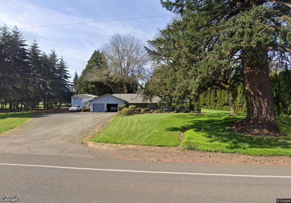
32910 SE Peoria Rd Corvallis, OR 97333
Estimated Value: $586,000 - $596,929
3
Beds
2
Baths
1,687
Sq Ft
$351/Sq Ft
Est. Value
About This Home
This home is located at 32910 SE Peoria Rd, Corvallis, OR 97333 and is currently estimated at $591,465, approximately $350 per square foot. 32910 SE Peoria Rd is a home located in Linn County with nearby schools including Garfield Elementary School, Linus Pauling Middle School, and Corvallis High School.
Ownership History
Date
Name
Owned For
Owner Type
Purchase Details
Closed on
Sep 15, 2025
Sold by
Anderson Sherry C and Anderson Wayne M
Bought by
Wayne M Anderson Living Trust and Anderson
Current Estimated Value
Purchase Details
Closed on
Jun 18, 2021
Sold by
M Alvah And Pauline J Davis Trust and Anderson Sheryl
Bought by
Anderson Wayne M
Purchase Details
Closed on
Jun 17, 2021
Sold by
Anderson Sheryl and M Alvah And Pauline J Davis Tr
Bought by
Anderson Wayne M and Anderson Sherry C
Create a Home Valuation Report for This Property
The Home Valuation Report is an in-depth analysis detailing your home's value as well as a comparison with similar homes in the area
Home Values in the Area
Average Home Value in this Area
Purchase History
| Date | Buyer | Sale Price | Title Company |
|---|---|---|---|
| Wayne M Anderson Living Trust | -- | None Listed On Document | |
| Anderson Wayne M | -- | None Listed On Document | |
| Anderson Wayne M | -- | None Available |
Source: Public Records
Tax History Compared to Growth
Tax History
| Year | Tax Paid | Tax Assessment Tax Assessment Total Assessment is a certain percentage of the fair market value that is determined by local assessors to be the total taxable value of land and additions on the property. | Land | Improvement |
|---|---|---|---|---|
| 2024 | $4,700 | $305,380 | -- | -- |
| 2023 | $4,562 | $296,490 | $0 | $0 |
| 2022 | $4,429 | $287,860 | $0 | $0 |
| 2021 | $4,236 | $279,480 | $0 | $0 |
| 2020 | $3,766 | $271,340 | $0 | $0 |
| 2019 | $3,687 | $263,440 | $0 | $0 |
| 2018 | $3,602 | $255,770 | $0 | $0 |
| 2017 | $3,296 | $248,330 | $0 | $0 |
| 2016 | $3,230 | $241,100 | $0 | $0 |
| 2015 | $3,135 | $234,080 | $0 | $0 |
| 2014 | $3,164 | $227,270 | $0 | $0 |
Source: Public Records
Map
Nearby Homes
- 33125 SE White Oak (#20) Rd Unit 20
- 33125 SE White Oak (#1) Rd Unit 1
- 33125 SE White Oak (#56) Rd Unit 56
- 33125 SE White Oak Rd Unit 5 Rd
- 33125 SE White Oak Rd Unit 21 Rd
- 33125 SE White Oak Rd Unit 17
- 32642 Peoria Rd SW
- 33844 SE White Oak Rd
- 29509 NE Pheasant Ave
- 1249 SE Rivergreen Ave
- 34123 Cushman Rd Unit 1400
- 34123 Cushman Rd Unit 1300
- 34123 Cushman Rd Unit 3 Lots
- 34123 Cushman Rd Unit 1200
- (Near 34123) Rd
- (Near 34123) Cushman (Lot 1400) Rd
- (Near 34123) Cushman (Lot 1300) Rd
- (Near 34123) Cushman (Lot 1200) Rd
- 824 SE Bayshore Cir
- 3565 SE Shoreline Dr
- 32886 SE Peoria Rd
- 32855 SE Peoria Rd
- 32865 SE Peoria Rd
- 32942 SE Peoria Rd
- 32958 SE Peoria Rd
- 32946 SE Peoria Rd
- 33000 SE Peoria Rd
- 32991 SE White Oak Rd
- 32848 Peoria Rd SW
- 32800 Peoria Rd SW
- 33022 SE Peoria Rd
- 33020 SE White Oak Rd
- 33048 SE Peoria Rd
- 33027 SE White Oak Rd
- 33027 SE White Oak Rd
- 33027 SE White Oak Rd
- 33027 SE White Oak Rd
- 33027 SE White Oak Rd
- 33027 SE White Oak Rd
- 33027 SE White Oak Rd