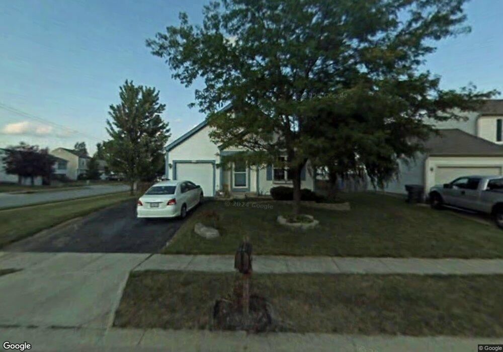
3292 Culloden Ct Reynoldsburg, OH 43068
Independence Village NeighborhoodEstimated Value: $251,835 - $264,000
3
Beds
2
Baths
2,069
Sq Ft
$124/Sq Ft
Est. Value
About This Home
This home is located at 3292 Culloden Ct, Reynoldsburg, OH 43068 and is currently estimated at $256,709, approximately $124 per square foot. 3292 Culloden Ct is a home located in Franklin County with nearby schools including Groveport Madison High School, A+ Arts Academy, and Brice Christian Academy Elementary School.
Ownership History
Date
Name
Owned For
Owner Type
Purchase Details
Closed on
Jun 13, 2009
Sold by
Rector Justin and Rector Rachel
Bought by
Kile John E and Kile Mary Lee
Current Estimated Value
Home Financials for this Owner
Home Financials are based on the most recent Mortgage that was taken out on this home.
Original Mortgage
$80,000
Interest Rate
5.62%
Mortgage Type
Purchase Money Mortgage
Purchase Details
Closed on
Nov 15, 2002
Sold by
Musch Kristi S and Musch Kristi S
Bought by
Rector Justin
Home Financials for this Owner
Home Financials are based on the most recent Mortgage that was taken out on this home.
Original Mortgage
$115,090
Interest Rate
6.22%
Mortgage Type
FHA
Purchase Details
Closed on
Apr 19, 1993
Purchase Details
Closed on
Mar 4, 1993
Create a Home Valuation Report for This Property
The Home Valuation Report is an in-depth analysis detailing your home's value as well as a comparison with similar homes in the area
Home Values in the Area
Average Home Value in this Area
Purchase History
| Date | Buyer | Sale Price | Title Company |
|---|---|---|---|
| Kile John E | $100,500 | Fidelity | |
| Rector Justin | $116,000 | Chicago Title | |
| -- | $83,200 | -- | |
| -- | -- | -- |
Source: Public Records
Mortgage History
| Date | Status | Borrower | Loan Amount |
|---|---|---|---|
| Previous Owner | Kile John E | $80,000 | |
| Previous Owner | Rector Justin | $115,090 |
Source: Public Records
Tax History Compared to Growth
Tax History
| Year | Tax Paid | Tax Assessment Tax Assessment Total Assessment is a certain percentage of the fair market value that is determined by local assessors to be the total taxable value of land and additions on the property. | Land | Improvement |
|---|---|---|---|---|
| 2024 | $2,816 | $66,400 | $17,500 | $48,900 |
| 2023 | $2,789 | $66,395 | $17,500 | $48,895 |
| 2022 | $2,403 | $47,600 | $8,750 | $38,850 |
| 2021 | $2,411 | $47,600 | $8,750 | $38,850 |
| 2020 | $2,415 | $47,600 | $8,750 | $38,850 |
| 2019 | $2,166 | $38,190 | $7,000 | $31,190 |
| 2018 | $2,054 | $38,190 | $7,000 | $31,190 |
| 2017 | $2,047 | $38,190 | $7,000 | $31,190 |
| 2016 | $1,908 | $30,460 | $7,110 | $23,350 |
| 2015 | $1,929 | $30,460 | $7,110 | $23,350 |
| 2014 | $1,951 | $30,460 | $7,110 | $23,350 |
| 2013 | $859 | $32,060 | $7,490 | $24,570 |
Source: Public Records
Map
Nearby Homes
- 3292 Draycott Ct
- 3188 Creighton Place
- 6926 Bennell Dr
- 3358 Cargin Ct
- 3124 Creighton Place
- 3133 Earlington Ln
- 3265 O'Heagra Dr
- 3072 Bocastle Ct
- 6775 Centennial Dr
- 3099 Ambarwent Rd
- 6800 Barker Dr
- 3624 Peany Ln
- 7287 Candlestone Dr
- 6605 Hancock Ct
- 2826-2828 Continental Dr
- 6486 Ethan Dr
- 3021 Sumner Dr
- 2832 Liberty Bell Ln
- 3205 Mahaffey Ct
- 6584 Benjamin Dr
- 3300 Culloden Ct
- 3283 Whitfield Dr
- 3308 Culloden Ct
- 3291 Whitfield Dr
- 6854 Brockland Dr
- 6848 Brockland Dr
- 3299 Whitfield Dr
- 3295 Culloden Ct
- 6860 Brockland Dr
- 3303 Culloden Ct
- 6842 Brockland Dr
- 3316 Culloden Ct
- 3311 Culloden Ct
- 3305 Whitfield Dr
- 6868 Brockland Dr
- 3311 Whitfield Dr
- 6830 Brockland Dr
- 6874 Brockland Dr
- 3322 Culloden Ct
- 3319 Culloden Ct