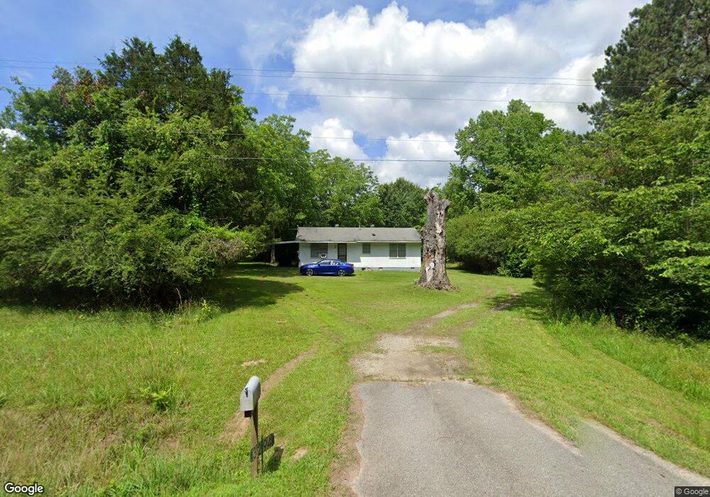
3294 Union Point Rd Union Point, GA 30669
Estimated Value: $107,266 - $496,000
2
Beds
1
Bath
960
Sq Ft
$301/Sq Ft
Est. Value
About This Home
This home is located at 3294 Union Point Rd, Union Point, GA 30669 and is currently estimated at $289,089, approximately $301 per square foot. 3294 Union Point Rd is a home located in Oglethorpe County with nearby schools including Oglethorpe County Primary School, Oglethorpe County Elementary School, and Oglethorpe County Middle School.
Ownership History
Date
Name
Owned For
Owner Type
Purchase Details
Closed on
Jan 18, 2012
Sold by
Mccannon Stephanie Lynne
Bought by
Steele Raymond A
Current Estimated Value
Purchase Details
Closed on
Apr 1, 2005
Sold by
Steele Pope Raymond
Bought by
Steele Jonell Marie
Purchase Details
Closed on
Aug 29, 2001
Sold by
Steele Pope R
Bought by
Steele Jonell Marie
Create a Home Valuation Report for This Property
The Home Valuation Report is an in-depth analysis detailing your home's value as well as a comparison with similar homes in the area
Home Values in the Area
Average Home Value in this Area
Purchase History
| Date | Buyer | Sale Price | Title Company |
|---|---|---|---|
| Steele Raymond A | -- | -- | |
| Steele Raymond A | -- | -- | |
| Steele Raymond A | -- | -- | |
| Steele Jonell Marie | -- | -- | |
| Steele Jonell Marie | -- | -- |
Source: Public Records
Tax History Compared to Growth
Tax History
| Year | Tax Paid | Tax Assessment Tax Assessment Total Assessment is a certain percentage of the fair market value that is determined by local assessors to be the total taxable value of land and additions on the property. | Land | Improvement |
|---|---|---|---|---|
| 2024 | $418 | $19,320 | $3,480 | $15,840 |
| 2023 | $48 | $19,320 | $3,480 | $15,840 |
| 2022 | $367 | $16,120 | $3,480 | $12,640 |
| 2021 | $323 | $13,080 | $3,160 | $9,920 |
| 2020 | $248 | $13,080 | $3,160 | $9,920 |
| 2019 | $325 | $13,080 | $3,160 | $9,920 |
| 2018 | $421 | $13,929 | $2,862 | $11,067 |
| 2017 | $366 | $13,929 | $2,862 | $11,067 |
| 2016 | $358 | $13,929 | $2,862 | $11,067 |
| 2015 | -- | $13,929 | $2,862 | $11,067 |
| 2014 | -- | $13,929 | $2,862 | $11,067 |
| 2013 | -- | $13,929 | $2,862 | $11,067 |
Source: Public Records
Map
Nearby Homes
- 3434 Union Point Rd
- 0 Dogwood Rd
- 1211 Peachtree Ave W
- 0 Woodville Rd Unit 7667944
- 0 Woodville Rd Unit 10628010
- 1110 Woodland Way
- 1110 Woodland Ln
- 5971 Penfield Rd
- 204 Maple St
- 5011 Penfield Rd
- 1101 Boswell Rd
- 1251 Adams Rd
- 181 Lower Wirebridge Rd
- 0 Lower Wirebridge Rd
- 3021 Penfield Rd
- 0 Washington Hwy Unit 7276060
- 0 Bob Smith Rd Unit 24738158
- 75 Bob Smith Rd
- 215 Hunter St
- 1860 Washington Hwy
- 575 Bairdstown Loop
- 3257 Union Point Rd
- 3403 Union Point Rd
- 3403 Union Point Rd
- 3264 Union Point Rd
- 3192 Union Point Rd
- 1121 Bairdstown Rd
- 1193 Bairdstown Rd
- 1381 Community Dr
- 1155 Bairdstown Rd
- 3434 Union Point Rd Unit 3434 Union Point Roa
- 1371 Bairdstown Rd
- 1322 Community Dr
- 72 Bairdstown Rd
- 1801 Bairdstown Rd
- 1328 Community Dr
- 0 Bairdstown Rd Unit 927611
- 1372 Community Dr
- 169 Bairdstown Loop