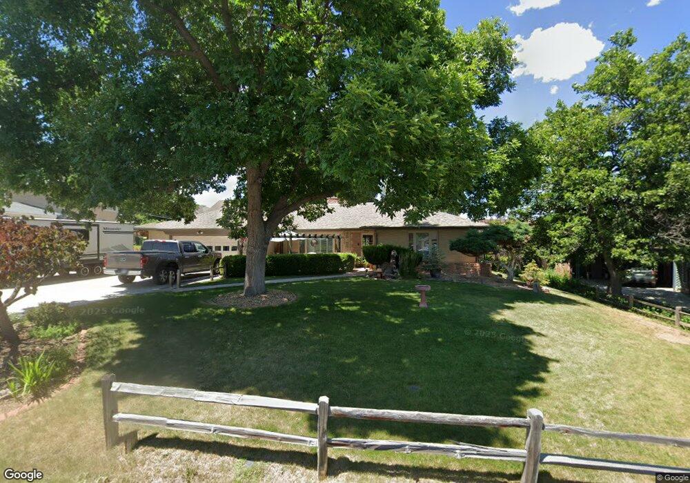
3295 Independence Ct Wheat Ridge, CO 80033
Bel Aire NeighborhoodEstimated Value: $752,554 - $850,000
2
Beds
3
Baths
1,960
Sq Ft
$410/Sq Ft
Est. Value
About This Home
This home is located at 3295 Independence Ct, Wheat Ridge, CO 80033 and is currently estimated at $804,389, approximately $410 per square foot. 3295 Independence Ct is a home located in Jefferson County with nearby schools including Stevens Elementary School, Everitt Middle School, and Wheat Ridge High School.
Ownership History
Date
Name
Owned For
Owner Type
Purchase Details
Closed on
Sep 15, 2000
Sold by
Flory Osterloh Timothy Edwin Osterloh Ann
Bought by
Wickersham William E and Wilson Wickersham Cleotilde M
Current Estimated Value
Home Financials for this Owner
Home Financials are based on the most recent Mortgage that was taken out on this home.
Original Mortgage
$155,000
Outstanding Balance
$55,971
Interest Rate
7.97%
Estimated Equity
$748,418
Purchase Details
Closed on
May 15, 2000
Sold by
Flory Osterloh Timothy Edwin Osterloh Ann
Bought by
Osterloh Timothy Edwin and Osterloh Anne Flory
Create a Home Valuation Report for This Property
The Home Valuation Report is an in-depth analysis detailing your home's value as well as a comparison with similar homes in the area
Home Values in the Area
Average Home Value in this Area
Purchase History
| Date | Buyer | Sale Price | Title Company |
|---|---|---|---|
| Wickersham William E | $249,900 | -- | |
| Osterloh Timothy Edwin | -- | -- |
Source: Public Records
Mortgage History
| Date | Status | Borrower | Loan Amount |
|---|---|---|---|
| Open | Wickersham William E | $155,000 |
Source: Public Records
Tax History Compared to Growth
Tax History
| Year | Tax Paid | Tax Assessment Tax Assessment Total Assessment is a certain percentage of the fair market value that is determined by local assessors to be the total taxable value of land and additions on the property. | Land | Improvement |
|---|---|---|---|---|
| 2024 | $3,537 | $43,865 | $24,023 | $19,842 |
| 2023 | $3,537 | $43,865 | $24,023 | $19,842 |
| 2022 | $2,509 | $32,895 | $16,030 | $16,865 |
| 2021 | $2,547 | $33,841 | $16,491 | $17,350 |
| 2020 | $2,328 | $31,663 | $15,491 | $16,172 |
| 2019 | $2,299 | $31,663 | $15,491 | $16,172 |
| 2018 | $2,118 | $29,084 | $10,048 | $19,036 |
| 2017 | $1,928 | $29,084 | $10,048 | $19,036 |
| 2016 | $1,756 | $26,735 | $9,080 | $17,655 |
| 2015 | $1,372 | $26,735 | $9,080 | $17,655 |
| 2014 | $1,372 | $21,792 | $6,190 | $15,602 |
Source: Public Records
Map
Nearby Homes
- 10005 W 34th Ave
- 10095 W 35th Ave
- 3725 Holland St
- 10340 W 34th Ave
- 31 Skyline Dr
- 9800 W 38th Ave
- 10320 W 35th Ave
- 3865 Independence Ct
- 10151 W 38th Ave
- 10163 W 38th Ave
- 10187 W 38th Ave
- 10169 W 38th Ave
- 3540 Everett St
- 22 Rangeview Dr
- 3220 Estes St
- 3730 Miller Ct
- 3738 Miller Ct
- 3744 Miller Ct
- 8888 W 37th Place
- 3127 Nelson Ct
- 3285 Independence Ct
- 3305 Independence Ct
- 3230 Iris Ct
- 3240 Iris Ct
- 3310 Independence Ct
- 3210 Independence Ct
- 3220 Iris Ct
- 3333 Independence Ct
- 3250 Iris Ct
- 3320 Independence Ct
- 9625 W 32nd Ave
- 3205 Independence Ct
- 3235 Iris Ct
- 3350 Independence Ct
- 3225 Iris Ct
- 3245 Iris Ct
- 3260 Iris Ct
- 3210 Iris Ct
- 3385 Independence Ct
- 3210 N Iris Ct