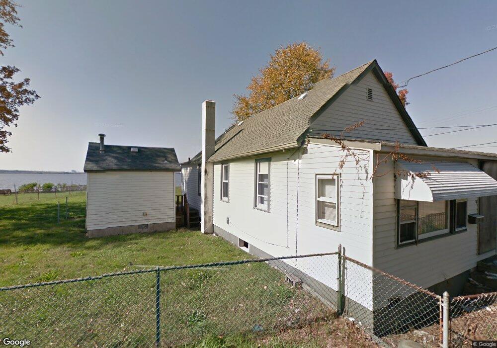
33 Airy Ave Unit 38 Penns Grove, NJ 08069
Estimated Value: $190,000 - $670,152
--
Bed
--
Bath
480
Sq Ft
$896/Sq Ft
Est. Value
About This Home
This home is located at 33 Airy Ave Unit 38, Penns Grove, NJ 08069 and is currently estimated at $430,051, approximately $895 per square foot. 33 Airy Ave Unit 38 is a home located in Salem County with nearby schools including Lafayette-Pershing Elementary School, Paul W. Carleton Elementary School, and Field Street Elementary School.
Ownership History
Date
Name
Owned For
Owner Type
Purchase Details
Closed on
May 15, 2008
Sold by
Donegal Partners Lp
Bought by
Seaboard Landing Llc
Current Estimated Value
Home Financials for this Owner
Home Financials are based on the most recent Mortgage that was taken out on this home.
Original Mortgage
$225,000
Outstanding Balance
$142,715
Interest Rate
5.91%
Mortgage Type
Purchase Money Mortgage
Estimated Equity
$287,336
Purchase Details
Closed on
Aug 25, 2004
Sold by
Sturgis Patricia A
Bought by
Bonner James F and Bonner Ann
Purchase Details
Closed on
Oct 30, 1995
Sold by
Sutter Anna M
Bought by
Sutter Anna M and Sturgis Patricia A
Create a Home Valuation Report for This Property
The Home Valuation Report is an in-depth analysis detailing your home's value as well as a comparison with similar homes in the area
Home Values in the Area
Average Home Value in this Area
Purchase History
| Date | Buyer | Sale Price | Title Company |
|---|---|---|---|
| Seaboard Landing Llc | $550,000 | -- | |
| Donegal Partners Lp | -- | -- | |
| Bonner James F | $200,000 | -- | |
| Sutter Anna M | -- | -- |
Source: Public Records
Mortgage History
| Date | Status | Borrower | Loan Amount |
|---|---|---|---|
| Open | Donegal Partners Lp | $225,000 | |
| Closed | Donegal Partners Lp | $213,948 |
Source: Public Records
Tax History Compared to Growth
Tax History
| Year | Tax Paid | Tax Assessment Tax Assessment Total Assessment is a certain percentage of the fair market value that is determined by local assessors to be the total taxable value of land and additions on the property. | Land | Improvement |
|---|---|---|---|---|
| 2025 | $24,375 | $439,500 | $370,300 | $69,200 |
| 2024 | $23,557 | $439,500 | $370,300 | $69,200 |
| 2023 | $23,557 | $439,500 | $370,300 | $69,200 |
| 2022 | $22,709 | $439,500 | $370,300 | $69,200 |
| 2021 | $21,729 | $439,500 | $370,300 | $69,200 |
| 2020 | $22,015 | $439,500 | $370,300 | $69,200 |
| 2019 | $22,107 | $439,500 | $370,300 | $69,200 |
| 2018 | $21,707 | $538,100 | $446,300 | $91,800 |
| 2017 | $21,782 | $538,100 | $446,300 | $91,800 |
| 2016 | $20,959 | $538,100 | $446,300 | $91,800 |
| 2015 | $20,077 | $538,100 | $446,300 | $91,800 |
| 2014 | $19,856 | $538,100 | $446,300 | $91,800 |
Source: Public Records
Map
Nearby Homes
- 50 Mill St
- 0 W Main Street and Delaware Ave Unit NJSA2009780
- 91 Mill St
- 88 Railroad Ave
- 3 Naylor Ave
- 78 W Harmony St
- 22 Delaware Ave
- 106 Sack Ave
- 35 Franklin St
- 0 Delaware Dr
- 48 Penn St
- 80 S Broad St
- 54 W Pitman St
- 106 S Broad St
- 87 W Pitman St
- 6 W Griffith St
- 49 Delaware Dr
- 15 Walnut St
- 65 S Broad St
- 18 Pearl St