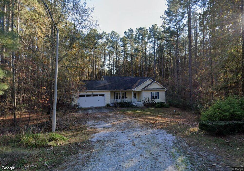
33 Apple Ct Clayton, NC 27527
Estimated Value: $290,000 - $313,000
3
Beds
2
Baths
1,354
Sq Ft
$226/Sq Ft
Est. Value
About This Home
This home is located at 33 Apple Ct, Clayton, NC 27527 and is currently estimated at $305,900, approximately $225 per square foot. 33 Apple Ct is a home with nearby schools including Smithfield Middle School, Smithfield-Selma High School, and Star Christian Academy.
Ownership History
Date
Name
Owned For
Owner Type
Purchase Details
Closed on
Jul 31, 2015
Sold by
Covered Bridge Homes Inc
Bought by
Trent Marilyn K
Current Estimated Value
Home Financials for this Owner
Home Financials are based on the most recent Mortgage that was taken out on this home.
Original Mortgage
$127,100
Outstanding Balance
$99,997
Interest Rate
4.04%
Mortgage Type
New Conventional
Estimated Equity
$205,903
Purchase Details
Closed on
Oct 2, 2014
Sold by
Cbe Development Llc
Bought by
Covered Bridge Homes Inc
Home Financials for this Owner
Home Financials are based on the most recent Mortgage that was taken out on this home.
Original Mortgage
$26,500
Interest Rate
4.17%
Mortgage Type
Purchase Money Mortgage
Create a Home Valuation Report for This Property
The Home Valuation Report is an in-depth analysis detailing your home's value as well as a comparison with similar homes in the area
Home Values in the Area
Average Home Value in this Area
Purchase History
| Date | Buyer | Sale Price | Title Company |
|---|---|---|---|
| Trent Marilyn K | $160,500 | None Available | |
| Covered Bridge Homes Inc | $26,500 | None Available |
Source: Public Records
Mortgage History
| Date | Status | Borrower | Loan Amount |
|---|---|---|---|
| Open | Trent Marilyn K | $127,100 | |
| Previous Owner | Covered Bridge Homes Inc | $26,500 |
Source: Public Records
Tax History
| Year | Tax Paid | Tax Assessment Tax Assessment Total Assessment is a certain percentage of the fair market value that is determined by local assessors to be the total taxable value of land and additions on the property. | Land | Improvement |
|---|---|---|---|---|
| 2025 | $3,813 | $335,940 | $70,000 | $265,940 |
| 2024 | $2,517 | $192,150 | $42,000 | $150,150 |
| 2023 | $2,287 | $192,150 | $42,000 | $150,150 |
| 2022 | $2,325 | $192,150 | $42,000 | $150,150 |
| 2021 | $2,325 | $192,150 | $42,000 | $150,150 |
| 2020 | $2,383 | $192,150 | $42,000 | $150,150 |
| 2019 | $2,383 | $192,150 | $42,000 | $150,150 |
| 2018 | $1,791 | $142,130 | $28,000 | $114,130 |
| 2017 | $1,791 | $142,130 | $28,000 | $114,130 |
| 2016 | $1,791 | $142,130 | $28,000 | $114,130 |
| 2015 | -- | $28,000 | $28,000 | $0 |
Source: Public Records
Map
Nearby Homes
- 116 Norris Creek Dr
- 195 Main St
- 0 Fire Department Rd Unit 751554
- 0 Fire Department Rd Unit 25173580
- 124 S Gallaspy Dr
- 105 Holmes Corner Dr
- 1715 Fire Department Rd
- 170 Johnston Farms Dr
- 235 Eason Creek Way
- 189 Holton St
- 193 Holton St
- 197 Holton St
- 201 Holton St
- 205 Holton St
- 139 Woodglen Dr
- 149 Fox Trot Way
- 204 Holmes Corner Dr
- 110 Carriedelle Ln
- 200 Holmes Corner Dr
- 120 Carriedelle Ln
- 656 Lockwood Dr
- 47 Apple Ct
- 648 Lockwood Dr
- 664 Lockwood Dr
- 634 Lockwood Dr
- 672 Lockwood Dr
- 672 Lockwood Dr Unit Lot70
- 61 Apple Ct
- 628 Lockwood Dr
- 52 Apple Ct
- 42 Apple Ct Unit 92
- 42 Apple Ct
- 618 Lockwood Dr
- 69 Apple Ct
- 60 Apple Ct
- 682 Lockwood Dr
- 643 Lockwood Dr
- 633 Lockwood Dr
- 651 Lockwood Dr
- 661 Lockwood Dr
Your Personal Tour Guide
Ask me questions while you tour the home.