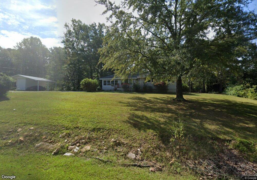
33 Armstrong Dr Carrollton, GA 30117
Estimated Value: $189,008 - $241,000
1
Bed
1
Bath
672
Sq Ft
$321/Sq Ft
Est. Value
About This Home
This home is located at 33 Armstrong Dr, Carrollton, GA 30117 and is currently estimated at $215,502, approximately $320 per square foot. 33 Armstrong Dr is a home located in Carroll County with nearby schools including Mt. Zion Elementary School, Mt. Zion Middle School, and Mt. Zion High School.
Ownership History
Date
Name
Owned For
Owner Type
Purchase Details
Closed on
Aug 20, 2020
Sold by
Wild Deer Llc
Bought by
Cochran Cynthia and Cochran Randall
Current Estimated Value
Purchase Details
Closed on
May 15, 2019
Sold by
Armstrong Charles R
Bought by
Wild Deer Llc
Purchase Details
Closed on
Jul 26, 2016
Sold by
Charles J
Bought by
Armstrong Charles R and Armstrong Alexa
Purchase Details
Closed on
Feb 10, 1998
Sold by
Green Robert D
Bought by
Armstrong Charles J
Purchase Details
Closed on
Oct 26, 1990
Sold by
Johnson
Bought by
Green Robert D
Purchase Details
Closed on
Dec 1, 1986
Bought by
Johnson
Create a Home Valuation Report for This Property
The Home Valuation Report is an in-depth analysis detailing your home's value as well as a comparison with similar homes in the area
Home Values in the Area
Average Home Value in this Area
Purchase History
| Date | Buyer | Sale Price | Title Company |
|---|---|---|---|
| Cochran Cynthia | -- | -- | |
| Wild Deer Llc | -- | -- | |
| Armstrong Charles R | -- | -- | |
| Armstrong Charles J | $25,000 | -- | |
| Green Robert D | $3,200 | -- | |
| Johnson | -- | -- |
Source: Public Records
Tax History Compared to Growth
Tax History
| Year | Tax Paid | Tax Assessment Tax Assessment Total Assessment is a certain percentage of the fair market value that is determined by local assessors to be the total taxable value of land and additions on the property. | Land | Improvement |
|---|---|---|---|---|
| 2024 | $1,069 | $47,256 | $12,000 | $35,256 |
| 2023 | $1,069 | $44,312 | $12,000 | $32,312 |
| 2022 | $952 | $37,950 | $12,000 | $25,950 |
| 2021 | $885 | $34,520 | $12,000 | $22,520 |
| 2020 | $820 | $31,935 | $12,000 | $19,935 |
| 2019 | $787 | $30,408 | $12,000 | $18,408 |
| 2018 | $762 | $29,022 | $12,000 | $17,022 |
| 2017 | $764 | $29,022 | $12,000 | $17,022 |
| 2016 | $667 | $29,766 | $12,000 | $17,766 |
| 2015 | $573 | $20,484 | $10,000 | $10,484 |
| 2014 | $575 | $20,484 | $10,000 | $10,484 |
Source: Public Records
Map
Nearby Homes
- 30 Joshua Way
- 38 Joshua Way
- 35 N Robinson Dr
- 265 Robinson Dr
- 2994 Mount Zion Rd
- 4031 Mount Zion Rd
- LOT 2 Bowdon Junction Rd
- LOT 1 Bowdon Junction Rd
- LOT 6 Bowdon Junction Rd
- 1202 Mount Zion Rd
- 305 Lambert Overlook Cir
- 206 Randall Dr
- 85 Eureka Church Rd Unit 152
- 85 Eureka Church Rd
- The Thomas 2 Plan at Lambert Overlook
- The Thomas Plan at Lambert Overlook
- The Brook Plan at Lambert Overlook
- 141 Anita Blvd
- 304 Kodiak Rd
- 778 Harrison Rd
- 33 Armstrong Dr
- 33 Armstrong Dr
- 33 Armstrong Dr
- 33 Armstrong Dr
- 33 Armstrong Dr
- 33 Armstrong Dr
- 33 Armstrong Dr
- 33 Armstrong Dr
- 33 Armstrong Dr
- 33 Armstrong Dr
- 33 Armstrong Dr
- 33 Armstrong Dr
- 33 Armstrong Dr
- 33 Armstrong Dr
- 33 Armstrong Dr
- 55 Armstrong Dr
- 15 Armstrong Dr
- 27 Armstrong Dr
- 27 Armstrong Rd
- 36 Armstrong Dr