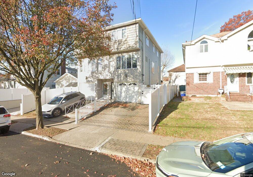
33 Bear St Staten Island, NY 10304
Dongan Hills NeighborhoodEstimated Value: $729,000 - $818,000
2
Beds
3
Baths
1,536
Sq Ft
$496/Sq Ft
Est. Value
About This Home
This home is located at 33 Bear St, Staten Island, NY 10304 and is currently estimated at $762,083, approximately $496 per square foot. 33 Bear St is a home located in Richmond County with nearby schools including P.S. 11 Thomas Dongan School, Is 2 George L Egbert, and New Dorp High School.
Ownership History
Date
Name
Owned For
Owner Type
Purchase Details
Closed on
Jun 29, 2007
Sold by
Lentini Louis and Lentini John V
Bought by
Mann Michelle
Current Estimated Value
Home Financials for this Owner
Home Financials are based on the most recent Mortgage that was taken out on this home.
Original Mortgage
$296,000
Interest Rate
6.41%
Mortgage Type
Purchase Money Mortgage
Purchase Details
Closed on
Apr 20, 2002
Sold by
Lentini John V and Lentini Louis
Bought by
Lentini John V and Lentini Louis
Create a Home Valuation Report for This Property
The Home Valuation Report is an in-depth analysis detailing your home's value as well as a comparison with similar homes in the area
Home Values in the Area
Average Home Value in this Area
Purchase History
| Date | Buyer | Sale Price | Title Company |
|---|---|---|---|
| Mann Michelle | $370,000 | None Available | |
| Lentini John V | -- | Lawyers Title Insurance Corp |
Source: Public Records
Mortgage History
| Date | Status | Borrower | Loan Amount |
|---|---|---|---|
| Previous Owner | Mann Michelle | $296,000 |
Source: Public Records
Tax History Compared to Growth
Tax History
| Year | Tax Paid | Tax Assessment Tax Assessment Total Assessment is a certain percentage of the fair market value that is determined by local assessors to be the total taxable value of land and additions on the property. | Land | Improvement |
|---|---|---|---|---|
| 2025 | $5,620 | $44,160 | $4,994 | $39,166 |
| 2024 | $5,632 | $43,200 | $4,816 | $38,384 |
| 2023 | $5,345 | $27,720 | $4,934 | $22,786 |
| 2022 | $5,247 | $38,100 | $7,080 | $31,020 |
| 2021 | $5,487 | $31,560 | $7,080 | $24,480 |
| 2020 | $5,198 | $31,740 | $7,080 | $24,660 |
| 2019 | $4,829 | $30,420 | $7,080 | $23,340 |
| 2018 | $4,411 | $23,100 | $7,080 | $16,020 |
| 2017 | $4,896 | $25,488 | $6,851 | $18,637 |
| 2016 | $4,560 | $24,358 | $6,416 | $17,942 |
| 2015 | $3,978 | $22,980 | $5,940 | $17,040 |
| 2014 | $3,978 | $22,320 | $5,940 | $16,380 |
Source: Public Records
Map
Nearby Homes
- 119 Raritan Ave
- 34 Bear St
- 137 Delaware Ave
- 102 Burgher Ave
- 91 Alter Ave
- 90 Alter Ave
- 65 Alter Ave
- 163 Cromwell Ave Unit 3B
- 165 Cromwell Ave Unit 3C
- 453 N Railroad Ave
- 0 Hylan Blvd Unit 2405533
- 0 Hylan Blvd Unit 11348978
- 32 Remsen St
- 132 S Railroad Ave
- 1373 Richmond Rd
- 1299 Richmond Rd
- 240 Alter Ave
- 2 Remsen St
- 40 Hancock St
- 76 Jefferson St
- 35 Bear St
- 31 Bear St
- 31 Bear St Unit 1
- 31 Bear St Unit 2
- 116 Atlantic Ave
- 129 Raritan Ave
- 125 Raritan Ave
- 108 Atlantic Ave
- 123 Raritan Ave
- 123 Raritan Ave Unit 2
- 141 Raritan Ave
- 44 Bear St
- 104 Atlantic Ave
- 123 Atlantic Ave
- 119 Atlantic Ave
- 117 Raritan Ave
- 117 Raritan Ave Unit 119
- 145 Raritan Ave
- 138 Atlantic Ave
- 105 Atlantic Ave