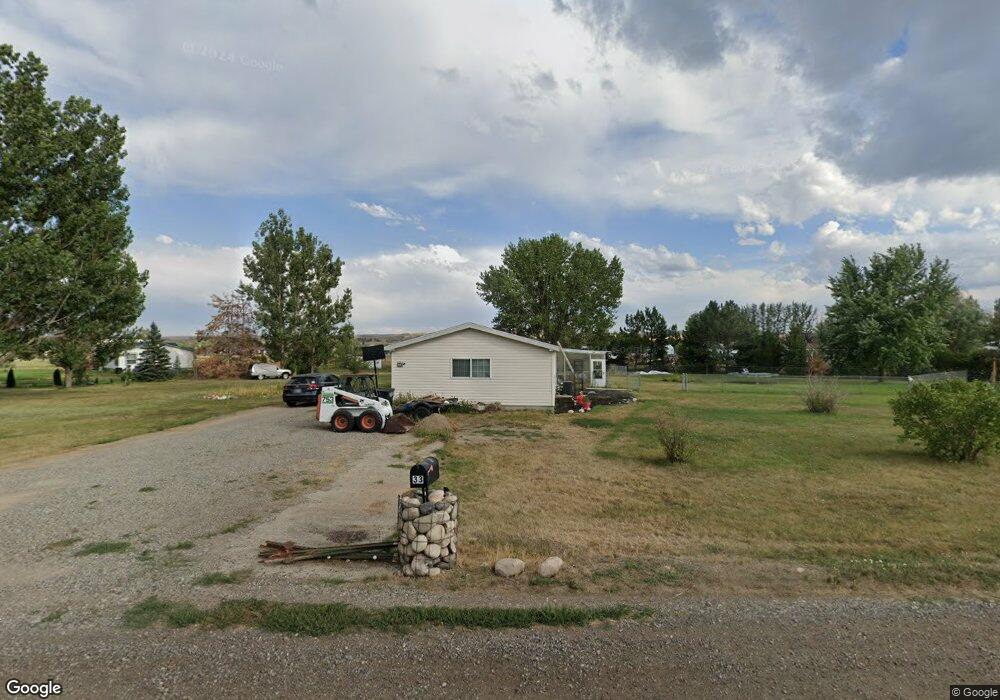
33 Beartooth View Dr Laurel, MT 59044
Estimated Value: $409,000 - $487,577
4
Beds
2
Baths
2,052
Sq Ft
$226/Sq Ft
Est. Value
About This Home
This home is located at 33 Beartooth View Dr, Laurel, MT 59044 and is currently estimated at $464,394, approximately $226 per square foot. 33 Beartooth View Dr is a home located in Carbon County with nearby schools including Fred W. Graff School, West School, and Laurel Middle School.
Ownership History
Date
Name
Owned For
Owner Type
Purchase Details
Closed on
May 1, 2019
Sold by
Kramer Douglas M and Kramer Debra C
Bought by
Stokes Janet D and Gonzalez Krystina K
Current Estimated Value
Home Financials for this Owner
Home Financials are based on the most recent Mortgage that was taken out on this home.
Original Mortgage
$192,000
Outstanding Balance
$168,807
Interest Rate
4.2%
Mortgage Type
New Conventional
Estimated Equity
$295,587
Create a Home Valuation Report for This Property
The Home Valuation Report is an in-depth analysis detailing your home's value as well as a comparison with similar homes in the area
Purchase History
| Date | Buyer | Sale Price | Title Company |
|---|---|---|---|
| Stokes Janet D | $240,000 | First Montana Title |
Source: Public Records
Mortgage History
| Date | Status | Borrower | Loan Amount |
|---|---|---|---|
| Open | Stokes Janet D | $192,000 |
Source: Public Records
Tax History
| Year | Tax Paid | Tax Assessment Tax Assessment Total Assessment is a certain percentage of the fair market value that is determined by local assessors to be the total taxable value of land and additions on the property. | Land | Improvement |
|---|---|---|---|---|
| 2025 | $1,888 | $469,100 | $0 | $0 |
| 2024 | $1,810 | $281,936 | $0 | $0 |
| 2023 | $1,696 | $313,600 | $0 | $0 |
| 2022 | $1,415 | $235,100 | $0 | $0 |
| 2021 | $1,619 | $260,100 | $0 | $0 |
| 2020 | $1,499 | $239,900 | $0 | $0 |
| 2019 | $1,500 | $239,900 | $0 | $0 |
| 2018 | $1,620 | $244,000 | $0 | $0 |
| 2017 | $1,605 | $244,000 | $0 | $0 |
| 2016 | $1,467 | $222,300 | $0 | $0 |
| 2015 | $421 | $225,800 | $0 | $0 |
| 2014 | $437 | $117,076 | $0 | $0 |
Source: Public Records
Map
Nearby Homes
- 615 Clarks River Rd
- 4320 Moser Dome Rd
- 751 Clarks River Rd
- Lot 16 Clarks Point Dr
- 2275 Shay Rd
- 51 Wildflower Cir
- TBD Wold Rd
- 409 Maple Ave
- 2460 Clarks Point Dr
- 208 West Ave
- TBD S Park City Rd Rd
- 120 Forrest Ave
- 211 Woodland Ave
- 10 Cc Ln
- 9 & 10 Cc Ln
- 102 8th Ave Unit B
- 3801 Spring Creek Rd
- 2907 Clarks Point Dr
- 310 (and 814 w 4) 8th Ave
- 319 6th Ave
- 30 Beartooth View Dr
- 7 Rogers Place
- 11 Rogers Place
- 43 Beartooth View Dr
- 21 Beartooth View Dr
- 38 Beartooth View Dr
- 6 Henrys Place
- 6 Rogers Place
- 44 Beartooth View Dr
- 5 Henrys Place
- 3150 Us Highway 212 S
- 5086 Us Highway 310
- 2 Rogers Place
- 8 Beartooth Ct
- 2 Henrys Place
- 20 Beartooth Way
- 28 Beartooth Way
- 10 Beartooth Way
- 14 Beartooth Way
- 48 Beartooth View Dr
Your Personal Tour Guide
Ask me questions while you tour the home.