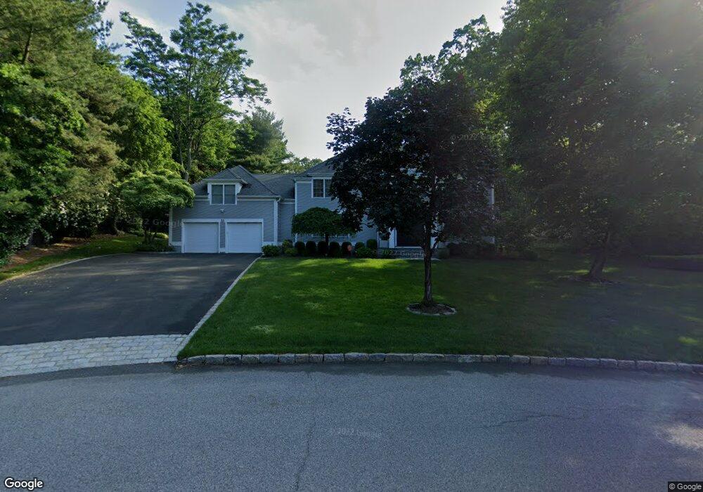
33 Benedict Rd Scarsdale, NY 10583
Secor Farms NeighborhoodEstimated Value: $2,875,000 - $3,065,000
5
Beds
5
Baths
4,129
Sq Ft
$715/Sq Ft
Est. Value
About This Home
This home is located at 33 Benedict Rd, Scarsdale, NY 10583 and is currently estimated at $2,950,193, approximately $714 per square foot. 33 Benedict Rd is a home located in Westchester County with nearby schools including Scarsdale Middle School, Scarsdale High School, and Kodomono Kuni School.
Ownership History
Date
Name
Owned For
Owner Type
Purchase Details
Closed on
Aug 26, 2009
Sold by
Lieberman Carolyn Tillman
Bought by
Levy Eric and Levy Liza
Current Estimated Value
Home Financials for this Owner
Home Financials are based on the most recent Mortgage that was taken out on this home.
Original Mortgage
$729,000
Outstanding Balance
$480,863
Interest Rate
5.36%
Mortgage Type
New Conventional
Estimated Equity
$2,469,330
Purchase Details
Closed on
May 24, 2002
Sold by
Lieberman James Sanford and Lieberman Carolyn Tillman
Bought by
Lieberman Carolyn Tillman
Home Financials for this Owner
Home Financials are based on the most recent Mortgage that was taken out on this home.
Original Mortgage
$150,000
Interest Rate
6.61%
Mortgage Type
Credit Line Revolving
Create a Home Valuation Report for This Property
The Home Valuation Report is an in-depth analysis detailing your home's value as well as a comparison with similar homes in the area
Home Values in the Area
Average Home Value in this Area
Purchase History
| Date | Buyer | Sale Price | Title Company |
|---|---|---|---|
| Levy Eric | $1,473,675 | First Amer Title Ins Co Ny | |
| Lieberman Carolyn Tillman | -- | Commonwealth Land Title Ins |
Source: Public Records
Mortgage History
| Date | Status | Borrower | Loan Amount |
|---|---|---|---|
| Open | Levy Eric | $729,000 | |
| Previous Owner | Lieberman Carolyn Tillman | $150,000 |
Source: Public Records
Tax History Compared to Growth
Tax History
| Year | Tax Paid | Tax Assessment Tax Assessment Total Assessment is a certain percentage of the fair market value that is determined by local assessors to be the total taxable value of land and additions on the property. | Land | Improvement |
|---|---|---|---|---|
| 2024 | $49,519 | $1,800,000 | $1,075,000 | $725,000 |
| 2023 | $47,779 | $1,800,000 | $1,075,000 | $725,000 |
| 2022 | $36,086 | $1,800,000 | $1,075,000 | $725,000 |
| 2021 | $44,463 | $1,800,000 | $1,075,000 | $725,000 |
| 2020 | $44,029 | $1,800,000 | $1,075,000 | $725,000 |
| 2019 | $43,674 | $1,800,000 | $1,075,000 | $725,000 |
| 2018 | $51,137 | $1,800,000 | $1,075,000 | $725,000 |
| 2017 | $0 | $1,800,000 | $1,075,000 | $725,000 |
| 2016 | $40,748 | $1,800,000 | $1,075,000 | $725,000 |
| 2015 | -- | $1,715,000 | $847,000 | $868,000 |
| 2014 | -- | $1,715,000 | $847,000 | $868,000 |
| 2013 | -- | $25,950 | $5,000 | $20,950 |
Source: Public Records
Map
Nearby Homes
- 3 Rock Meadow Ln
- 2 Rock Meadow Ln
- 82 Spier Rd
- 32 Benedict Rd
- 84 Spier Rd
- 1 Boulder Brook Rd
- 34 Benedict Rd
- 34 Benedict Rd Unit A
- 48 Springdale Rd
- 86 Spier Rd
- 36 Benedict Rd
- 2 Boulder Brook Rd
- 7 Boulder Brook Rd
- 56 Sycamore Rd
- 4 Boulder Brook Rd
- 52 Sycamore Rd
- 50 Sycamore Rd
- 44 Springdale Rd
- 42 Springdale Rd
- 81 Spier Rd