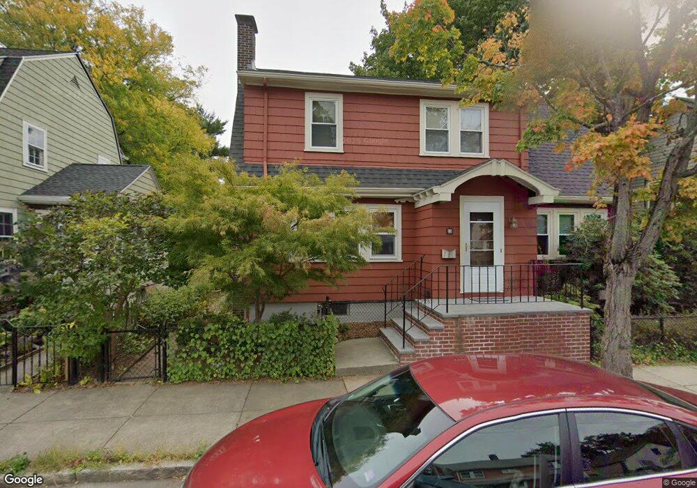
33 Bournedale Rd Jamaica Plain, MA 02130
Jamaica Plain NeighborhoodEstimated Value: $772,000 - $1,026,000
3
Beds
1
Bath
1,478
Sq Ft
$599/Sq Ft
Est. Value
About This Home
This home is located at 33 Bournedale Rd, Jamaica Plain, MA 02130 and is currently estimated at $885,298, approximately $598 per square foot. 33 Bournedale Rd is a home located in Suffolk County with nearby schools including Brooke Charter School Roslindale, The Croft School - Jamaica Plain, and St. Clare High School.
Ownership History
Date
Name
Owned For
Owner Type
Purchase Details
Closed on
Jul 1, 2020
Sold by
Morong Susan G and Movelle Mary M
Bought by
Movelle Mary M
Current Estimated Value
Purchase Details
Closed on
Jun 11, 1998
Sold by
Raab Jonathan and Raab Ingrid
Bought by
Morong Susan G and Movelle Mary M
Purchase Details
Closed on
Aug 17, 1989
Sold by
Shaffer Nathan
Bought by
Raab Jonathan
Create a Home Valuation Report for This Property
The Home Valuation Report is an in-depth analysis detailing your home's value as well as a comparison with similar homes in the area
Home Values in the Area
Average Home Value in this Area
Purchase History
| Date | Buyer | Sale Price | Title Company |
|---|---|---|---|
| Movelle Mary M | -- | None Available | |
| Movelle Mary M | -- | None Available | |
| Morong Susan G | $213,500 | -- | |
| Raab Jonathan | $164,750 | -- |
Source: Public Records
Mortgage History
| Date | Status | Borrower | Loan Amount |
|---|---|---|---|
| Previous Owner | Raab Jonathan | $95,000 | |
| Previous Owner | Raab Jonathan | $176,000 | |
| Previous Owner | Raab Jonathan | $30,000 | |
| Previous Owner | Raab Jonathan | $175,500 |
Source: Public Records
Tax History Compared to Growth
Tax History
| Year | Tax Paid | Tax Assessment Tax Assessment Total Assessment is a certain percentage of the fair market value that is determined by local assessors to be the total taxable value of land and additions on the property. | Land | Improvement |
|---|---|---|---|---|
| 2025 | $9,263 | $799,900 | $234,800 | $565,100 |
| 2024 | $8,948 | $820,900 | $225,400 | $595,500 |
| 2023 | $8,238 | $767,000 | $210,600 | $556,400 |
| 2022 | $7,653 | $703,400 | $193,100 | $510,300 |
| 2021 | $7,288 | $683,000 | $187,500 | $495,500 |
| 2020 | $6,064 | $574,200 | $183,500 | $390,700 |
| 2019 | $5,765 | $547,000 | $151,200 | $395,800 |
| 2018 | $5,117 | $488,300 | $151,200 | $337,100 |
| 2017 | $5,072 | $478,900 | $151,200 | $327,700 |
| 2016 | $5,165 | $469,500 | $151,200 | $318,300 |
| 2015 | $5,209 | $430,100 | $145,200 | $284,900 |
| 2014 | $4,738 | $376,600 | $145,200 | $231,400 |
Source: Public Records
Map
Nearby Homes
- 50 Southbourne Rd
- 18-20 Northbourne Rd Unit 18
- 31 Rodman St Unit 2
- 31 Rodman St Unit 1
- 158 Wachusett St Unit 3
- 348-350 Hyde Park Ave Unit 2
- 140 Wachusett St
- 178 Hyde Park Ave Unit 3
- 71 Wyvern St
- 24 Waterman Rd
- 19 Delford St
- 19 Delford St Unit 1
- 36 Neponset Ave Unit 1
- 143-171 Hyde Park Ave Unit 169A
- 105 Neponset Ave Unit 105
- 103 Neponset Ave Unit 103A
- 103-105 Neponset Ave
- 4012 Washington St
- 602 Canterbury St Unit 14
- 602 Canterbury St Unit 4
- 37 Bournedale Rd
- 27 Bournedale Rd
- 68 Southbourne Rd
- 68 Southbourne Rd Unit 9999
- 41 Bournedale Rd Unit 2
- 41 Bournedale Rd Unit 1
- 41 Bournedale Rd
- 70 Southbourne Rd
- 23 Bournedale Rd
- 66 Southbourne Rd
- 66 Southbourne Rd Unit 66
- 32 Bournedale Rd
- 34 Bournedale Rd
- 72 Southbourne Rd
- 28 Bournedale Rd
- 64 Southbourne Rd
- 82 Southbourne Rd
- 80 Southbourne Rd
- 74 Southbourne Rd
- 36 Bournedale Rd