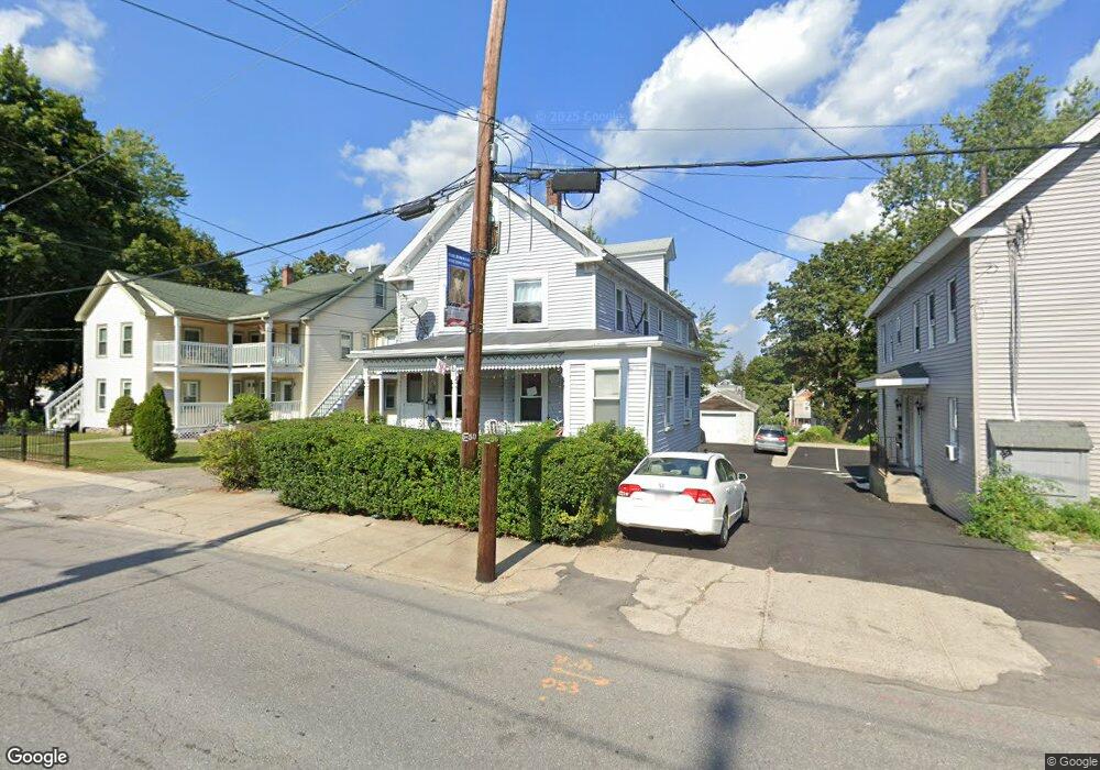
33 Broad St Marlborough, MA 01752
French Hill NeighborhoodEstimated Value: $677,000 - $833,543
6
Beds
3
Baths
1,924
Sq Ft
$379/Sq Ft
Est. Value
About This Home
This home is located at 33 Broad St, Marlborough, MA 01752 and is currently estimated at $728,386, approximately $378 per square foot. 33 Broad St is a home located in Middlesex County with nearby schools including Marlborough High School, Advanced Math & Science Academy, and New Covenant Christian School.
Ownership History
Date
Name
Owned For
Owner Type
Purchase Details
Closed on
Jul 15, 2002
Sold by
Monfalcone Joseph A and Monfalcone Christine
Bought by
Rooney Frederick P
Current Estimated Value
Home Financials for this Owner
Home Financials are based on the most recent Mortgage that was taken out on this home.
Original Mortgage
$309,676
Outstanding Balance
$132,022
Interest Rate
6.79%
Mortgage Type
Purchase Money Mortgage
Estimated Equity
$596,364
Purchase Details
Closed on
May 21, 1993
Sold by
Roy Yvonne
Bought by
Seymour Robert C and Seymour Dorothy A
Home Financials for this Owner
Home Financials are based on the most recent Mortgage that was taken out on this home.
Original Mortgage
$56,800
Interest Rate
7.54%
Mortgage Type
Purchase Money Mortgage
Create a Home Valuation Report for This Property
The Home Valuation Report is an in-depth analysis detailing your home's value as well as a comparison with similar homes in the area
Home Values in the Area
Average Home Value in this Area
Purchase History
| Date | Buyer | Sale Price | Title Company |
|---|---|---|---|
| Rooney Frederick P | $338,000 | -- | |
| Seymour Robert C | $71,000 | -- |
Source: Public Records
Mortgage History
| Date | Status | Borrower | Loan Amount |
|---|---|---|---|
| Open | Rooney Frederick P | $309,676 | |
| Previous Owner | Seymour Robert C | $25,000 | |
| Previous Owner | Seymour Robert C | $99,750 | |
| Previous Owner | Seymour Robert C | $27,400 | |
| Previous Owner | Seymour Robert C | $56,800 |
Source: Public Records
Tax History Compared to Growth
Tax History
| Year | Tax Paid | Tax Assessment Tax Assessment Total Assessment is a certain percentage of the fair market value that is determined by local assessors to be the total taxable value of land and additions on the property. | Land | Improvement |
|---|---|---|---|---|
| 2025 | $5,391 | $546,800 | $160,500 | $386,300 |
| 2024 | $5,421 | $529,400 | $145,900 | $383,500 |
| 2023 | $5,494 | $476,100 | $114,800 | $361,300 |
| 2022 | $5,440 | $414,600 | $109,300 | $305,300 |
| 2021 | $1,658 | $377,800 | $89,100 | $288,700 |
| 2020 | $1,591 | $346,000 | $86,800 | $259,200 |
| 2019 | $1,438 | $332,200 | $85,100 | $247,100 |
| 2018 | $1,369 | $271,200 | $76,100 | $195,100 |
| 2017 | $3,753 | $245,000 | $76,000 | $169,000 |
| 2016 | $3,654 | $238,200 | $76,000 | $162,200 |
| 2015 | $3,040 | $192,900 | $80,500 | $112,400 |
Source: Public Records
Map
Nearby Homes
- 30 Broad St Unit 104
- 11 Paris St
- 8 Saint Mary's Way Unit 8
- 76 Broad St
- 30A Winter Ave
- 156 Chestnut St
- 72 Chestnut St
- 32 Water St
- 118 Elm St
- 38 Gleason Street Extension
- 52 Norwood St
- 61 Fairmount St Unit 11
- 29 Elm St
- 272 Lincoln St Unit 101
- 272 Lincoln St Unit 103
- 272 Lincoln St Unit 104
- 27 Jefferson St
- 27 Jefferson St Unit 204
- 2 Adams St
- 240 Lincoln St
- 27 Broad St
- 25 Broad St
- 25 Broad St Unit 1
- 25 Broad St Unit 2
- 25 Broad St Unit 7
- 37 Broad St
- 21 Broad St
- 21 Broad St Unit 1
- 21 Broad St Unit 2
- 18A Grant St Unit 1
- 18 Grant St Unit A
- 28 Grant St
- 36 Grant St
- 36 Grant St Unit 36A
- 36 Grant St Unit 2
- 19 Broad St Unit 5
- 22 Grant St
- 22 Grant St Unit 2
- 49 Broad St
- 28 Broad St Unit 207