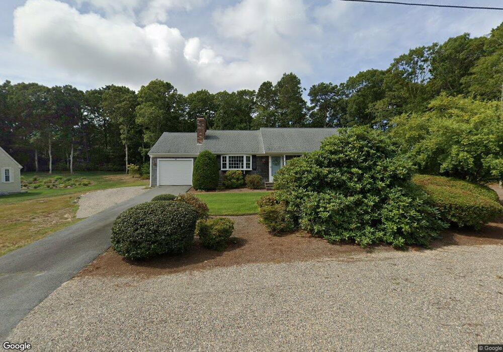
33 Captain Walsh Rd Dennis, MA 02638
East Dennis NeighborhoodEstimated Value: $664,000 - $710,000
3
Beds
2
Baths
1,244
Sq Ft
$546/Sq Ft
Est. Value
About This Home
This home is located at 33 Captain Walsh Rd, Dennis, MA 02638 and is currently estimated at $679,801, approximately $546 per square foot. 33 Captain Walsh Rd is a home located in Barnstable County with nearby schools including Dennis-Yarmouth Regional High School.
Ownership History
Date
Name
Owned For
Owner Type
Purchase Details
Closed on
Dec 19, 2014
Sold by
Turcketta Ellen M and Ward Richard J
Bought by
Troutman Peter D and Troutman Martha
Current Estimated Value
Purchase Details
Closed on
Jun 30, 1987
Sold by
Otoole Brian G
Bought by
Ward James
Create a Home Valuation Report for This Property
The Home Valuation Report is an in-depth analysis detailing your home's value as well as a comparison with similar homes in the area
Home Values in the Area
Average Home Value in this Area
Purchase History
| Date | Buyer | Sale Price | Title Company |
|---|---|---|---|
| Troutman Peter D | $300,000 | -- | |
| Ward James | $149,000 | -- |
Source: Public Records
Tax History Compared to Growth
Tax History
| Year | Tax Paid | Tax Assessment Tax Assessment Total Assessment is a certain percentage of the fair market value that is determined by local assessors to be the total taxable value of land and additions on the property. | Land | Improvement |
|---|---|---|---|---|
| 2025 | $2,512 | $580,200 | $162,400 | $417,800 |
| 2024 | $2,401 | $546,900 | $156,100 | $390,800 |
| 2023 | $2,344 | $502,000 | $141,900 | $360,100 |
| 2022 | $2,287 | $408,400 | $142,100 | $266,300 |
| 2021 | $2,197 | $364,300 | $139,300 | $225,000 |
| 2020 | $2,095 | $343,400 | $139,300 | $204,100 |
| 2019 | $1,976 | $320,300 | $136,600 | $183,700 |
| 2018 | $1,813 | $286,000 | $117,000 | $169,000 |
| 2017 | $1,725 | $280,500 | $117,000 | $163,500 |
| 2016 | $1,760 | $269,600 | $130,000 | $139,600 |
| 2015 | $1,725 | $269,600 | $130,000 | $139,600 |
| 2014 | $1,712 | $269,600 | $130,000 | $139,600 |
Source: Public Records
Map
Nearby Homes
- 32 Captain Walsh Dr
- 15 Trudy Cir
- 52 Uncle Bobs Way
- 17 Margate Ln
- 153 Bayridge Dr
- 102 Prince Way
- 4 Ebb Rd
- 35 Crown Grant Dr
- 4 Maureens Way
- 6 Thomas Ct
- 15 Signal Hill Dr
- 268 Main St
- 13 Covey Dr
- 59 Main St Unit 19-2
- 59 Route 6a Unit 29-4
- 38 Greenland Cir
- 59 Massachusetts 6a Unit 19-2
- 645 Main St Back Lot
- 831 Main St
- 55 Monument View Rd
- 25 Captain Walsh Rd
- 51 Captain Walsh Rd
- 51 Captain Walsh Dr
- 14 Blackberry Ln
- 20 Blackberry Ln
- 33 Capt Walsh Rd
- 46 Captain Walsh Dr
- 15 Pavian Way
- 8 Blackberry Ln
- 26 Blackberry Ln
- 32 Captain Walsh Rd
- 19 Captain Walsh Rd
- 19 Captain Walsh Rd
- 0 Blackberry Ln Unit 9902880
- 0 Blackberry Ln Unit 20500082
- 0 Blackberry Ln Unit 16 2037220
- 0 Blackberry Ln Unit 2 2013195
- 0 Blackberry Ln
- 46 Captain Walsh Rd
- 19 Captain Walsh Dr