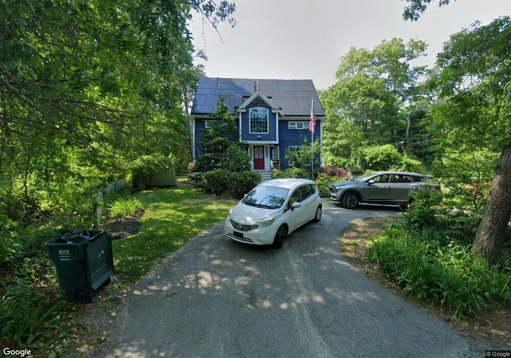
33 Carters Bridge Rd Plymouth, MA 02360
Estimated Value: $584,000 - $618,000
3
Beds
2
Baths
1,824
Sq Ft
$333/Sq Ft
Est. Value
About This Home
This home is located at 33 Carters Bridge Rd, Plymouth, MA 02360 and is currently estimated at $606,719, approximately $332 per square foot. 33 Carters Bridge Rd is a home located in Plymouth County with nearby schools including Indian Brook, Plymouth South Middle School, and Plymouth South High School.
Ownership History
Date
Name
Owned For
Owner Type
Purchase Details
Closed on
Aug 8, 2008
Sold by
Taylor Avenue Llc and Diodato
Bought by
Folsom Henry and Folsom Suzanne
Current Estimated Value
Home Financials for this Owner
Home Financials are based on the most recent Mortgage that was taken out on this home.
Original Mortgage
$285,600
Interest Rate
6.49%
Mortgage Type
Purchase Money Mortgage
Purchase Details
Closed on
May 16, 2007
Sold by
Anderso Richard W and Awadallah Deborah A
Bought by
Taylor Avenue Llc and Diodato
Home Financials for this Owner
Home Financials are based on the most recent Mortgage that was taken out on this home.
Original Mortgage
$100,000
Interest Rate
6.18%
Mortgage Type
Purchase Money Mortgage
Purchase Details
Closed on
Aug 25, 2006
Sold by
Anderson Richard W and Awadallah Deborah A
Bought by
Anderson Richard W
Purchase Details
Closed on
Apr 22, 1997
Sold by
Laskie Melvin C
Bought by
Anderson Richard W and Awadallah Deborah A
Create a Home Valuation Report for This Property
The Home Valuation Report is an in-depth analysis detailing your home's value as well as a comparison with similar homes in the area
Home Values in the Area
Average Home Value in this Area
Purchase History
| Date | Buyer | Sale Price | Title Company |
|---|---|---|---|
| Folsom Henry | $288,400 | -- | |
| Taylor Avenue Llc | $117,000 | -- | |
| Anderson Richard W | -- | -- | |
| Anderson Richard W | $76,000 | -- |
Source: Public Records
Mortgage History
| Date | Status | Borrower | Loan Amount |
|---|---|---|---|
| Open | Anderson Richard W | $288,666 | |
| Closed | Anderson Richard W | $285,600 | |
| Previous Owner | Anderson Richard W | $100,000 |
Source: Public Records
Tax History Compared to Growth
Tax History
| Year | Tax Paid | Tax Assessment Tax Assessment Total Assessment is a certain percentage of the fair market value that is determined by local assessors to be the total taxable value of land and additions on the property. | Land | Improvement |
|---|---|---|---|---|
| 2025 | $6,189 | $487,700 | $195,300 | $292,400 |
| 2024 | $6,027 | $468,300 | $191,300 | $277,000 |
| 2023 | $5,732 | $418,100 | $167,300 | $250,800 |
| 2022 | $5,269 | $341,500 | $152,100 | $189,400 |
| 2021 | $5,239 | $324,200 | $152,100 | $172,100 |
| 2020 | $5,230 | $319,900 | $148,100 | $171,800 |
| 2019 | $5,031 | $304,200 | $132,100 | $172,100 |
| 2018 | $4,828 | $293,300 | $122,100 | $171,200 |
| 2017 | $4,543 | $274,000 | $122,100 | $151,900 |
| 2016 | $4,312 | $265,000 | $112,100 | $152,900 |
| 2015 | $4,132 | $265,900 | $112,100 | $153,800 |
| 2014 | $3,946 | $260,800 | $112,100 | $148,700 |
Source: Public Records
Map
Nearby Homes
- 1096 Long Pond Rd
- 65 Lakewood Dr
- 110 Valley Rd
- 1150 Long Pond Rd
- 1 Kara's Way
- 18 Westcliff Dr
- 20 Westcliff Dr Unit 20
- 4 Westcliff Dr Unit Golfview
- 12 Kara's Way
- 5 Laurie Ann's Ln
- 42 Fairway Dr Unit Golfview
- 21 Dublin Dr
- 53 White Cliff Dr
- 249 Little Sandy Pond Rd
- 2462 State Rd
- 6 Sea Cliff Dr Unit 6
- 6 Seacliff Dr Unit 6
- 101 Perseverance Path
- 92 Cliffside Dr
- 92 Cliffside Dr Unit White Cliff
- 33 Carter's Bridge Rd
- 38 James Cir
- 41 Carters Bridge Rd
- 27 Carters Bridge Rd
- 40 James Cir
- 27 Carter's Bridge Rd
- 36 James Cir
- 42 Haskell Rd
- 23 Haskell Rd
- 21 Carters Bridge Rd
- 14 Stetson Ct
- 37 James Cir
- 43 James Cir
- 45 Carters Bridge Rd
- 18 Stetson Ct
- 10 Stetson Ct
- 42 Carter's Bridge Rd
- 46 James Cir
- 42 Carters Bridge Rd
- 41 Haskell Rd