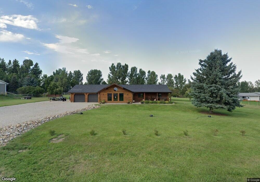
33 Cessna Rd Sheridan, WY 82801
Estimated Value: $580,059 - $671,000
3
Beds
2
Baths
1,648
Sq Ft
$373/Sq Ft
Est. Value
About This Home
This home is located at 33 Cessna Rd, Sheridan, WY 82801 and is currently estimated at $614,686, approximately $372 per square foot. 33 Cessna Rd is a home with nearby schools including Sheridan High School.
Ownership History
Date
Name
Owned For
Owner Type
Purchase Details
Closed on
Oct 5, 2020
Sold by
Johnson Ronald A and Johnson Lisa Le
Bought by
Haworth Paul S and Haworth Christina C
Current Estimated Value
Home Financials for this Owner
Home Financials are based on the most recent Mortgage that was taken out on this home.
Original Mortgage
$283,000
Interest Rate
2.8%
Mortgage Type
New Conventional
Create a Home Valuation Report for This Property
The Home Valuation Report is an in-depth analysis detailing your home's value as well as a comparison with similar homes in the area
Home Values in the Area
Average Home Value in this Area
Purchase History
| Date | Buyer | Sale Price | Title Company |
|---|---|---|---|
| Haworth Paul S | -- | None Available |
Source: Public Records
Mortgage History
| Date | Status | Borrower | Loan Amount |
|---|---|---|---|
| Previous Owner | Haworth Paul S | $283,000 |
Source: Public Records
Tax History Compared to Growth
Tax History
| Year | Tax Paid | Tax Assessment Tax Assessment Total Assessment is a certain percentage of the fair market value that is determined by local assessors to be the total taxable value of land and additions on the property. | Land | Improvement |
|---|---|---|---|---|
| 2025 | $3,074 | $34,499 | $12,325 | $22,174 |
| 2024 | $3,074 | $46,229 | $16,433 | $29,796 |
| 2023 | $3,060 | $46,011 | $15,292 | $30,719 |
| 2022 | $2,653 | $39,893 | $12,553 | $27,340 |
| 2021 | $2,186 | $32,865 | $10,613 | $22,252 |
| 2020 | $2,017 | $30,328 | $8,559 | $21,769 |
| 2019 | $1,894 | $28,484 | $8,559 | $19,925 |
| 2018 | $1,780 | $26,769 | $7,988 | $18,781 |
| 2017 | $1,737 | $26,124 | $7,760 | $18,364 |
| 2015 | $1,618 | $24,337 | $6,034 | $18,303 |
| 2014 | $2,011 | $30,247 | $6,034 | $24,213 |
| 2013 | -- | $29,297 | $6,034 | $23,263 |
Source: Public Records
Map
Nearby Homes
- 18 Convair Rd
- 18 Cessna Rd
- TDB Piccard St Unit Lot 23
- 11 Piccard Rd
- TBD Convair Rd Unit Lot 46
- TBD Convair Rd Unit Lot 44
- TBD Convair Rd Unit Lot 42
- TBD Piccard Rd Unit Lot 31
- TBD Piccard Rd Unit Lot 29
- TBD Piccard Rd Unit Lot 27
- TBD Piccard Rd Unit Lot 26
- TBD Piccard Rd Unit Lot 24
- TBD Piccard Rd Unit Lot 19
- TBD Piccard Rd Unit Lot 15
- TBD Piccard Rd Unit Lot 22
- TBD Piccard Rd Unit Lot 21
- TBD Piccard Rd Unit Lot 25
- TBD Upper Rd
- 31 Mountain Brook Dr
- 1 Crystal Creek Dr