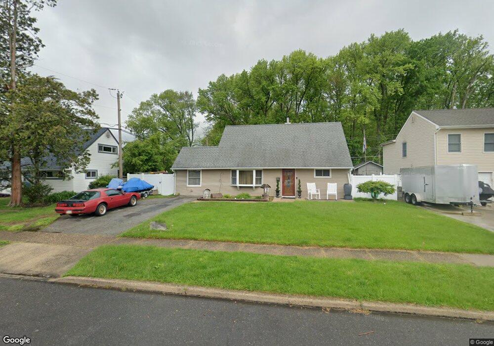
33 Cobalt Ridge Dr N Levittown, PA 19057
Estimated Value: $388,143 - $446,000
3
Beds
2
Baths
1,275
Sq Ft
$321/Sq Ft
Est. Value
About This Home
This home is located at 33 Cobalt Ridge Dr N, Levittown, PA 19057 and is currently estimated at $409,786, approximately $321 per square foot. 33 Cobalt Ridge Dr N is a home located in Bucks County with nearby schools including Walter Miller Elementary School, Sandburg Middle School, and Neshaminy High School.
Ownership History
Date
Name
Owned For
Owner Type
Purchase Details
Closed on
Apr 12, 2010
Sold by
Soto Ronald E
Bought by
Hartigan Gary and Oconnell Melissa
Current Estimated Value
Home Financials for this Owner
Home Financials are based on the most recent Mortgage that was taken out on this home.
Original Mortgage
$220,899
Interest Rate
4.5%
Mortgage Type
FHA
Purchase Details
Closed on
Apr 26, 1989
Bought by
Soto Ronald E
Create a Home Valuation Report for This Property
The Home Valuation Report is an in-depth analysis detailing your home's value as well as a comparison with similar homes in the area
Home Values in the Area
Average Home Value in this Area
Purchase History
| Date | Buyer | Sale Price | Title Company |
|---|---|---|---|
| Hartigan Gary | $225,000 | Commonwealth Land Title Insu | |
| Soto Ronald E | $109,900 | -- |
Source: Public Records
Mortgage History
| Date | Status | Borrower | Loan Amount |
|---|---|---|---|
| Previous Owner | Hartigan Gary | $220,899 |
Source: Public Records
Tax History Compared to Growth
Tax History
| Year | Tax Paid | Tax Assessment Tax Assessment Total Assessment is a certain percentage of the fair market value that is determined by local assessors to be the total taxable value of land and additions on the property. | Land | Improvement |
|---|---|---|---|---|
| 2025 | $4,006 | $18,400 | $4,120 | $14,280 |
| 2024 | $4,006 | $18,400 | $4,120 | $14,280 |
| 2023 | $3,942 | $18,400 | $4,120 | $14,280 |
| 2022 | $3,839 | $18,400 | $4,120 | $14,280 |
| 2021 | $3,839 | $18,400 | $4,120 | $14,280 |
| 2020 | $3,793 | $18,400 | $4,120 | $14,280 |
| 2019 | $3,708 | $18,400 | $4,120 | $14,280 |
| 2018 | $3,640 | $18,400 | $4,120 | $14,280 |
| 2017 | $3,547 | $18,400 | $4,120 | $14,280 |
| 2016 | $3,547 | $18,400 | $4,120 | $14,280 |
| 2015 | $3,736 | $18,400 | $4,120 | $14,280 |
| 2014 | $3,736 | $18,400 | $4,120 | $14,280 |
Source: Public Records
Map
Nearby Homes
- 53 Crestwood Rd
- 65 Candle Rd
- 23 Crystal Place
- 114 Nursery Ave
- 14 Cleft Rock Rd
- 28 Rust Hill Rd
- 75 Flamehill Rd
- 33 Red Rose Way
- 14 Cinnamon Rd
- 212 Apple St
- 479 Stanford Rd
- 88 Forsythia Dr N
- 17 Quay Rd
- 46 Quill Rd
- 7 Canal Rd
- 225 Yorkshire Rd Unit HIII
- 31 Quail Rd
- 58 Queen Lily Rd
- 8 Haven Rd
- 57 Island Rd
- 37 Cobalt Ridge Dr N
- 29 Cobalt Ridge Dr N
- 25 Cobalt Ridge Dr N
- 41 Cobalt Ridge Dr N
- 30 Cobalt Ridge Dr N
- 95 Crystal Rd
- 19 Cobalt Ridge Dr N
- 15 Cobalt Ridge Dr N
- 28 Cobalt Ridge Dr N
- 42 Cobalt Ridge Dr N
- 4 Cosmos Rd
- 84 Candle Rd
- 89 Crystal Rd
- 51 Crystal Place
- 11 Cobalt Ridge Dr N
- 2 Cosmos Rd
- 88 Crystal Rd
- 75 Crestwood Rd
- 47 Crystal Place
- 1479 Bristol Oxford Valley Rd