33 Coventry Ln North Andover, MA 01845
Estimated Value: $1,072,000 - $1,275,000
4
Beds
3
Baths
2,542
Sq Ft
$455/Sq Ft
Est. Value
About This Home
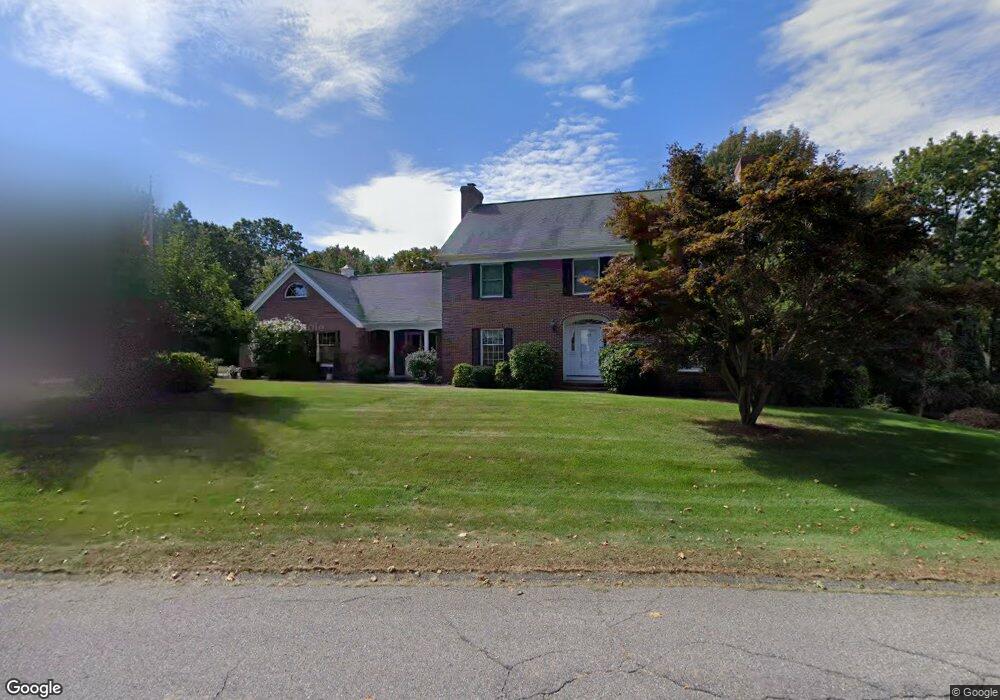
This home is located at 33 Coventry Ln, North Andover, MA 01845 and is currently estimated at $1,155,582, approximately $454 per square foot. 33 Coventry Ln is a home located in Essex County with nearby schools including Franklin Elementary School, North Andover Middle School, and North Andover High School.
Ownership History
Date
Name
Owned For
Owner Type
Purchase Details
Closed on
Jul 20, 1988
Sold by
Wynbrook Rt
Bought by
Bruce Susan L
Current Estimated Value
Home Financials for this Owner
Home Financials are based on the most recent Mortgage that was taken out on this home.
Original Mortgage
$312,000
Interest Rate
10.49%
Mortgage Type
Purchase Money Mortgage
Create a Home Valuation Report for This Property
The Home Valuation Report is an in-depth analysis detailing your home's value as well as a comparison with similar homes in the area
Home Values in the Area
Average Home Value in this Area
Purchase History
| Date | Buyer | Sale Price | Title Company |
|---|---|---|---|
| Bruce Susan L | $390,000 | -- |
Source: Public Records
Mortgage History
| Date | Status | Borrower | Loan Amount |
|---|---|---|---|
| Closed | Bruce Susan L | $312,000 |
Source: Public Records
Tax History Compared to Growth
Tax History
| Year | Tax Paid | Tax Assessment Tax Assessment Total Assessment is a certain percentage of the fair market value that is determined by local assessors to be the total taxable value of land and additions on the property. | Land | Improvement |
|---|---|---|---|---|
| 2025 | $11,637 | $1,033,500 | $441,000 | $592,500 |
| 2024 | $11,108 | $1,001,600 | $419,200 | $582,400 |
| 2023 | $10,394 | $849,200 | $335,600 | $513,600 |
| 2022 | $9,946 | $735,100 | $292,000 | $443,100 |
| 2021 | $9,592 | $676,900 | $265,900 | $411,000 |
| 2020 | $9,210 | $670,300 | $259,300 | $411,000 |
| 2019 | $8,989 | $670,300 | $259,300 | $411,000 |
| 2018 | $9,739 | $670,300 | $259,300 | $411,000 |
| 2017 | $9,435 | $660,700 | $234,300 | $426,400 |
| 2016 | $8,973 | $628,800 | $238,600 | $390,200 |
| 2015 | $8,907 | $619,000 | $223,100 | $395,900 |
Source: Public Records
Map
Nearby Homes
- 240 Dale St
- 141 Cortland Dr
- 141 Cortland Dr Unit 141
- 121 Cortland Dr
- 121 Cortland Dr Unit 121
- 125 Lancaster Rd
- 378 Salem St
- 27 Marbleridge Rd
- 65 Saile Way
- 75 Thistle Rd
- 26 Woodberry Ln
- 45 Thistle Rd
- 56 Meadowview Rd
- 20 Highwood Way
- 894 Great Pond Rd
- 316 Johnson St
- Lot 5A Essex St
- 70 Salem St
- 495 Johnson St
- 590 Foster St