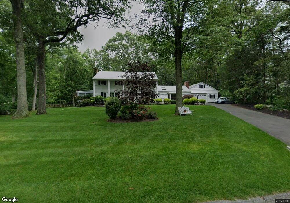
33 Coventry Rd Stamford, CT 06903
North Stamford NeighborhoodEstimated Value: $1,148,000 - $1,652,000
4
Beds
3
Baths
3,807
Sq Ft
$356/Sq Ft
Est. Value
About This Home
This home is located at 33 Coventry Rd, Stamford, CT 06903 and is currently estimated at $1,354,710, approximately $355 per square foot. 33 Coventry Rd is a home located in Fairfield County with nearby schools including Northeast Elementary School, Turn of River School, and Westhill High School.
Ownership History
Date
Name
Owned For
Owner Type
Purchase Details
Closed on
Aug 29, 2001
Sold by
Seltzer Clifford and Seltzer Jennifer E
Bought by
Purpura Gary and Purpura Nancy
Current Estimated Value
Home Financials for this Owner
Home Financials are based on the most recent Mortgage that was taken out on this home.
Original Mortgage
$490,000
Interest Rate
6.75%
Purchase Details
Closed on
Nov 6, 1997
Sold by
Volpe Robert P and Volpe Frances
Bought by
Seltzer Clifford and Seltzer Jennifer E
Create a Home Valuation Report for This Property
The Home Valuation Report is an in-depth analysis detailing your home's value as well as a comparison with similar homes in the area
Home Values in the Area
Average Home Value in this Area
Purchase History
| Date | Buyer | Sale Price | Title Company |
|---|---|---|---|
| Purpura Gary | $690,000 | -- | |
| Seltzer Clifford | $450,000 | -- |
Source: Public Records
Mortgage History
| Date | Status | Borrower | Loan Amount |
|---|---|---|---|
| Closed | Seltzer Clifford | $320,500 | |
| Closed | Seltzer Clifford | $485,000 | |
| Closed | Seltzer Clifford | $490,000 | |
| Closed | Seltzer Clifford | $490,000 |
Source: Public Records
Tax History Compared to Growth
Tax History
| Year | Tax Paid | Tax Assessment Tax Assessment Total Assessment is a certain percentage of the fair market value that is determined by local assessors to be the total taxable value of land and additions on the property. | Land | Improvement |
|---|---|---|---|---|
| 2025 | $15,514 | $666,710 | $262,580 | $404,130 |
| 2024 | $15,174 | $666,710 | $262,580 | $404,130 |
| 2023 | $16,308 | $666,710 | $262,580 | $404,130 |
| 2022 | $14,211 | $539,740 | $198,920 | $340,820 |
| 2021 | $14,017 | $539,740 | $198,920 | $340,820 |
| 2020 | $13,672 | $539,740 | $198,920 | $340,820 |
| 2019 | $13,672 | $539,740 | $198,920 | $340,820 |
| 2018 | $13,197 | $539,740 | $198,920 | $340,820 |
| 2017 | $13,460 | $526,000 | $207,580 | $318,420 |
| 2016 | $13,055 | $526,000 | $207,580 | $318,420 |
| 2015 | $12,698 | $526,000 | $207,580 | $318,420 |
| 2014 | $12,261 | $526,000 | $207,580 | $318,420 |
Source: Public Records
Map
Nearby Homes
- 115 Mayapple Rd
- 2993 High Ridge Rd
- 65 Mcintosh Rd
- 78 Trinity Pass
- 61 Shady Ln
- 32 Joshua Hobby Ln
- 22 Joshua Hobby Ln
- 199 Upper Shad Rd
- 22 Blackberry Dr E
- 1287 Rock Rimmon Rd
- 23 Kendall Rd
- 226 Ingleside Dr
- 49 Alexandra Dr
- 0 Rolling Meadow Ln Unit ONEH6302491
- 52 Mill Spring Ln
- 518 Woodbine Rd
- 501 Woodbine Rd
- 2856 Long Ridge Rd
- 30 Dulan Dr
- 331 Dans Hwy
- 15 Coventry Rd
- 49 Coventry Rd
- 36 Coventry Rd
- 24 Coventry Rd
- 7 Coventry Rd
- 112 Country Club Rd
- 59 Coventry Rd
- 52 Coventry Rd
- 0 Coventry Rd
- 21 Rolling Ridge Rd
- 35 Rolling Ridge Rd
- 74 Coventry Rd
- 77 Coventry Rd
- 94 Country Club Rd
- 141 Country Club Rd
- 51 Rolling Ridge Rd
- 133 Country Club Rd
- 111 Country Club Rd
- 151 Country Club Rd
- 105 Country Club Rd