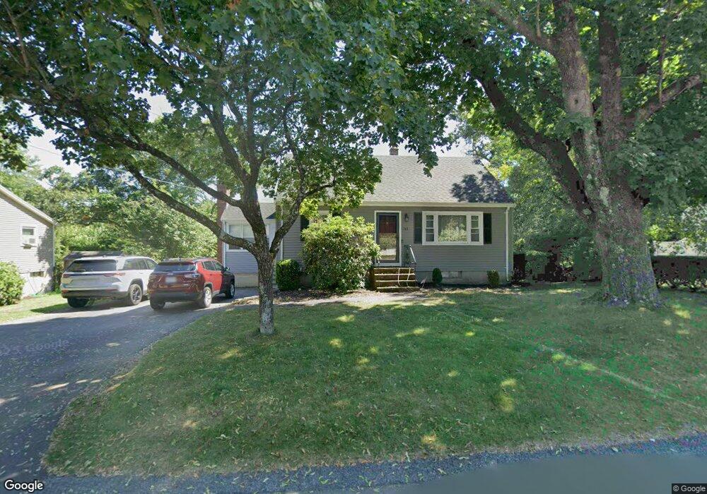
33 Donald Tennant Cir North Attleboro, MA 02760
North Attleboro NeighborhoodEstimated Value: $463,427 - $550,000
3
Beds
2
Baths
1,075
Sq Ft
$474/Sq Ft
Est. Value
About This Home
This home is located at 33 Donald Tennant Cir, North Attleboro, MA 02760 and is currently estimated at $509,107, approximately $473 per square foot. 33 Donald Tennant Cir is a home located in Bristol County with nearby schools including North Attleboro High School, Cadence Academy Preschool - North Attleborough, and Bishop Feehan High School.
Ownership History
Date
Name
Owned For
Owner Type
Purchase Details
Closed on
Sep 28, 2001
Sold by
Long Matthew and Long Janet
Bought by
Griffin Timothy P and Griffin Angela M
Current Estimated Value
Home Financials for this Owner
Home Financials are based on the most recent Mortgage that was taken out on this home.
Original Mortgage
$216,000
Interest Rate
6.91%
Mortgage Type
Purchase Money Mortgage
Purchase Details
Closed on
Apr 30, 1993
Sold by
Gocht Russell C and Gocht Nancy K
Bought by
Long Matthew and Long Janet
Create a Home Valuation Report for This Property
The Home Valuation Report is an in-depth analysis detailing your home's value as well as a comparison with similar homes in the area
Home Values in the Area
Average Home Value in this Area
Purchase History
| Date | Buyer | Sale Price | Title Company |
|---|---|---|---|
| Griffin Timothy P | $235,000 | -- | |
| Long Matthew | $115,000 | -- |
Source: Public Records
Mortgage History
| Date | Status | Borrower | Loan Amount |
|---|---|---|---|
| Open | Long Matthew | $216,800 | |
| Closed | Long Matthew | $216,000 |
Source: Public Records
Tax History Compared to Growth
Tax History
| Year | Tax Paid | Tax Assessment Tax Assessment Total Assessment is a certain percentage of the fair market value that is determined by local assessors to be the total taxable value of land and additions on the property. | Land | Improvement |
|---|---|---|---|---|
| 2025 | $4,402 | $373,400 | $114,900 | $258,500 |
| 2024 | $4,188 | $362,900 | $114,900 | $248,000 |
| 2023 | $4,236 | $331,200 | $114,900 | $216,300 |
| 2022 | $3,977 | $285,500 | $114,900 | $170,600 |
| 2021 | $0 | $275,000 | $114,900 | $160,100 |
| 2020 | $3,833 | $267,100 | $114,900 | $152,200 |
| 2019 | $3,655 | $256,700 | $104,500 | $152,200 |
| 2018 | $0 | $244,900 | $104,500 | $140,400 |
| 2017 | $0 | $230,500 | $104,500 | $126,000 |
| 2016 | $2,949 | $223,100 | $116,100 | $107,000 |
| 2015 | $2,808 | $213,700 | $121,900 | $91,800 |
| 2014 | $2,686 | $202,900 | $112,700 | $90,200 |
Source: Public Records
Map
Nearby Homes
- 196 Donald Tennant Cir
- 11 Landry Ave
- 115 Westfield Dr
- 57 Vine St
- 11 Buckthorn Ln
- Lot 2 Jeffrey Dr
- Lot 5 Jeffrey Dr
- 5 Old Wood Rd
- 116 George St
- 255 Mckeon Dr
- 12 Houde St
- 40 Natalie Dr
- 150 Gilbert St
- 24 Maverick Dr
- 20 Sperry Ln
- 835 Mt Hope St Unit 39
- 21 Shady Ln
- 28 Messenger St
- 9 Sunnyside Dr Unit 9
- 711 Mount Hope St Unit 13
- 39 Donald Tennant Cir
- 27 Donald Tennant Cir
- 34 Donald Tennant Cir
- 26 Donald Tennant Cir
- 42 Donald Tennant Cir
- 19 Donald Tennant Cir
- 47 Donald Tennant Cir
- 48 Donald Tennant Cir
- 206 Donald Tennant Cir
- 206 Donald Tennant Cir
- 190 Donald Tennant Cir
- 14 Donald Tennant Cir
- 56 Donald Tennant Cir
- 53 Donald Tennant Cir
- 215 Donald Tennant Cir
- 5 Donald Tennant Cir
- 199 Donald Tennant Cir
- 209 Donald Tennant Cir
- 191 Donald Tennant Cir
- 205 Donald Tennant Cir