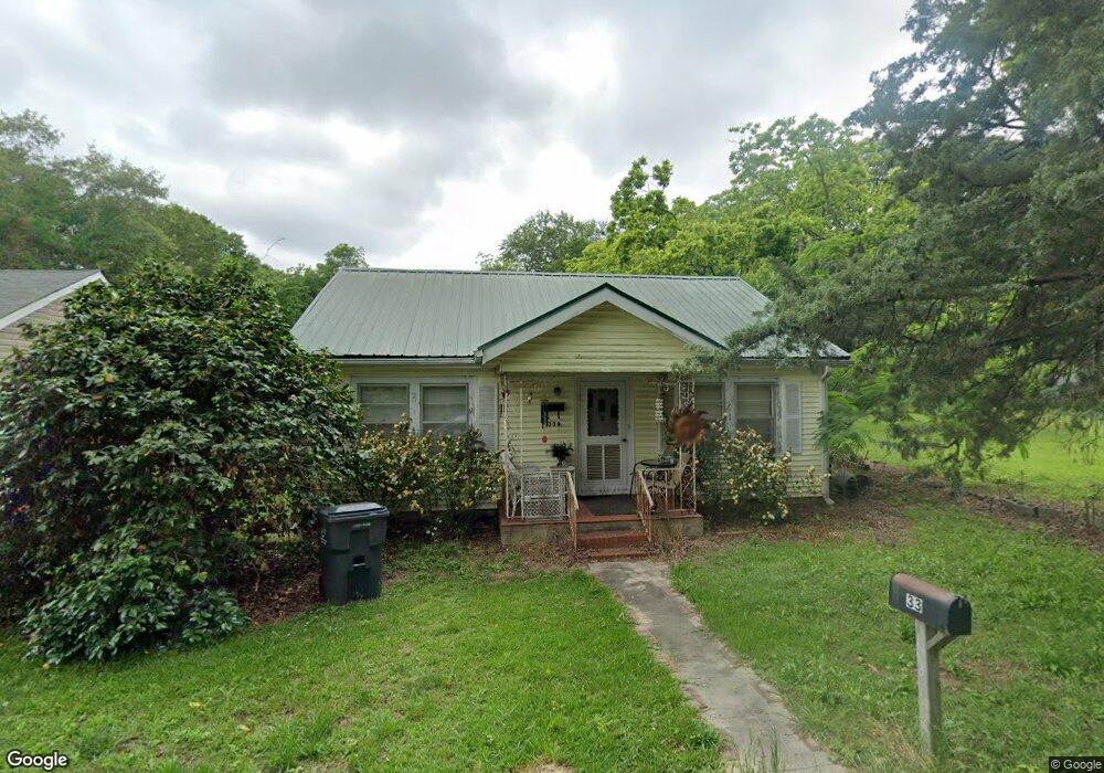
33 Dungan St Forsyth, GA 31029
Estimated Value: $145,146 - $206,000
2
Beds
1
Bath
1,426
Sq Ft
$120/Sq Ft
Est. Value
About This Home
This home is located at 33 Dungan St, Forsyth, GA 31029 and is currently estimated at $170,537, approximately $119 per square foot. 33 Dungan St is a home located in Monroe County with nearby schools including T.G. Scott Elementary School, Mary Persons High School, and Lighthouse Academy.
Ownership History
Date
Name
Owned For
Owner Type
Purchase Details
Closed on
Jun 16, 2015
Sold by
Pardue Lyn Douglas
Bought by
Pardue Lyn Douglas and Pardue Karen Ann
Current Estimated Value
Purchase Details
Closed on
Feb 28, 2006
Sold by
Not Provided
Bought by
Pardue Lyn
Home Financials for this Owner
Home Financials are based on the most recent Mortgage that was taken out on this home.
Original Mortgage
$58,700
Interest Rate
6.19%
Mortgage Type
New Conventional
Purchase Details
Closed on
Mar 29, 1995
Sold by
Taylor D P
Bought by
Harrell Walter S
Purchase Details
Closed on
Sep 30, 1988
Sold by
Brasher Ralph L
Bought by
Taylor D P
Create a Home Valuation Report for This Property
The Home Valuation Report is an in-depth analysis detailing your home's value as well as a comparison with similar homes in the area
Home Values in the Area
Average Home Value in this Area
Purchase History
| Date | Buyer | Sale Price | Title Company |
|---|---|---|---|
| Pardue Lyn Douglas | -- | -- | |
| Pardue Lyn | $61,800 | -- | |
| Harrell Walter S | $43,500 | -- | |
| Taylor D P | $39,500 | -- |
Source: Public Records
Mortgage History
| Date | Status | Borrower | Loan Amount |
|---|---|---|---|
| Previous Owner | Pardue Lyn | $58,700 |
Source: Public Records
Tax History Compared to Growth
Tax History
| Year | Tax Paid | Tax Assessment Tax Assessment Total Assessment is a certain percentage of the fair market value that is determined by local assessors to be the total taxable value of land and additions on the property. | Land | Improvement |
|---|---|---|---|---|
| 2024 | $806 | $26,720 | $1,480 | $25,240 |
| 2023 | $775 | $22,800 | $1,480 | $21,320 |
| 2022 | $674 | $22,800 | $1,480 | $21,320 |
| 2021 | $696 | $22,800 | $1,480 | $21,320 |
| 2020 | $724 | $22,800 | $1,480 | $21,320 |
| 2019 | $729 | $22,800 | $1,480 | $21,320 |
| 2018 | $731 | $22,800 | $1,480 | $21,320 |
| 2017 | $731 | $22,800 | $1,480 | $21,320 |
| 2016 | $698 | $22,800 | $1,480 | $21,320 |
| 2015 | $666 | $22,800 | $1,480 | $21,320 |
| 2014 | -- | $22,800 | $1,480 | $21,320 |
Source: Public Records
Map
Nearby Homes
- 285 E Main St
- 0 Patrol Rd Unit 10473001
- 101 E Chambers St
- 2022 Highway 41 N
- 4580 Capulet Ct
- 205 Solomon St
- S S Lee St
- 0 S Lee St Unit 10646818
- 4616 Capulet Ct
- Cypress Plan at Juliette Crossing
- Jackson Plan at Juliette Crossing
- Cannaberra Plan at Juliette Crossing
- Oakwood Plan at Juliette Crossing
- Delilah Plan at Juliette Crossing
- Maple Plan at Juliette Crossing
- Hawthorne Plan at Juliette Crossing
- Harrison Plan at Juliette Crossing
- Camden Plan at Juliette Crossing
- Ash II Plan at Juliette Crossing
- Belmont Plan at Juliette Crossing
- 37 Dungan St
- 43 Dungan St
- 34 Dungan St
- 285 E Main St Unit 6,7,8
- 285 E Main St Unit 8
- 269 E Main St
- 297 E Main St
- 305 E Main St
- 313 Abernathy St
- 312 Abernathy St
- 74 Brooklyn Ave
- 255 E Main St
- 315 E Main St
- 323 Abernathy St
- 282 E Main St
- 294 E Main St
- 62 Brooklyn Ave
- 321 E Main St
- 314 E Main St
- 543 Abernathy St