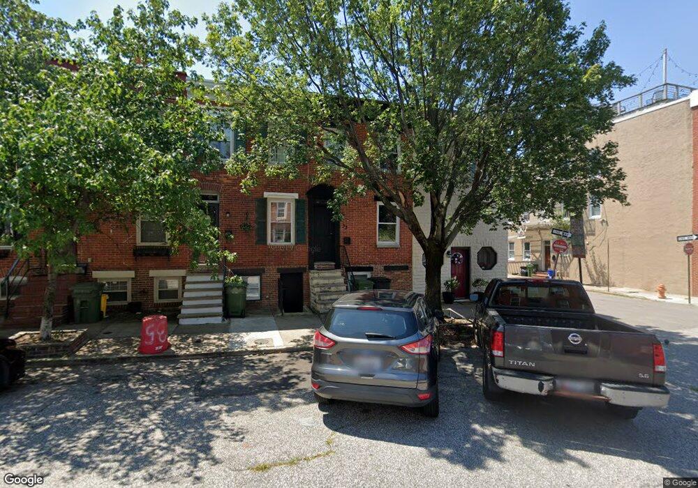
33 E Randall St Baltimore, MD 21230
South Baltimore NeighborhoodEstimated Value: $221,000 - $302,614
3
Beds
2
Baths
988
Sq Ft
$265/Sq Ft
Est. Value
About This Home
This home is located at 33 E Randall St, Baltimore, MD 21230 and is currently estimated at $261,807, approximately $264 per square foot. 33 E Randall St is a home located in Baltimore City with nearby schools including Thomas Johnson Elementary School, Booker T. Washington Middle School, and Digital Harbor High School.
Ownership History
Date
Name
Owned For
Owner Type
Purchase Details
Closed on
Oct 8, 2008
Sold by
Calder Craig
Bought by
Holden Jesse and Hess Mandy
Current Estimated Value
Home Financials for this Owner
Home Financials are based on the most recent Mortgage that was taken out on this home.
Original Mortgage
$261,890
Outstanding Balance
$174,151
Interest Rate
6.43%
Mortgage Type
FHA
Estimated Equity
$87,656
Purchase Details
Closed on
May 18, 2007
Sold by
Wolff Edward J
Bought by
Calder Craig and Floyd Karen
Create a Home Valuation Report for This Property
The Home Valuation Report is an in-depth analysis detailing your home's value as well as a comparison with similar homes in the area
Home Values in the Area
Average Home Value in this Area
Purchase History
| Date | Buyer | Sale Price | Title Company |
|---|---|---|---|
| Holden Jesse | $266,000 | -- | |
| Calder Craig | $206,000 | -- |
Source: Public Records
Mortgage History
| Date | Status | Borrower | Loan Amount |
|---|---|---|---|
| Open | Holden Jesse | $261,890 |
Source: Public Records
Tax History
| Year | Tax Paid | Tax Assessment Tax Assessment Total Assessment is a certain percentage of the fair market value that is determined by local assessors to be the total taxable value of land and additions on the property. | Land | Improvement |
|---|---|---|---|---|
| 2025 | $4,346 | $202,233 | -- | -- |
| 2024 | $4,346 | $196,867 | -- | -- |
| 2023 | $4,519 | $191,500 | $100,000 | $91,500 |
| 2022 | $4,240 | $190,400 | $0 | $0 |
| 2021 | $4,467 | $189,300 | $0 | $0 |
| 2020 | $4,192 | $188,200 | $100,000 | $88,200 |
| 2019 | $4,143 | $187,000 | $0 | $0 |
| 2018 | $4,164 | $185,800 | $0 | $0 |
| 2017 | $4,172 | $184,600 | $0 | $0 |
| 2016 | $3,799 | $178,467 | $0 | $0 |
| 2015 | $3,799 | $172,333 | $0 | $0 |
| 2014 | $3,799 | $166,200 | $0 | $0 |
Source: Public Records
Map
Nearby Homes
- 1622 Patapsco St
- 1601 Marshall St
- 1613 S Charles St
- 1628 S Charles St
- 1728 Light St
- 12 W Randall St
- 40 E Barney St
- 1520 Byrd St
- 1745 S Charles St
- 1535 S Hanover St
- 17 Birckhead St
- 1720 Byrd St
- 23 E Barney St
- 17 W Fort Ave
- 117 Bloomsberry St
- 1612 S Hanover St
- 1534 S Hanover St
- 1749 S Hanover St
- 1526 S Hanover St
- 1436 Light St
- 35 E Randall St
- 31 E Randall St
- 39 E Randall St
- 1603 Patapsco St
- 41 E Randall St
- 1605 Patapsco St
- 43 E Randall St
- 29 E Randall St
- 1607 Patapsco St
- 45 E Randall St
- 1609 Patapsco St
- 27 E Randall St
- 47 E Randall St
- 1600 Marshall St
- 1611 Patapsco St
- 25 E Randall St
- 1602 Marshall St
- 1602 Patapsco St
- 49 E Randall St
- 1604 Marshall St
Your Personal Tour Guide
Ask me questions while you tour the home.