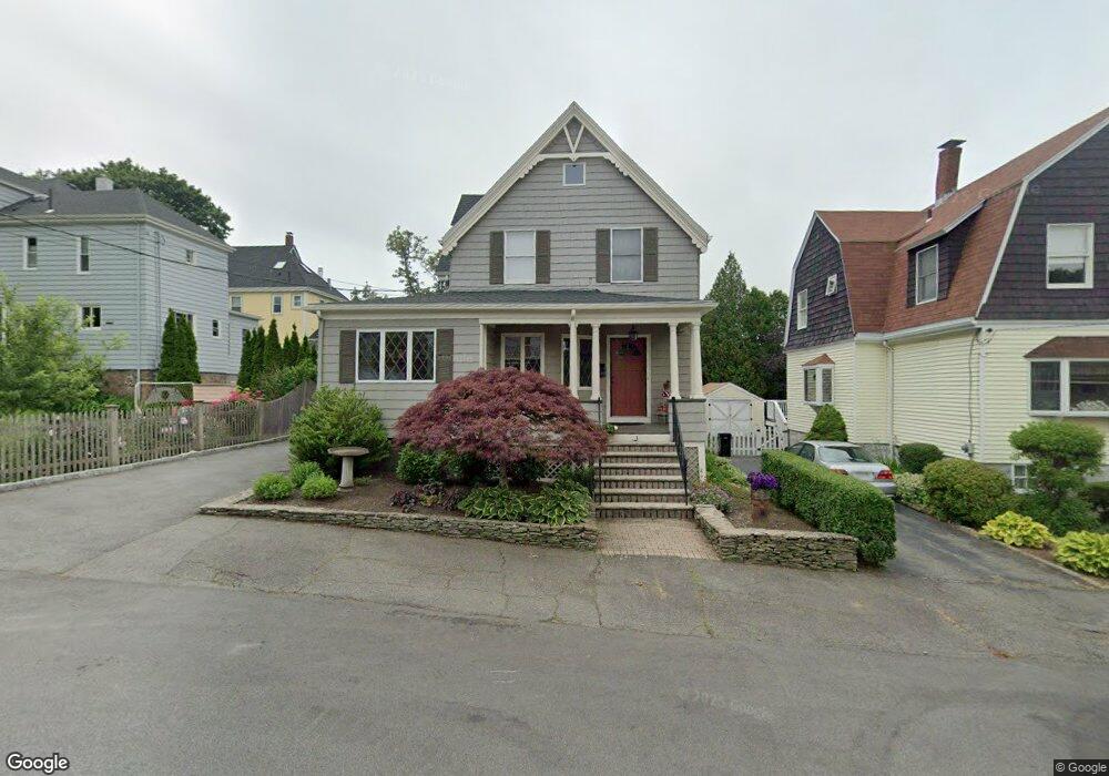
33 Ellis Rd Swampscott, MA 01907
Estimated Value: $816,454 - $1,026,000
4
Beds
2
Baths
2,092
Sq Ft
$420/Sq Ft
Est. Value
About This Home
This home is located at 33 Ellis Rd, Swampscott, MA 01907 and is currently estimated at $877,864, approximately $419 per square foot. 33 Ellis Rd is a home located in Essex County with nearby schools including Swampscott Middle School and Swampscott High School.
Ownership History
Date
Name
Owned For
Owner Type
Purchase Details
Closed on
Aug 13, 2013
Sold by
Balzotti Bonnie Y and Balzotti Joseph D
Bought by
Balzotti Ft
Current Estimated Value
Purchase Details
Closed on
Aug 31, 1993
Sold by
Nestor Paul R and Nestor Anne M
Bought by
Balzotti Bonnie and Balzotti Joseph
Create a Home Valuation Report for This Property
The Home Valuation Report is an in-depth analysis detailing your home's value as well as a comparison with similar homes in the area
Home Values in the Area
Average Home Value in this Area
Purchase History
| Date | Buyer | Sale Price | Title Company |
|---|---|---|---|
| Balzotti Ft | -- | -- | |
| Balzotti Ft | -- | -- | |
| Balzotti Bonnie | $217,500 | -- | |
| Balzotti Bonnie | $217,500 | -- |
Source: Public Records
Mortgage History
| Date | Status | Borrower | Loan Amount |
|---|---|---|---|
| Previous Owner | Balzotti Bonnie | $92,000 | |
| Previous Owner | Balzotti Bonnie | $20,000 | |
| Previous Owner | Balzotti Bonnie | $110,000 |
Source: Public Records
Tax History Compared to Growth
Tax History
| Year | Tax Paid | Tax Assessment Tax Assessment Total Assessment is a certain percentage of the fair market value that is determined by local assessors to be the total taxable value of land and additions on the property. | Land | Improvement |
|---|---|---|---|---|
| 2025 | $8,026 | $699,700 | $325,300 | $374,400 |
| 2024 | $7,743 | $673,900 | $309,500 | $364,400 |
| 2023 | $7,213 | $614,400 | $277,700 | $336,700 |
| 2022 | $6,823 | $531,800 | $238,100 | $293,700 |
| 2021 | $7,027 | $509,200 | $222,200 | $287,000 |
| 2020 | $6,878 | $481,000 | $198,400 | $282,600 |
| 2019 | $7,009 | $461,100 | $178,500 | $282,600 |
| 2018 | $6,768 | $423,000 | $162,700 | $260,300 |
| 2017 | $6,814 | $390,500 | $152,400 | $238,100 |
| 2016 | $6,767 | $390,500 | $152,400 | $238,100 |
| 2015 | $6,697 | $390,500 | $152,400 | $238,100 |
| 2014 | $6,521 | $348,700 | $127,000 | $221,700 |
Source: Public Records
Map
Nearby Homes
- 98 Paradise Rd
- 30 Paradise Rd
- 140 Elmwood Rd
- 106 Norfolk Ave
- 80 Norfolk Ave Unit 1
- 189 Burrill St Unit 2
- 108-110 Burrill St Unit 1
- 28 Claremont Terrace Unit 4
- 28 Claremont Terrace Unit 6
- 76 Stetson Ave
- 29-31 Essex Ave Unit 2
- 7-9 Rock Ave
- 133 Eastern Ave Unit 8
- 51 Barnstable St
- 71 Greenwood Ave Unit 207
- 306 Paradise Rd
- 35 Columbia Ave
- 44 Cherry St Unit 2
- 309 Paradise Rd
- 100 Burpee Rd
- 29 Ellis Rd
- 48 Farragut Rd
- 42 Farragut Rd
- 115-117 Paradise Rd Unit 117
- 123 Generic St
- 115 Paradise Rd Unit 117
- 119 Paradise Rd
- 113 Paradise Rd
- 32 Ellis Rd
- 38 Farragut Rd
- 58 Farragut Rd
- 36 Ellis Rd
- 127 Paradise Rd
- 60 Farragut Rd
- 131 Paradise Rd
- 34 Farragut Rd
- 116 Paradise Rd
- 120 Paradise Rd
- 97 Paradise Rd
- 133 Paradise Rd