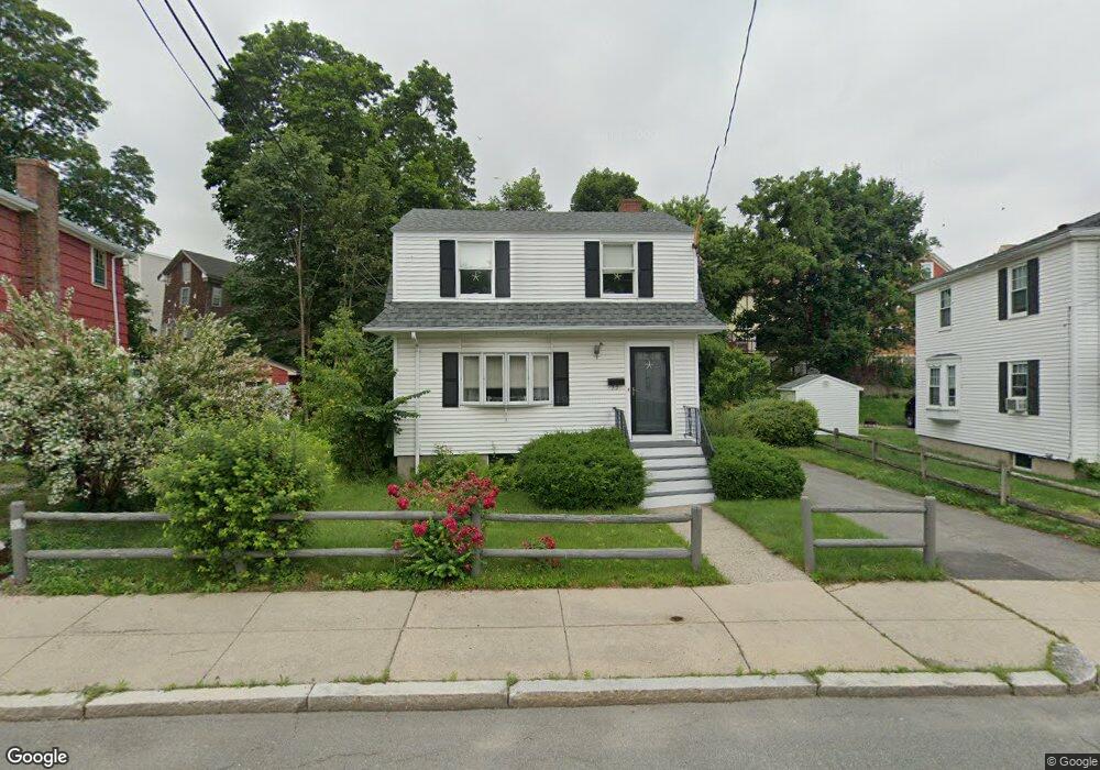
33 Everdean St Dorchester, MA 02122
Fields Corner East NeighborhoodEstimated Value: $601,000 - $705,000
3
Beds
1
Bath
1,104
Sq Ft
$589/Sq Ft
Est. Value
About This Home
This home is located at 33 Everdean St, Dorchester, MA 02122 and is currently estimated at $650,773, approximately $589 per square foot. 33 Everdean St is a home located in Suffolk County with nearby schools including Neighborhood House Charter School and Helen Y. Davis Leadership Academy Charter Public School.
Ownership History
Date
Name
Owned For
Owner Type
Purchase Details
Closed on
Aug 3, 2020
Sold by
Aa Ft
Bought by
Tavares Brett and Connolly Vanessa M
Current Estimated Value
Home Financials for this Owner
Home Financials are based on the most recent Mortgage that was taken out on this home.
Original Mortgage
$444,000
Outstanding Balance
$394,586
Interest Rate
3.1%
Mortgage Type
New Conventional
Estimated Equity
$256,187
Create a Home Valuation Report for This Property
The Home Valuation Report is an in-depth analysis detailing your home's value as well as a comparison with similar homes in the area
Home Values in the Area
Average Home Value in this Area
Purchase History
| Date | Buyer | Sale Price | Title Company |
|---|---|---|---|
| Tavares Brett | $499,000 | None Available |
Source: Public Records
Mortgage History
| Date | Status | Borrower | Loan Amount |
|---|---|---|---|
| Open | Tavares Brett | $444,000 |
Source: Public Records
Tax History
| Year | Tax Paid | Tax Assessment Tax Assessment Total Assessment is a certain percentage of the fair market value that is determined by local assessors to be the total taxable value of land and additions on the property. | Land | Improvement |
|---|---|---|---|---|
| 2025 | $6,646 | $573,900 | $283,900 | $290,000 |
| 2024 | $5,854 | $537,100 | $238,600 | $298,500 |
| 2023 | $5,768 | $537,100 | $238,600 | $298,500 |
| 2022 | $5,413 | $497,500 | $221,000 | $276,500 |
| 2021 | $5,068 | $475,000 | $212,500 | $262,500 |
| 2020 | $4,478 | $424,100 | $202,500 | $221,600 |
| 2019 | $4,216 | $400,000 | $162,000 | $238,000 |
| 2018 | $3,847 | $367,100 | $162,000 | $205,100 |
| 2017 | $3,772 | $356,200 | $162,000 | $194,200 |
| 2016 | $3,732 | $339,300 | $162,000 | $177,300 |
| 2015 | $3,362 | $277,600 | $114,800 | $162,800 |
| 2014 | $3,292 | $261,700 | $114,800 | $146,900 |
Source: Public Records
Map
Nearby Homes
- 3 Mill St Unit C
- 30 Park St Unit 4
- 34 Houghton St
- 382 Adams St Unit 384-1
- 4 Payne St Unit FIVE
- 60 Houghton St Unit 62
- 15 Duncan St
- 12 Thelma Rd Unit 3
- 131 King St Unit 3
- 385 Centre St Unit 1
- 18 Parkman St Unit 2
- 572 Freeport St Unit 103
- 39 Juliette St Unit 3
- 40 Mckone St Unit 1
- 36 Mckone St Unit 1
- 36 Mckone St
- 36 Mckone St Unit 2
- 37 Longfellow St
- 243 D Savin Hill Ave
- 7 Fox St Unit 1
- 37 Everdean St
- 29 Everdean St
- 16 Mill St
- 14 Mill St
- 25 Everdean St
- 20 Mill St
- 40 Ashland St
- 12 Mill St
- 28 Everdean St
- 36 Ashland St
- 19 Everdean St Unit 21
- 19 Everdean St Unit 1
- 21 Everdean St Unit 2
- 10 Mill St
- 24 Everdean St
- 24 Everdean St Unit 1
- 24 Mill St
- 24 Mill St Unit 1
- 24 Mill St Unit 3
- 24 Mill St Unit 2
Your Personal Tour Guide
Ask me questions while you tour the home.