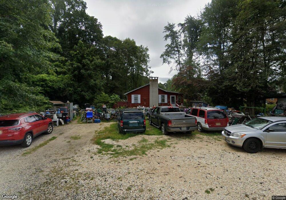
33 Forest Rd Millville, NJ 08332
Estimated Value: $137,389 - $234,000
--
Bed
--
Bath
672
Sq Ft
$283/Sq Ft
Est. Value
About This Home
This home is located at 33 Forest Rd, Millville, NJ 08332 and is currently estimated at $190,347, approximately $283 per square foot. 33 Forest Rd is a home located in Cumberland County with nearby schools including Silver Run Elementary School, Lakeside Middle School, and Memorial High School.
Ownership History
Date
Name
Owned For
Owner Type
Purchase Details
Closed on
Dec 15, 2023
Sold by
Taylor Claude L
Bought by
Taylor Donald C
Current Estimated Value
Purchase Details
Closed on
Apr 12, 1996
Sold by
Knott Timothy A
Bought by
Taylor Donald C and Taylor Claude L
Home Financials for this Owner
Home Financials are based on the most recent Mortgage that was taken out on this home.
Original Mortgage
$62,372
Interest Rate
7.39%
Mortgage Type
FHA
Purchase Details
Closed on
Oct 10, 1995
Sold by
Rambone Marion M
Bought by
Knotts Timothy A
Create a Home Valuation Report for This Property
The Home Valuation Report is an in-depth analysis detailing your home's value as well as a comparison with similar homes in the area
Home Values in the Area
Average Home Value in this Area
Purchase History
| Date | Buyer | Sale Price | Title Company |
|---|---|---|---|
| Taylor Donald C | -- | None Listed On Document | |
| Taylor Donald C | -- | None Listed On Document | |
| Taylor Donald C | $62,500 | Colonial Title Agency Inc | |
| Knotts Timothy A | $34,000 | Colonial Title Agency Inc |
Source: Public Records
Mortgage History
| Date | Status | Borrower | Loan Amount |
|---|---|---|---|
| Previous Owner | Taylor Donald C | $62,372 |
Source: Public Records
Tax History Compared to Growth
Tax History
| Year | Tax Paid | Tax Assessment Tax Assessment Total Assessment is a certain percentage of the fair market value that is determined by local assessors to be the total taxable value of land and additions on the property. | Land | Improvement |
|---|---|---|---|---|
| 2025 | $2,838 | $72,300 | $14,000 | $58,300 |
| 2024 | $2,838 | $72,300 | $14,000 | $58,300 |
| 2023 | $2,814 | $72,300 | $14,000 | $58,300 |
| 2022 | $2,741 | $72,300 | $14,000 | $58,300 |
| 2021 | $2,398 | $72,300 | $14,000 | $58,300 |
| 2020 | $2,608 | $72,300 | $14,000 | $58,300 |
| 2019 | $2,487 | $72,300 | $14,000 | $58,300 |
| 2018 | $2,436 | $72,300 | $14,000 | $58,300 |
| 2017 | $2,413 | $72,300 | $14,000 | $58,300 |
| 2016 | $2,383 | $72,300 | $14,000 | $58,300 |
| 2015 | $2,330 | $72,300 | $14,000 | $58,300 |
| 2014 | $2,334 | $72,300 | $14,000 | $58,300 |
Source: Public Records
Map
Nearby Homes
- 252 Lake Shore Dr
- 16 E Buckshutem & 16 Juniper Rd
- 700 NE Lake Shore Dr
- 33 Laurel Rd
- 108 Quail Rd
- 112 Quail Rd
- 107 Pine Rd
- 6811 Battle Ln
- 6801 Battle Ln
- 108 River Dr
- 117 Main Dr
- 118 Canary Rd
- 110 Daffodil Rd
- 7601 Magnolia Dr
- 334 Opal Rd
- 6415 Magnolia Dr
- 250 Jute Rd
- 340 Robin Rd
- 232 Gooseberry Rd
- 6214 Whittier Dr
- 32 Forest Rd
- 44 SE Lakeshore Dr
- 512 SE Lakeshore Dr
- 31 SE Lakeshore Dr
- 39 SE Lakeshore Dr
- 502 SE Lakeshore Dr
- 414 SE Lake Shore Dr
- 414 SE Lakeshore Dr
- 19 Grove Rd
- 35 Grove Rd S
- 404 SE Lakeshore Dr
- 28 & 36 Grove Rd N
- 0 Forest Rd Unit 1004771805
- 0 Forest Rd
- 514 E Buckshutem Rd
- 42 Grove Rd
- 702 Chickarea Cabin Rd
- 0 Grove Rd Unit 1007205788
- 0 Grove Rd Unit 1006516944
- 0 Grove Rd Unit 5485896