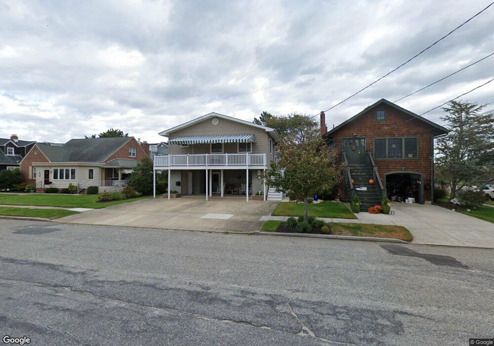
33 Harbor Rd Ocean City, NJ 08226
Estimated Value: $1,203,104 - $2,779,000
--
Bed
--
Bath
2,126
Sq Ft
$905/Sq Ft
Est. Value
About This Home
This home is located at 33 Harbor Rd, Ocean City, NJ 08226 and is currently estimated at $1,923,026, approximately $904 per square foot. 33 Harbor Rd is a home located in Cape May County with nearby schools including Ocean City Primary School, Ocean City Intermediate School, and Ocean City High School.
Ownership History
Date
Name
Owned For
Owner Type
Purchase Details
Closed on
Oct 16, 1998
Sold by
Jacobs Family Partnership
Bought by
Conroy Rita and Conroy Thomas
Current Estimated Value
Home Financials for this Owner
Home Financials are based on the most recent Mortgage that was taken out on this home.
Original Mortgage
$208,000
Outstanding Balance
$44,911
Interest Rate
6.74%
Estimated Equity
$1,878,115
Purchase Details
Closed on
Dec 20, 1990
Sold by
Jacobs Jacobs H and Jacobs Margaret H
Bought by
Jacobs Family Partnership
Create a Home Valuation Report for This Property
The Home Valuation Report is an in-depth analysis detailing your home's value as well as a comparison with similar homes in the area
Home Values in the Area
Average Home Value in this Area
Purchase History
| Date | Buyer | Sale Price | Title Company |
|---|---|---|---|
| Conroy Rita | $260,000 | -- | |
| Jacobs Family Partnership | $105,200 | -- |
Source: Public Records
Mortgage History
| Date | Status | Borrower | Loan Amount |
|---|---|---|---|
| Open | Conroy Rita | $208,000 |
Source: Public Records
Tax History Compared to Growth
Tax History
| Year | Tax Paid | Tax Assessment Tax Assessment Total Assessment is a certain percentage of the fair market value that is determined by local assessors to be the total taxable value of land and additions on the property. | Land | Improvement |
|---|---|---|---|---|
| 2025 | $6,197 | $552,300 | $370,500 | $181,800 |
| 2024 | $6,197 | $552,300 | $370,500 | $181,800 |
| 2023 | $5,767 | $538,500 | $370,500 | $168,000 |
| 2022 | $5,541 | $538,500 | $370,500 | $168,000 |
| 2021 | $4,017 | $538,500 | $370,500 | $168,000 |
| 2020 | $5,267 | $538,500 | $370,500 | $168,000 |
| 2019 | $5,207 | $538,500 | $370,500 | $168,000 |
| 2018 | $5,159 | $538,500 | $370,500 | $168,000 |
| 2017 | $5,078 | $538,500 | $370,500 | $168,000 |
| 2016 | $4,884 | $538,500 | $370,500 | $168,000 |
| 2015 | $4,820 | $538,500 | $370,500 | $168,000 |
| 2014 | $4,750 | $538,500 | $370,500 | $168,000 |
Source: Public Records
Map
Nearby Homes
- 21 Cardiff Rd
- 510 Gardens Pkwy
- 230 W Seaspray Rd
- 12 E Newcastle Rd
- 211 W Seaspray Rd
- 9 E Newcastle Rd
- 112 W Atlantic Blvd
- 312 W Surf Rd
- 301 Wesley Rd
- 319 E Seaspray Rd
- 70 Bay Rd
- 51 Simpson Rd Unit 2
- 114 Wesley Rd
- 118 Pinnacle Rd
- 50 Wesley Rd
- 3408 Haven Ave Unit 301
- 3408 Haven Ave Unit 223
- 24 Haven Ave
- 118 Ocean Rd
- 143 Pinnacle Rd
- 35 Harbor Rd
- 27 Harbor Rd
- 15 W Dundee Rd
- 28 W Belfast Rd
- 25 Harbor Rd
- 9 W Dundee Rd
- 26 W Belfast Rd
- 16 W Dundee Rd
- 7 W Dundee Rd
- 22 W Belfast Rd
- 61 Harbor Rd
- 255 Northpoint Rd
- 251 Northpoint Rd
- 249 Northpoint Rd
- 257 Northpoint Rd
- 5 W Dundee Rd
- 20 W Belfast Rd
- 710 Bridge Blvd
- 18 W Belfast Rd
- 247 Northpoint Rd