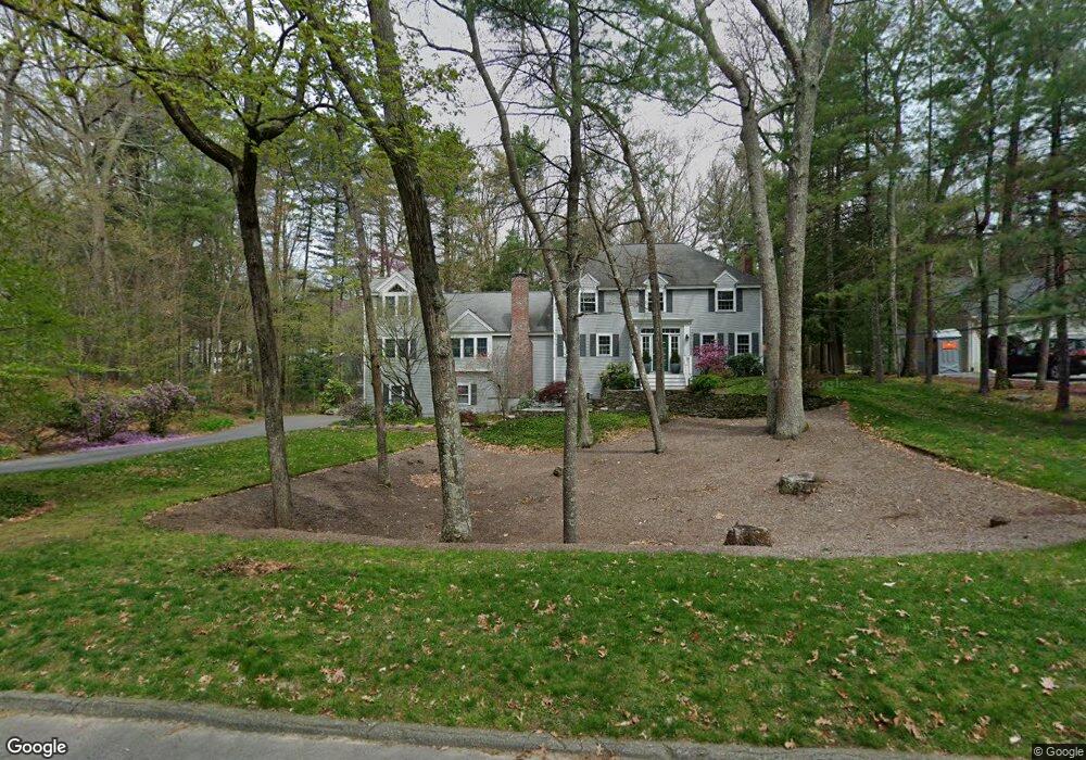
33 High Pine Cir Concord, MA 01742
Estimated Value: $1,671,000 - $2,002,000
5
Beds
5
Baths
4,100
Sq Ft
$448/Sq Ft
Est. Value
About This Home
This home is located at 33 High Pine Cir, Concord, MA 01742 and is currently estimated at $1,836,341, approximately $447 per square foot. 33 High Pine Cir is a home located in Middlesex County with nearby schools including Thoreau Elementary School, Concord Middle School, and Concord Carlisle High School.
Ownership History
Date
Name
Owned For
Owner Type
Purchase Details
Closed on
May 30, 1989
Sold by
Mckenna Harold C
Bought by
Andrews Timothy A
Current Estimated Value
Create a Home Valuation Report for This Property
The Home Valuation Report is an in-depth analysis detailing your home's value as well as a comparison with similar homes in the area
Home Values in the Area
Average Home Value in this Area
Purchase History
| Date | Buyer | Sale Price | Title Company |
|---|---|---|---|
| Andrews Timothy A | $428,000 | -- |
Source: Public Records
Mortgage History
| Date | Status | Borrower | Loan Amount |
|---|---|---|---|
| Open | Andrews Timothy A | $290,000 | |
| Closed | Andrews Timothy A | $75,000 | |
| Closed | Andrews Timothy A | $270,000 |
Source: Public Records
Tax History
| Year | Tax Paid | Tax Assessment Tax Assessment Total Assessment is a certain percentage of the fair market value that is determined by local assessors to be the total taxable value of land and additions on the property. | Land | Improvement |
|---|---|---|---|---|
| 2025 | $242 | $1,824,400 | $418,500 | $1,405,900 |
| 2024 | $23,639 | $1,800,400 | $418,500 | $1,381,900 |
| 2023 | $18,727 | $1,445,000 | $348,800 | $1,096,200 |
| 2022 | $19,342 | $1,310,400 | $309,400 | $1,001,000 |
| 2021 | $18,764 | $1,274,700 | $309,400 | $965,300 |
| 2020 | $18,338 | $1,288,700 | $309,400 | $979,300 |
| 2019 | $17,879 | $1,260,000 | $329,800 | $930,200 |
| 2018 | $17,432 | $1,219,900 | $328,100 | $891,800 |
| 2017 | $16,693 | $1,186,400 | $294,600 | $891,800 |
| 2016 | $16,736 | $1,202,300 | $294,600 | $907,700 |
| 2015 | $15,846 | $1,108,900 | $272,800 | $836,100 |
Source: Public Records
Map
Nearby Homes
- 29 Black Birch Ln Unit 29
- 96 Forest Ridge Rd Unit 96
- 1201 Old Marlboro Rd
- 62 Edgewood Rd
- 100 Harrington Ave
- 1844 Main St Unit 1844
- 1828 Main St
- 27 Water St
- 37 Water St
- 2 Skyview Ln
- 45 Millrun Ln Unit 45
- 26 Field Rd
- 1687 Main St
- 19 Deer Path Unit 5
- 24 Deer Path Unit 5
- 66 Old Stow Rd
- 42 Dakin Rd
- 3 Drummer Rd Unit B3
- 31 Drummer Rd Unit 31
- 22 Center Village Dr
- 45 High Pine Cir
- 121 Border Rd
- 17 High Pine Cir
- 55 High Pine Cir
- 65 High Pine Cir
- 134 Border Rd
- 144 Border Rd
- 118 Border Rd
- 104 Border Rd
- 77 High Pine Cir
- 595 Hayward Mill Rd
- 581 Hayward Mill Rd
- 611 Hayward Mill Rd
- 571 Hayward Mill Rd
- 76 High Pine Cir
- 188 Border Rd
- 92 Border Rd
- 69 Border Rd
- 561 Hayward Mill Rd
- 78 Border Rd
Your Personal Tour Guide
Ask me questions while you tour the home.