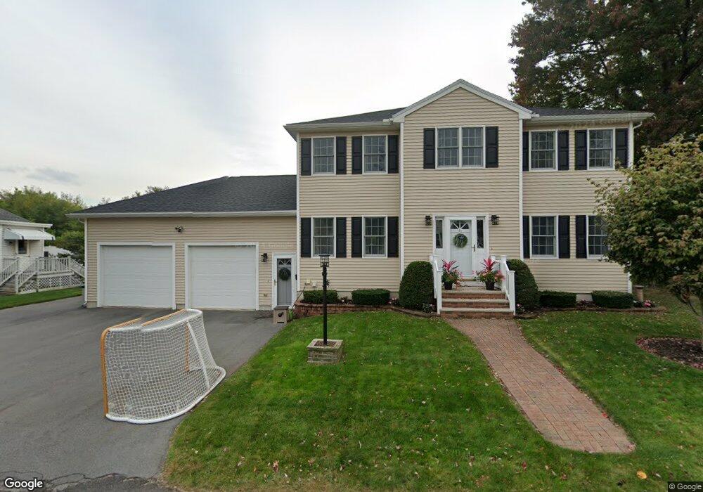
33 Hoffman Ave Lawrence, MA 01841
Prospect Hill-Back Bay NeighborhoodEstimated Value: $624,000 - $701,000
4
Beds
3
Baths
2,064
Sq Ft
$318/Sq Ft
Est. Value
About This Home
This home is located at 33 Hoffman Ave, Lawrence, MA 01841 and is currently estimated at $656,930, approximately $318 per square foot. 33 Hoffman Ave is a home located in Essex County with nearby schools including School For Exceptional Studies, Community Day Charter Public School - Gateway, and Esperanza Academy School of Hope.
Ownership History
Date
Name
Owned For
Owner Type
Purchase Details
Closed on
Oct 17, 2006
Sold by
Beaulieu Alfred J and Beaulieu Joseph A
Bought by
Beaulieu Joseph A and Beaulieu Tara
Current Estimated Value
Create a Home Valuation Report for This Property
The Home Valuation Report is an in-depth analysis detailing your home's value as well as a comparison with similar homes in the area
Home Values in the Area
Average Home Value in this Area
Purchase History
| Date | Buyer | Sale Price | Title Company |
|---|---|---|---|
| Beaulieu Joseph A | -- | -- |
Source: Public Records
Tax History
| Year | Tax Paid | Tax Assessment Tax Assessment Total Assessment is a certain percentage of the fair market value that is determined by local assessors to be the total taxable value of land and additions on the property. | Land | Improvement |
|---|---|---|---|---|
| 2025 | $4,817 | $547,400 | $154,500 | $392,900 |
| 2024 | $4,928 | $532,800 | $135,900 | $396,900 |
| 2023 | $5,077 | $499,700 | $123,700 | $376,000 |
| 2022 | $4,971 | $434,500 | $117,200 | $317,300 |
| 2021 | $4,741 | $386,400 | $117,200 | $269,200 |
| 2020 | $4,559 | $366,800 | $117,200 | $249,600 |
| 2019 | $4,651 | $340,000 | $91,900 | $248,100 |
| 2018 | $4,250 | $296,800 | $90,100 | $206,700 |
| 2017 | $3,879 | $252,900 | $82,900 | $170,000 |
| 2016 | $4,017 | $259,000 | $78,400 | $180,600 |
| 2015 | $3,916 | $259,000 | $78,400 | $180,600 |
Source: Public Records
Map
Nearby Homes
- 264 E Haverhill St Unit 2
- 32 Josephine Ave
- 1 Riverview Blvd Unit 8-203
- 1 Riverview Blvd Unit 1:209
- 1 Riverview Blvd Unit 4-203
- 106 Leroy Ave
- 109 Ferry St
- 2 Leslie St
- 201 Aberdeen Rd
- 18 Erhardt Terrace
- 7 Erhardt Terrace
- 162 E Haverhill St
- 39 Swan Ave
- 27 Woodland Ct
- 12 Annette St
- 14 Court St
- 68 Ashford St
- 52 Howard St
- 7 Stevens Ct
- 192 Union St
Your Personal Tour Guide
Ask me questions while you tour the home.