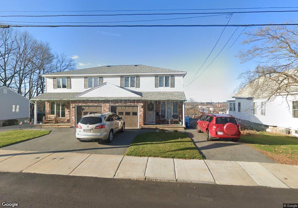
33 Lenox St Lawrence, MA 01843
Mount Vernon NeighborhoodEstimated Value: $308,000 - $497,000
3
Beds
2
Baths
--
Sq Ft
--
Built
About This Home
This home is located at 33 Lenox St, Lawrence, MA 01843 and is currently estimated at $417,023. 33 Lenox St is a home located in Essex County with nearby schools including Olive Branch Elementary School, John Breen School, and School For Exceptional Studies.
Ownership History
Date
Name
Owned For
Owner Type
Purchase Details
Closed on
Jun 16, 2008
Sold by
Quirion Louis A and Quirion Diane
Bought by
Desantis Tr Sam A and Desantis Rachel K
Current Estimated Value
Purchase Details
Closed on
Nov 1, 2002
Sold by
Potvin Anita
Bought by
Quirion Diane and Quirion Louis A
Purchase Details
Closed on
Jan 15, 1988
Sold by
Pinet Ghislain
Bought by
Potvin Romeo
Create a Home Valuation Report for This Property
The Home Valuation Report is an in-depth analysis detailing your home's value as well as a comparison with similar homes in the area
Home Values in the Area
Average Home Value in this Area
Purchase History
| Date | Buyer | Sale Price | Title Company |
|---|---|---|---|
| Desantis Tr Sam A | $187,000 | -- | |
| Quirion Diane | $190,000 | -- | |
| Potvin Romeo | $114,900 | -- |
Source: Public Records
Tax History Compared to Growth
Tax History
| Year | Tax Paid | Tax Assessment Tax Assessment Total Assessment is a certain percentage of the fair market value that is determined by local assessors to be the total taxable value of land and additions on the property. | Land | Improvement |
|---|---|---|---|---|
| 2025 | $2,949 | $335,100 | $0 | $335,100 |
| 2024 | $2,753 | $297,600 | $0 | $297,600 |
| 2023 | $2,691 | $264,900 | $0 | $264,900 |
| 2022 | $2,815 | $246,100 | $0 | $246,100 |
| 2021 | $2,690 | $219,200 | $0 | $219,200 |
| 2020 | $2,558 | $205,800 | $0 | $205,800 |
| 2019 | $2,532 | $185,100 | $0 | $185,100 |
| 2018 | $2,379 | $166,100 | $0 | $166,100 |
| 2017 | $2,313 | $150,800 | $0 | $150,800 |
| 2016 | $2,280 | $147,000 | $0 | $147,000 |
| 2015 | $2,223 | $147,000 | $0 | $147,000 |
Source: Public Records
Map
Nearby Homes
- 24 Inman St Unit 32
- 5 W Kenneth St
- 34 Leeds Terrace
- 11 W Hawley St
- 5 Lafayette Ave
- 33 Jefferson St
- 42 Beresford St
- 102 Weare St
- 49 Bowdoin St Unit 51
- 15 Beaconsfield St
- 27-29 Dorchester St
- 629 Andover St
- 19 Front St
- 20 Mckenney Cir
- 54 Amherst St
- 91-93 Newton St
- 356-360 S Union St
- 437 N Main St Unit C
- 5 Marc Ln
- 41 Durham St
- 33 Lenox St Unit 33
- 29 Lenox St
- 35 Lenox St
- 35 Lenox St Unit 2 35
- 49 Lenox St
- 46 Kenneth St
- 52 W Kenneth St
- 32 Lenox St
- 28 Lenox St Unit 30
- 28 Lenox St Unit 1
- 25 Lenox St Unit 2 R
- 25 Lenox St Unit 25 Lenox St 2r Lawr
- 25 Lenox St
- 36 Lenox St
- 24 Lenox St
- 24 Lenox St
- 24 Lenox St Unit 1
- 24 Lenox St
- 24 Lenox St Unit 4
- 136 Brookfield St