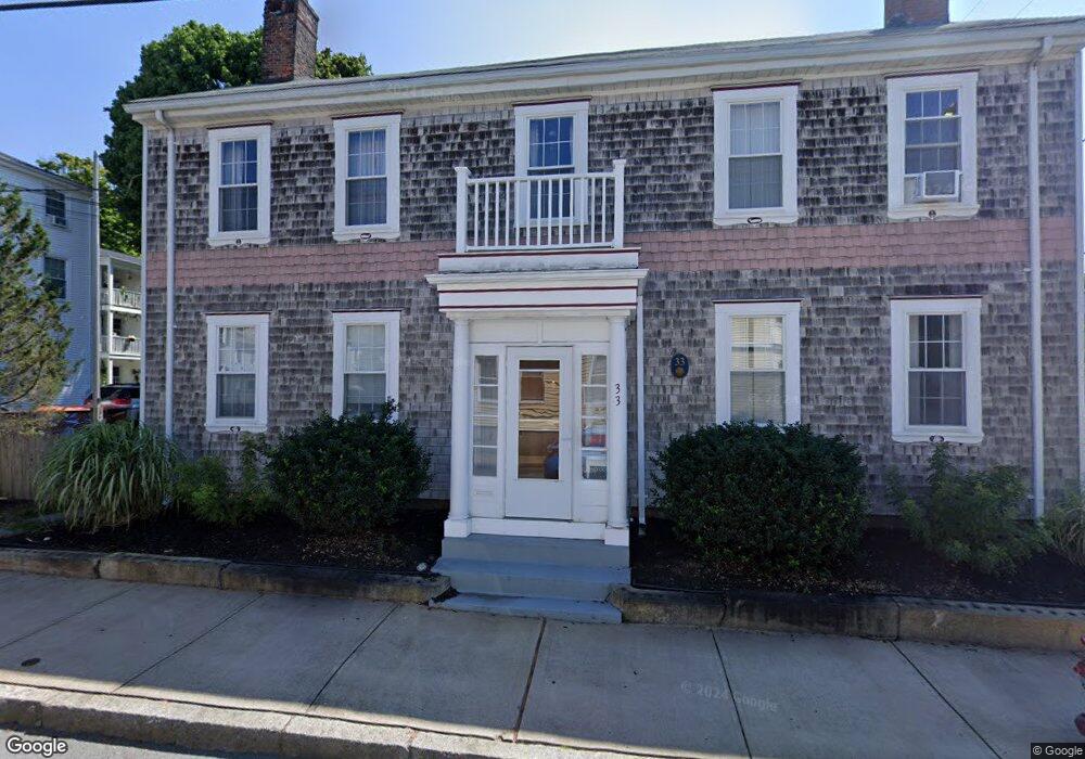
33 Main St Fairhaven, MA 02719
Estimated Value: $520,000 - $680,000
4
Beds
3
Baths
3,298
Sq Ft
$191/Sq Ft
Est. Value
About This Home
This home is located at 33 Main St, Fairhaven, MA 02719 and is currently estimated at $630,048, approximately $191 per square foot. 33 Main St is a home located in Bristol County with nearby schools including Fairhaven High School, City On A Hill Charter Public School New Bedford, and St. Joseph School.
Ownership History
Date
Name
Owned For
Owner Type
Purchase Details
Closed on
May 4, 2021
Sold by
Allan Geoffrey K
Bought by
Anacleto Kelcie K and Lawis Kelly
Current Estimated Value
Home Financials for this Owner
Home Financials are based on the most recent Mortgage that was taken out on this home.
Original Mortgage
$368,000
Outstanding Balance
$332,978
Interest Rate
3%
Mortgage Type
Purchase Money Mortgage
Estimated Equity
$297,070
Purchase Details
Closed on
Jul 3, 1995
Sold by
Swift Robert W
Bought by
Allan Geoffrey K
Home Financials for this Owner
Home Financials are based on the most recent Mortgage that was taken out on this home.
Original Mortgage
$124,500
Interest Rate
7.8%
Mortgage Type
Purchase Money Mortgage
Create a Home Valuation Report for This Property
The Home Valuation Report is an in-depth analysis detailing your home's value as well as a comparison with similar homes in the area
Home Values in the Area
Average Home Value in this Area
Purchase History
| Date | Buyer | Sale Price | Title Company |
|---|---|---|---|
| Anacleto Kelcie K | $460,000 | None Available | |
| Allan Geoffrey K | $177,900 | -- |
Source: Public Records
Mortgage History
| Date | Status | Borrower | Loan Amount |
|---|---|---|---|
| Open | Anacleto Kelcie K | $368,000 | |
| Previous Owner | Allan Geoffrey K | $124,500 | |
| Previous Owner | Allan Geoffrey K | $52,000 | |
| Previous Owner | Allan Geoffrey K | $19,030 | |
| Previous Owner | Allan Geoffrey K | $15,020 |
Source: Public Records
Tax History Compared to Growth
Tax History
| Year | Tax Paid | Tax Assessment Tax Assessment Total Assessment is a certain percentage of the fair market value that is determined by local assessors to be the total taxable value of land and additions on the property. | Land | Improvement |
|---|---|---|---|---|
| 2025 | $45 | $487,600 | $172,300 | $315,300 |
| 2024 | $4,467 | $484,000 | $172,300 | $311,700 |
| 2023 | $4,360 | $438,200 | $150,900 | $287,300 |
| 2022 | $4,397 | $430,200 | $140,200 | $290,000 |
| 2021 | $4,272 | $378,400 | $126,900 | $251,500 |
| 2020 | $4,185 | $378,400 | $126,900 | $251,500 |
| 2019 | $4,257 | $364,800 | $105,300 | $259,500 |
| 2018 | $3,999 | $340,300 | $100,200 | $240,100 |
| 2017 | $3,801 | $315,700 | $100,200 | $215,500 |
| 2016 | $3,619 | $297,100 | $100,200 | $196,900 |
| 2015 | $3,536 | $291,000 | $100,200 | $190,800 |
Source: Public Records
Map
Nearby Homes