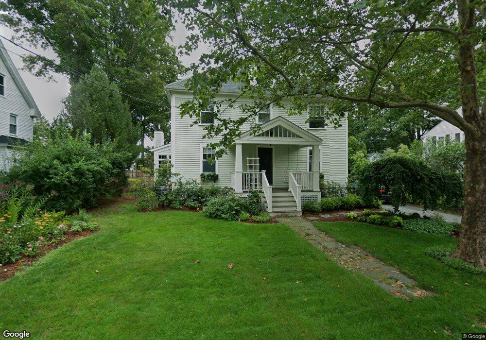
33 Maple St Concord, MA 01742
Estimated Value: $1,335,623 - $1,419,000
3
Beds
4
Baths
2,253
Sq Ft
$609/Sq Ft
Est. Value
About This Home
This home is located at 33 Maple St, Concord, MA 01742 and is currently estimated at $1,373,156, approximately $609 per square foot. 33 Maple St is a home located in Middlesex County with nearby schools including Thoreau Elementary School, Concord Middle School, and Concord Carlisle High School.
Ownership History
Date
Name
Owned For
Owner Type
Purchase Details
Closed on
Jun 8, 1998
Sold by
Jurras John R and Jurras Linda K
Bought by
Sgarzi Christopher and Sgarzi Ann B
Current Estimated Value
Create a Home Valuation Report for This Property
The Home Valuation Report is an in-depth analysis detailing your home's value as well as a comparison with similar homes in the area
Home Values in the Area
Average Home Value in this Area
Purchase History
| Date | Buyer | Sale Price | Title Company |
|---|---|---|---|
| Sgarzi Christopher | $370,000 | -- |
Source: Public Records
Mortgage History
| Date | Status | Borrower | Loan Amount |
|---|---|---|---|
| Open | Sgarzi Christopher | $80,000 |
Source: Public Records
Tax History
| Year | Tax Paid | Tax Assessment Tax Assessment Total Assessment is a certain percentage of the fair market value that is determined by local assessors to be the total taxable value of land and additions on the property. | Land | Improvement |
|---|---|---|---|---|
| 2025 | $144 | $1,087,600 | $414,100 | $673,500 |
| 2024 | $13,948 | $1,062,300 | $414,100 | $648,200 |
| 2023 | $11,803 | $910,700 | $376,500 | $534,200 |
| 2022 | $13,079 | $886,100 | $301,200 | $584,900 |
| 2021 | $12,004 | $815,500 | $301,200 | $514,300 |
| 2020 | $11,629 | $817,200 | $301,200 | $516,000 |
| 2019 | $11,116 | $783,400 | $311,200 | $472,200 |
| 2018 | $10,134 | $709,200 | $285,600 | $423,600 |
| 2017 | $9,852 | $700,200 | $265,300 | $434,900 |
| 2016 | $9,026 | $648,400 | $265,300 | $383,100 |
| 2015 | $8,444 | $590,900 | $245,600 | $345,300 |
Source: Public Records
Map
Nearby Homes
- 54 Maple St
- 95 Conant St Unit 320
- 116 Conant St
- 42 Sunnyside Ln
- 70 McCallar Ln
- 22 Center Village Dr
- 111 Central St
- 53 Prairie St
- 21 Concord Greene Unit 8
- 66 Old Stow Rd
- 47 Bridgecourt Ln
- 45 Millrun Ln Unit 45
- 16 Concord Greene Unit 5
- 20 Westvale Meadows Unit C
- 55 Staffordshire Ln Unit B
- 27 Water St
- 37 Water St
- 245 Oak Hill Cir
- 79-81 Assabet Ave
- 65 Summit St
- 25 Maple St
- 41 Maple St
- 37 Maple Ct
- 28 Maple St
- 38 Maple St
- 15 Maple St Unit 15
- 53 Maple St
- 48 Maple St
- 31 Maple Ct
- 15 Brooks St
- 15 Brooks St Unit 1
- 15 Brooks St Unit 15
- 16-18 Maple St Unit 18
- 16-18 Maple St Unit 16
- 17 Laws Brook Rd
- 17 Laws Brook Rd Unit 2
- 17 Laws Brook Rd Unit 1
- 17 Laws Brook Rd Unit 3
- 17 Laws Brook Rd Unit B
- 135 Commonwealth Ave Unit 3
Your Personal Tour Guide
Ask me questions while you tour the home.