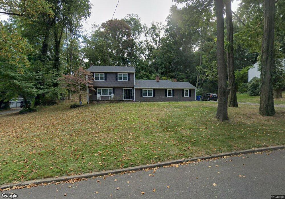
33 Marlpit Place Middletown, NJ 07748
New Monmouth NeighborhoodEstimated Value: $749,672 - $939,000
3
Beds
3
Baths
2,158
Sq Ft
$392/Sq Ft
Est. Value
About This Home
This home is located at 33 Marlpit Place, Middletown, NJ 07748 and is currently estimated at $845,418, approximately $391 per square foot. 33 Marlpit Place is a home located in Monmouth County with nearby schools including Middletown Village Elementary School, Thompson Middle School, and Middletown High School North.
Ownership History
Date
Name
Owned For
Owner Type
Purchase Details
Closed on
Apr 9, 2009
Sold by
Velardi Joseph F and Velardi Jessica A
Bought by
Velardi Joseph F and Velardi Jessica A
Current Estimated Value
Home Financials for this Owner
Home Financials are based on the most recent Mortgage that was taken out on this home.
Original Mortgage
$350,000
Outstanding Balance
$219,827
Interest Rate
4.82%
Mortgage Type
Stand Alone Refi Refinance Of Original Loan
Estimated Equity
$625,591
Purchase Details
Closed on
Jul 2, 2005
Sold by
Fitzgerald John P
Bought by
Velardi Joseph F and Aguirre Jessica
Home Financials for this Owner
Home Financials are based on the most recent Mortgage that was taken out on this home.
Original Mortgage
$359,650
Interest Rate
5.68%
Mortgage Type
Purchase Money Mortgage
Create a Home Valuation Report for This Property
The Home Valuation Report is an in-depth analysis detailing your home's value as well as a comparison with similar homes in the area
Home Values in the Area
Average Home Value in this Area
Purchase History
| Date | Buyer | Sale Price | Title Company |
|---|---|---|---|
| Velardi Joseph F | -- | Multiple | |
| Velardi Joseph F | $555,500 | -- |
Source: Public Records
Mortgage History
| Date | Status | Borrower | Loan Amount |
|---|---|---|---|
| Open | Velardi Joseph F | $350,000 | |
| Previous Owner | Velardi Joseph F | $359,650 |
Source: Public Records
Tax History Compared to Growth
Tax History
| Year | Tax Paid | Tax Assessment Tax Assessment Total Assessment is a certain percentage of the fair market value that is determined by local assessors to be the total taxable value of land and additions on the property. | Land | Improvement |
|---|---|---|---|---|
| 2025 | $11,012 | $675,200 | $360,400 | $314,800 |
| 2024 | $10,124 | $669,400 | $360,400 | $309,000 |
| 2023 | $10,124 | $582,500 | $328,900 | $253,600 |
| 2022 | $11,086 | $578,000 | $313,200 | $264,800 |
| 2021 | $11,086 | $533,000 | $297,400 | $235,600 |
| 2020 | $11,314 | $529,200 | $295,600 | $233,600 |
| 2019 | $11,149 | $527,900 | $295,600 | $232,300 |
| 2018 | $11,275 | $520,300 | $295,600 | $224,700 |
| 2017 | $10,439 | $491,500 | $273,700 | $217,800 |
| 2016 | $10,229 | $480,000 | $273,700 | $206,300 |
| 2015 | $10,219 | $478,400 | $273,700 | $204,700 |
| 2014 | $10,087 | $460,800 | $273,700 | $187,100 |
Source: Public Records
Map
Nearby Homes
- 17 Winding Brook Way
- 3 Green Oak Blvd
- 8 Church St
- 61 Pate Dr
- 63 Pate Dr
- 27 Pate Dr
- 7 Rosewood Terrace
- 123-125 Magnolia Ln
- 4 Del Ray Ct
- 161 Cherry Tree Ln
- 4 Coral Place
- 164 Heights Terrace
- 44 Devonshire Ct
- 7 Acker Dr
- 93 Twin Brooks Ave
- 2 Ware Place
- 93 Wallace Rd
- 1305 Arose Ln
- 20 Devon Rd
- 35 Woodland Dr