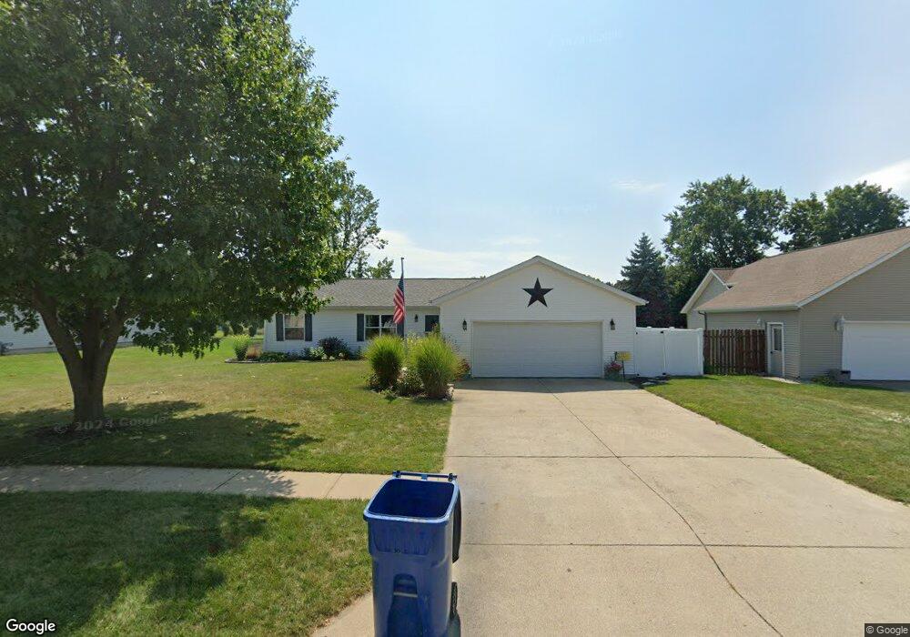
33 Michael Dr Coldwater, MI 49036
Estimated Value: $239,540 - $274,000
3
Beds
2
Baths
1,421
Sq Ft
$181/Sq Ft
Est. Value
About This Home
This home is located at 33 Michael Dr, Coldwater, MI 49036 and is currently estimated at $256,885, approximately $180 per square foot. 33 Michael Dr is a home located in Branch County with nearby schools including Coldwater High School, Pansophia Academy, and St. Paul Lutheran School - Coldwater.
Ownership History
Date
Name
Owned For
Owner Type
Purchase Details
Closed on
Sep 28, 2020
Sold by
Houtz Jon
Bought by
Houtz Jon and Houtz Amy
Current Estimated Value
Purchase Details
Closed on
May 10, 2011
Sold by
Houtz Donna
Bought by
Houtz Jon
Purchase Details
Closed on
May 17, 2002
Sold by
Mullen Randy J and Mullen Deborah I
Bought by
Houtz Jon and Houtz Donna
Purchase Details
Closed on
Nov 26, 2001
Sold by
Moore Brit A and Moore Jennifer J
Bought by
Mullen Randy J and Mullen Deborah I
Purchase Details
Closed on
Nov 5, 1999
Bought by
Moore Brit A and Moore Jennifer J
Create a Home Valuation Report for This Property
The Home Valuation Report is an in-depth analysis detailing your home's value as well as a comparison with similar homes in the area
Home Values in the Area
Average Home Value in this Area
Purchase History
| Date | Buyer | Sale Price | Title Company |
|---|---|---|---|
| Houtz Jon | -- | None Available | |
| Houtz Jon | -- | None Available | |
| Houtz Jon | $120,000 | -- | |
| Mullen Randy J | $115,000 | -- | |
| Moore Brit A | $110,000 | -- |
Source: Public Records
Tax History
| Year | Tax Paid | Tax Assessment Tax Assessment Total Assessment is a certain percentage of the fair market value that is determined by local assessors to be the total taxable value of land and additions on the property. | Land | Improvement |
|---|---|---|---|---|
| 2025 | $3,343 | $118,700 | $0 | $0 |
| 2024 | $32 | $112,950 | $0 | $0 |
| 2023 | $2,243 | $100,000 | $0 | $0 |
| 2022 | $3,209 | $108,100 | $0 | $0 |
| 2020 | -- | $88,500 | $0 | $0 |
| 2019 | -- | $82,550 | $0 | $0 |
| 2018 | -- | $77,250 | $0 | $0 |
| 2017 | -- | $66,500 | $0 | $0 |
| 2016 | -- | $74,600 | $0 | $0 |
| 2015 | -- | $70,700 | $0 | $0 |
| 2014 | -- | $68,150 | $0 | $0 |
| 2013 | -- | $65,350 | $0 | $0 |
Source: Public Records
Map
Nearby Homes
- 56 Thompson Blvd
- 195 Cutter Ave
- 67 E Pierce St
- 122 N Hudson St
- 36 E Alden St
- 40 Balfour Dr
- 175 N Michigan Ave Unit 99
- 175 N Michigan Ave Unit 193
- 175 N Michigan Ave Unit 179
- 175 N Michigan Ave Unit 60
- 175 N Michigan Ave Unit 199
- 175 N Michigan Ave Unit 137
- 175 N Michigan Ave Unit 200
- 175 N Michigan Ave Unit 217
- 175 N Michigan Ave Unit 195
- 175 N Michigan Ave Unit 203
- 175 N Michigan Ave Unit 194
- 175 N Michigan Ave Unit 178
- 175 N Michigan Ave Unit 198
- 279 Marshall St
- 21 Michael Dr
- 39 Michael Dr
- 27 Michael Dr
- 47 Michael Dr
- 40 Michael Dr
- 32 Michael Dr
- 56 Central Park Dr
- 50 Central Park Dr
- 48 Michael Dr
- 15 Michael Dr
- 26 Michael Dr
- 62 Central Park Dr
- 46 Central Park Dr
- 56 Michael Dr
- 0 Girard Rd
- 20 Michael Dr
- 53 Central Park Dr
- 23 Thompson Blvd
- 59 Michael Dr
- 68 Central Park Dr
Your Personal Tour Guide
Ask me questions while you tour the home.