
Seller's Agent in 2026
Robert Nichols
MIG
(617) 997-4963
3 in this area
117 Total Sales
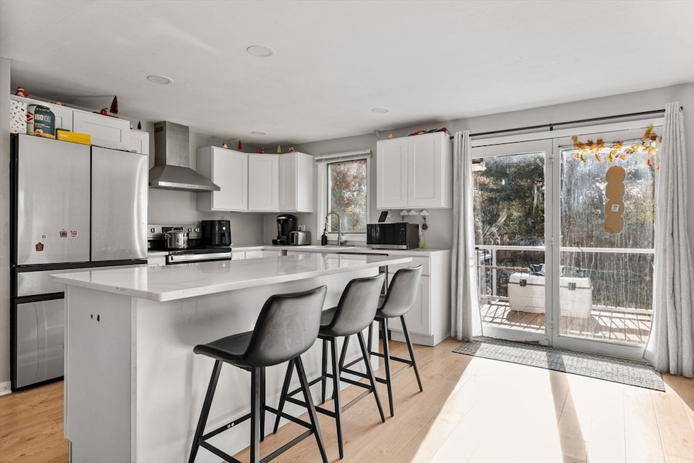
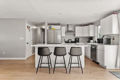
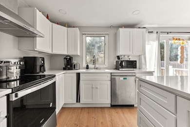
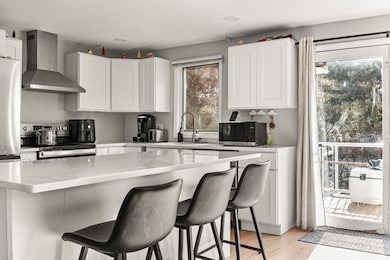
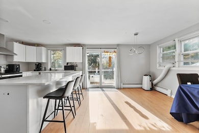
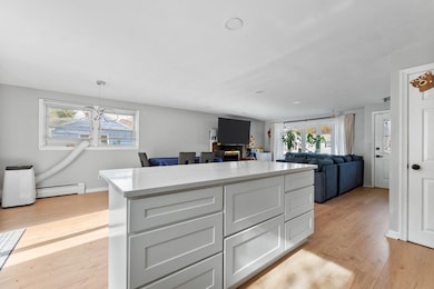
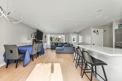
Charming single family ranch on a quiet street. The main level has been fully renovated with a new kitchen featuring shaker cabinets, quartz counter tops stainless steel appliaces and large island andbaths hardwood floors and plenty of natural light, and the finished lower level includes an in-law style setup that adds great flexibility for extended family, guests or extra living space. The home has a solid list of updates in the past two years including recessed LED lighting, a new deck, a newer water heater and furnace, plus recent repointing. Vinyl siding keeps exterior maintenance simple. The fenced backyard with a deck and storage shed rounds it out, giving you a comfortable space to relax or entertain. This is a well cared for home ready for its next owner.
| Date | Type | Sale Price | Title Company |
|---|---|---|---|
| Quit Claim Deed | $660,000 | -- | |
| Quit Claim Deed | -- | -- | |
| Quit Claim Deed | -- | None Available | |
| Quit Claim Deed | -- | None Available | |
| Land Court Massachusetts | $369,900 | -- | |
| Leasehold Conv With Agreement Of Sale Fee Purchase Hawaii | $130,000 | -- | |
| Leasehold Conv With Agreement Of Sale Fee Purchase Hawaii | $139,000 | -- | |
| Land Court Massachusetts | $369,900 | -- | |
| Land Court Massachusetts | $234,900 | -- | |
| Leasehold Conv With Agreement Of Sale Fee Purchase Hawaii | $130,000 | -- | |
| Leasehold Conv With Agreement Of Sale Fee Purchase Hawaii | $139,000 | -- |
| Date | Status | Loan Amount | Loan Type |
|---|---|---|---|
| Open | $648,045 | Purchase Money Mortgage | |
| Previous Owner | $380,000 | Purchase Money Mortgage | |
| Previous Owner | $332,900 | Purchase Money Mortgage | |
| Previous Owner | $211,410 | Purchase Money Mortgage | |
| Previous Owner | $102,700 | No Value Available |
| Date | Event | Price | List to Sale | Price per Sq Ft |
|---|---|---|---|---|
| 03/02/2026 03/02/26 | Sold | $660,000 | +1.7% | $378 / Sq Ft |
| 12/09/2025 12/09/25 | Pending | -- | -- | -- |
| 11/20/2025 11/20/25 | For Sale | $649,000 | -- | $372 / Sq Ft |
| Year | Tax Paid | Tax Assessment Tax Assessment Total Assessment is a certain percentage of the fair market value that is determined by local assessors to be the total taxable value of land and additions on the property. | Land | Improvement |
|---|---|---|---|---|
| 2025 | $5,797 | $499,300 | $254,200 | $245,100 |
| 2024 | $5,408 | $472,300 | $249,100 | $223,200 |
| 2023 | $5,231 | $433,000 | $226,500 | $206,500 |
| 2022 | $5,093 | $374,500 | $188,800 | $185,700 |
| 2021 | $4,997 | $338,100 | $157,300 | $180,800 |
| 2020 | $4,871 | $326,700 | $157,300 | $169,400 |
| 2019 | $4,674 | $312,000 | $149,900 | $162,100 |
| 2018 | $4,651 | $292,900 | $136,100 | $156,800 |
| 2017 | $4,352 | $269,000 | $129,700 | $139,300 |
| 2016 | $4,233 | $243,400 | $117,800 | $125,600 |
| 2015 | $4,120 | $227,600 | $112,300 | $115,300 |
Seller's Agent in 2026
Robert Nichols
MIG
(617) 997-4963
3 in this area
117 Total Sales
Seller Co-Listing Agent in 2026
Mauricio Florian
MIG
(617) 515-8720
1 in this area
2 Total Sales
Source: MLS Property Information Network (MLS PIN)
MLS Number: 73456721
APN: RAND-000010-B000000-003340
Disclaimer: Certain information contained herein is derived from information provided by parties other than Homes.com. All information provided is deemed reliable, but is not guaranteed to be accurate and should be independently verified.
![]() The property listing data and information, or the Images, set forth herein were provided to MLS Property Information Network, Inc. from third party sources, including sellers, lessors and public records, and were compiled by MLS Property Information Network, Inc. The property listing data and information, and the Images, are for the personal, non-commercial use of consumers having a good faith interest in purchasing or leasing listed properties of the type displayed to them and may not be used for any purpose other than to identify prospective properties which such consumers may have a good faith interest in purchasing or leasing. MLS Property Information Network, Inc. and its subscribers disclaim any and all representations and warranties as to the accuracy of the property listing data and information, or as to the accuracy of any of the Images, set forth herein.
The property listing data and information, or the Images, set forth herein were provided to MLS Property Information Network, Inc. from third party sources, including sellers, lessors and public records, and were compiled by MLS Property Information Network, Inc. The property listing data and information, and the Images, are for the personal, non-commercial use of consumers having a good faith interest in purchasing or leasing listed properties of the type displayed to them and may not be used for any purpose other than to identify prospective properties which such consumers may have a good faith interest in purchasing or leasing. MLS Property Information Network, Inc. and its subscribers disclaim any and all representations and warranties as to the accuracy of the property listing data and information, or as to the accuracy of any of the Images, set forth herein.
Ask me questions while you tour the home.