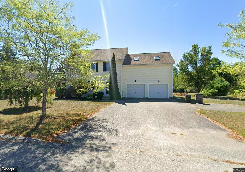
33 Mohawk Dr Gardner, MA 01440
Estimated Value: $477,000 - $541,000
3
Beds
3
Baths
2,256
Sq Ft
$227/Sq Ft
Est. Value
About This Home
This home is located at 33 Mohawk Dr, Gardner, MA 01440 and is currently estimated at $511,635, approximately $226 per square foot. 33 Mohawk Dr is a home located in Worcester County with nearby schools including Gardner High School and Holy Family Academy.
Ownership History
Date
Name
Owned For
Owner Type
Purchase Details
Closed on
Aug 8, 2002
Sold by
Kao Hill T and Kao Hakala
Bought by
Hastings Dwight S and Hastings Christine M
Current Estimated Value
Home Financials for this Owner
Home Financials are based on the most recent Mortgage that was taken out on this home.
Original Mortgage
$231,180
Outstanding Balance
$98,033
Interest Rate
6.58%
Mortgage Type
Purchase Money Mortgage
Estimated Equity
$413,602
Create a Home Valuation Report for This Property
The Home Valuation Report is an in-depth analysis detailing your home's value as well as a comparison with similar homes in the area
Home Values in the Area
Average Home Value in this Area
Purchase History
| Date | Buyer | Sale Price | Title Company |
|---|---|---|---|
| Hastings Dwight S | $243,350 | -- |
Source: Public Records
Mortgage History
| Date | Status | Borrower | Loan Amount |
|---|---|---|---|
| Open | Hastings Dwight S | $231,180 |
Source: Public Records
Tax History
| Year | Tax Paid | Tax Assessment Tax Assessment Total Assessment is a certain percentage of the fair market value that is determined by local assessors to be the total taxable value of land and additions on the property. | Land | Improvement |
|---|---|---|---|---|
| 2025 | $64 | $448,400 | $86,000 | $362,400 |
| 2024 | $6,666 | $444,700 | $78,300 | $366,400 |
| 2023 | $6,283 | $389,500 | $77,200 | $312,300 |
| 2022 | $6,181 | $332,500 | $58,400 | $274,100 |
| 2021 | $5,998 | $299,300 | $50,700 | $248,600 |
| 2020 | $5,707 | $289,100 | $50,700 | $238,400 |
| 2019 | $5,514 | $273,800 | $50,700 | $223,100 |
| 2018 | $5,138 | $253,500 | $50,700 | $202,800 |
| 2017 | $5,186 | $253,200 | $50,700 | $202,500 |
| 2016 | $4,972 | $242,900 | $50,700 | $192,200 |
| 2015 | $4,741 | $237,300 | $50,700 | $186,600 |
| 2014 | $4,210 | $223,100 | $45,000 | $178,100 |
Source: Public Records
Map
Nearby Homes
- 199 Barthel Ave
- 11 Patriots Rd
- 14 Baker Ln
- 179 Waterford St
- 72
- 143 Greenwood St
- 40 Sawyer St
- 448 Pleasant St
- 337-343 Parker St
- 210 Nichols St
- 126 Dyer St
- 18 S Main St
- 0 Gardner Rd Unit Applewood
- 0 Gardner Rd Unit Willow
- 65 S Main St
- 172 Parker St
- 25 Coleman St
- 205-213 Main St
- 84 Jean St
- 8-12 Nichols St