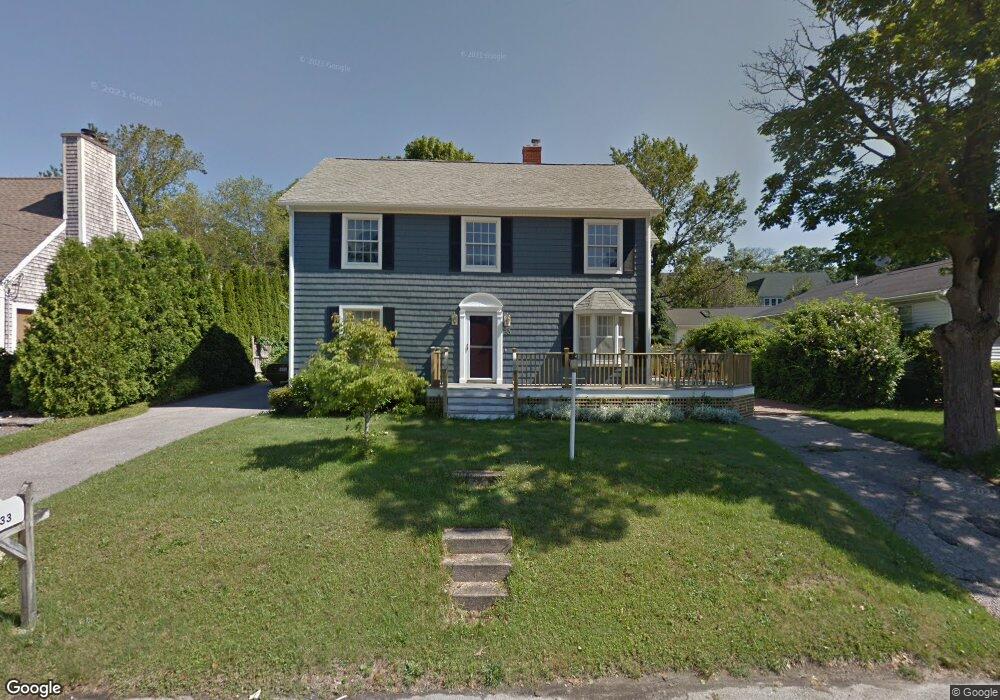
33 Othmar St Narragansett, RI 02882
Estimated Value: $1,076,000 - $1,466,000
3
Beds
2
Baths
2,619
Sq Ft
$493/Sq Ft
Est. Value
About This Home
This home is located at 33 Othmar St, Narragansett, RI 02882 and is currently estimated at $1,289,997, approximately $492 per square foot. 33 Othmar St is a home located in Washington County with nearby schools including Narragansett Elementary School, Narragansett Pier Middle School, and Narragansett High School.
Ownership History
Date
Name
Owned For
Owner Type
Purchase Details
Closed on
Jun 12, 2025
Sold by
Maclean Paul G and Maclean Diane M
Bought by
Maclean Paul G and Maclean Diane M
Current Estimated Value
Create a Home Valuation Report for This Property
The Home Valuation Report is an in-depth analysis detailing your home's value as well as a comparison with similar homes in the area
Home Values in the Area
Average Home Value in this Area
Purchase History
| Date | Buyer | Sale Price | Title Company |
|---|---|---|---|
| Maclean Paul G | -- | None Available | |
| Maclean Paul G | -- | None Available |
Source: Public Records
Tax History Compared to Growth
Tax History
| Year | Tax Paid | Tax Assessment Tax Assessment Total Assessment is a certain percentage of the fair market value that is determined by local assessors to be the total taxable value of land and additions on the property. | Land | Improvement |
|---|---|---|---|---|
| 2025 | $6,826 | $1,005,300 | $568,700 | $436,600 |
| 2024 | $6,585 | $1,005,300 | $568,700 | $436,600 |
| 2023 | $7,221 | $775,600 | $427,700 | $347,900 |
| 2022 | $6,980 | $775,600 | $427,700 | $347,900 |
| 2021 | $6,872 | $775,600 | $427,700 | $347,900 |
| 2020 | $6,234 | $594,800 | $269,000 | $325,800 |
| 2019 | $6,085 | $594,800 | $269,000 | $325,800 |
| 2018 | $5,918 | $594,800 | $269,000 | $325,800 |
| 2017 | $5,929 | $561,500 | $285,900 | $275,600 |
| 2016 | $5,660 | $561,500 | $285,900 | $275,600 |
| 2015 | $5,581 | $561,500 | $285,900 | $275,600 |
| 2014 | $4,840 | $482,100 | $215,800 | $266,300 |
Source: Public Records
Map
Nearby Homes
- 56 Wanda St
- 14 Robinson St
- 20 Narragansett Ave Unit 905
- 137A Kingstown Rd
- 137 Kingstown Rd
- 20 5th Ave
- 16 Courtway St
- 126 Boon St
- 31 Avice St
- 19 Castle Rd
- 49 Westmoreland St
- 30 Sweet Meadows Ct Unit 26
- 27 Westmoreland St
- 26 Westmoreland St
- 275 Boston Neck Rd
- 150 Camden Ct
- 73 Camden Ct
- 0 Hazard Ave
- 45 Cherry Ln Unit E
- 45 Cherry Ln Unit C