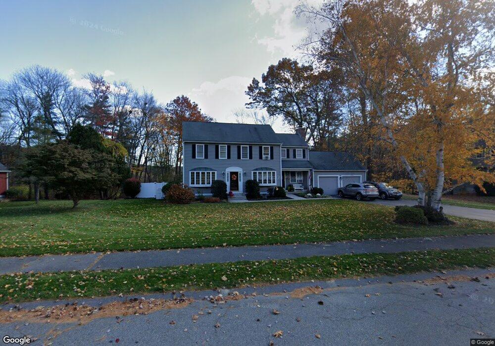
33 Paige Farm Rd Amesbury, MA 01913
Estimated Value: $871,155 - $999,000
4
Beds
3
Baths
2,272
Sq Ft
$402/Sq Ft
Est. Value
About This Home
This home is located at 33 Paige Farm Rd, Amesbury, MA 01913 and is currently estimated at $912,289, approximately $401 per square foot. 33 Paige Farm Rd is a home located in Essex County with nearby schools including Amesbury High School and Amesbury Seventh-Day Adventist School.
Ownership History
Date
Name
Owned For
Owner Type
Purchase Details
Closed on
Jun 30, 2005
Sold by
Brownell James A and Choimere Raymond P
Bought by
Delisle Joseph S and Delisle Melissa S
Current Estimated Value
Home Financials for this Owner
Home Financials are based on the most recent Mortgage that was taken out on this home.
Original Mortgage
$484,000
Outstanding Balance
$253,795
Interest Rate
5.73%
Mortgage Type
Purchase Money Mortgage
Estimated Equity
$658,494
Purchase Details
Closed on
Mar 22, 1993
Sold by
Southampton Woods Dev
Bought by
Choiniere Raymond P and Brownell James A
Home Financials for this Owner
Home Financials are based on the most recent Mortgage that was taken out on this home.
Original Mortgage
$189,900
Interest Rate
7.75%
Mortgage Type
Purchase Money Mortgage
Create a Home Valuation Report for This Property
The Home Valuation Report is an in-depth analysis detailing your home's value as well as a comparison with similar homes in the area
Home Values in the Area
Average Home Value in this Area
Purchase History
| Date | Buyer | Sale Price | Title Company |
|---|---|---|---|
| Delisle Joseph S | $605,000 | -- | |
| Choiniere Raymond P | $199,900 | -- |
Source: Public Records
Mortgage History
| Date | Status | Borrower | Loan Amount |
|---|---|---|---|
| Open | Choiniere Raymond P | $484,000 | |
| Previous Owner | Choiniere Raymond P | $135,000 | |
| Previous Owner | Choiniere Raymond P | $164,000 | |
| Previous Owner | Choiniere Raymond P | $189,900 |
Source: Public Records
Tax History Compared to Growth
Tax History
| Year | Tax Paid | Tax Assessment Tax Assessment Total Assessment is a certain percentage of the fair market value that is determined by local assessors to be the total taxable value of land and additions on the property. | Land | Improvement |
|---|---|---|---|---|
| 2025 | $11,911 | $778,500 | $302,900 | $475,600 |
| 2024 | $11,375 | $727,300 | $285,700 | $441,600 |
| 2023 | $10,423 | $637,900 | $248,500 | $389,400 |
| 2022 | $10,227 | $578,100 | $216,500 | $361,600 |
| 2021 | $9,738 | $533,600 | $175,000 | $358,600 |
| 2020 | $8,449 | $491,800 | $168,400 | $323,400 |
| 2019 | $8,603 | $468,300 | $168,400 | $299,900 |
| 2018 | $8,479 | $446,500 | $160,300 | $286,200 |
| 2017 | $8,712 | $436,700 | $160,300 | $276,400 |
| 2016 | $8,512 | $419,700 | $160,300 | $259,400 |
Source: Public Records
Map
Nearby Homes
- 25 Whittier Meadows Dr
- 1 Brown Ave Unit 1-37
- 1 Brown Ave Unit 3-78
- 1 Brown Ave Unit 3-80
- 3 Brown Ave Unit 75
- 2 Locke Hill Ln
- 1 Stacey Ln
- 57 Clinton St
- 51 Locust St
- 28 Powderhouse Ct Unit 28
- 105 Market St Unit B
- 103 Market St Unit A
- 16 Glen Devin St
- 101 Market St Unit B
- 101 Market St Unit A
- 3 Arlington St
- 48 Orchard St
- 10 Mason Ct Unit 10
- 20 Mason Ct
- 100 Congress St
- 31 Paige Farm Rd
- 35 Paige Farm Rd
- 34 Paige Farm Rd
- 37 Paige Farm Rd
- 30 Paige Farm Rd
- 29 Paige Farm Rd
- 36 Paige Farm Rd
- 8 Pennycook Ln
- 9 Pennycook Ln
- 39 Paige Farm Rd
- 27 Paige Farm Rd
- 28 Paige Farm Rd
- 6 Pennycook Ln
- 7 Pennycook Ln
- 8 Morse Croft Ln
- 5 Hannah Currier Cir
- 40 Paige Farm Rd
- 23 Paige Farm Rd
- 4 Pennycook Ln
- 6 Morse Croft Ln