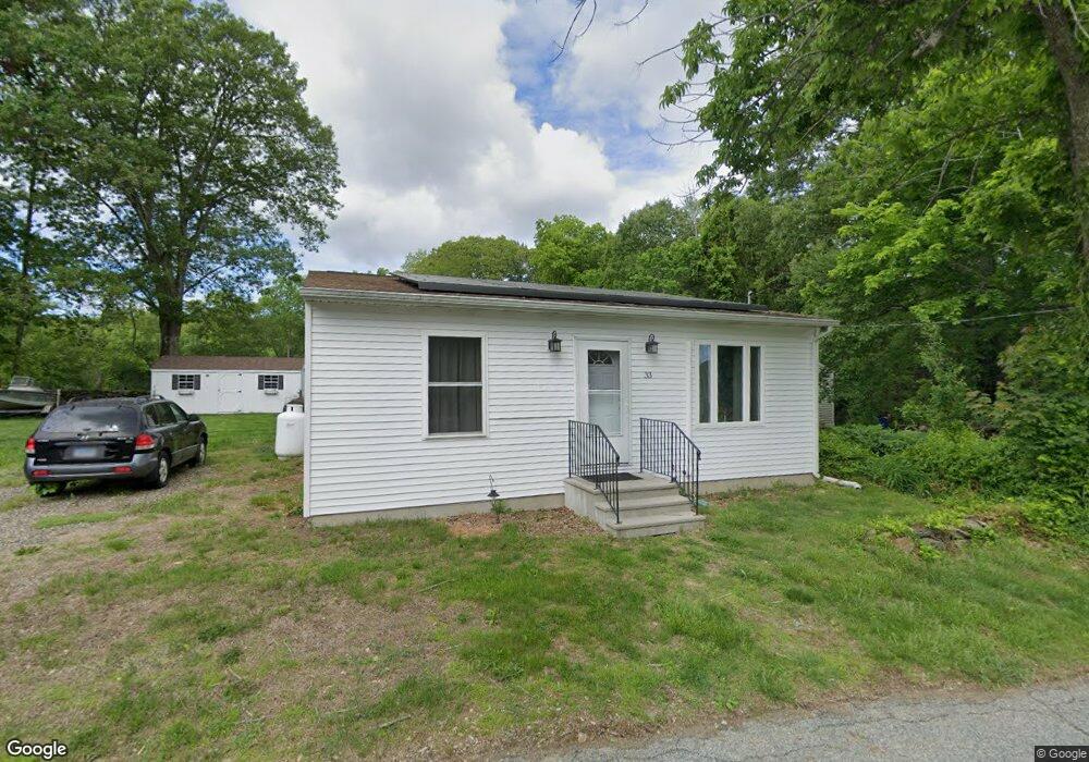
33 Pendleton Rd Preston, CT 06365
Estimated Value: $238,000 - $428,000
2
Beds
1
Bath
1,275
Sq Ft
$261/Sq Ft
Est. Value
About This Home
This home is located at 33 Pendleton Rd, Preston, CT 06365 and is currently estimated at $332,681, approximately $260 per square foot. 33 Pendleton Rd is a home located in New London County.
Ownership History
Date
Name
Owned For
Owner Type
Purchase Details
Closed on
Jun 30, 1989
Sold by
Grout Jeffrey
Bought by
Macarthur Duncan
Current Estimated Value
Home Financials for this Owner
Home Financials are based on the most recent Mortgage that was taken out on this home.
Original Mortgage
$101,900
Interest Rate
10.56%
Create a Home Valuation Report for This Property
The Home Valuation Report is an in-depth analysis detailing your home's value as well as a comparison with similar homes in the area
Home Values in the Area
Average Home Value in this Area
Purchase History
| Date | Buyer | Sale Price | Title Company |
|---|---|---|---|
| Macarthur Duncan | $101,250 | -- |
Source: Public Records
Mortgage History
| Date | Status | Borrower | Loan Amount |
|---|---|---|---|
| Open | Macarthur Duncan | $90,800 | |
| Closed | Macarthur Duncan | $102,250 | |
| Closed | Macarthur Duncan | $12,000 | |
| Closed | Macarthur Duncan | $101,900 |
Source: Public Records
Tax History
| Year | Tax Paid | Tax Assessment Tax Assessment Total Assessment is a certain percentage of the fair market value that is determined by local assessors to be the total taxable value of land and additions on the property. | Land | Improvement |
|---|---|---|---|---|
| 2025 | $3,805 | $151,550 | $45,080 | $106,470 |
| 2024 | $3,542 | $151,550 | $45,080 | $106,470 |
| 2023 | $3,478 | $151,550 | $45,080 | $106,470 |
| 2022 | $3,513 | $126,000 | $39,200 | $86,800 |
| 2021 | $3,394 | $126,000 | $39,200 | $86,800 |
| 2020 | $2,615 | $97,200 | $39,200 | $58,000 |
| 2019 | $2,540 | $96,100 | $39,200 | $56,900 |
| 2018 | $2,442 | $93,800 | $39,200 | $54,600 |
| 2017 | $2,352 | $98,000 | $39,200 | $58,800 |
| 2016 | $2,328 | $98,000 | $39,200 | $58,800 |
| 2015 | $2,254 | $98,000 | $39,200 | $58,800 |
| 2014 | $2,268 | $98,000 | $39,200 | $58,800 |
Source: Public Records
Map
Nearby Homes
- 9 Mains Way
- 26 Tanglewood Dr
- 6 Lake of Isles Rd
- 4 Lake of Isles Rd
- 36 NW Corner Rd
- 57 NW Corner Rd
- 381 Route 2
- 55A Anna Farm Rd W
- 0 Lake of Isles Rd Unit 170371521
- 991 Shewville Rd
- 256 Route 2
- 381 Route 164
- 16 Abbey Rd
- 14 Abbey Rd
- 15 Paster Rd
- 7 Halls Mill Rd
- 36 Route 2a
- 25 Coachman Pike
- 19 Cedarcrest Dr
- 104 Route 2a
- 34 Pendleton Rd
- 29 Pendleton Rd
- 18 Pendleton Rd
- 39 Pendleton Rd
- 36 Pendleton Rd
- 16 Pendleton Rd
- 14 Hollowell Rd
- 131 Route 164
- 31 Hollowell Rd
- 5 Pendleton Rd
- 12 Hollowell Rd
- 13 Hollowell Rd
- 127 Route 164
- 1 Cooktown Rd
- 3 Cooktown Rd
- 16 Savage Rd
- 2 Cooktown Rd
- 4 Cooktown Rd
- 0 Cooktown Rd Unit E10163105
- 52 Hollowell Rd
Your Personal Tour Guide
Ask me questions while you tour the home.