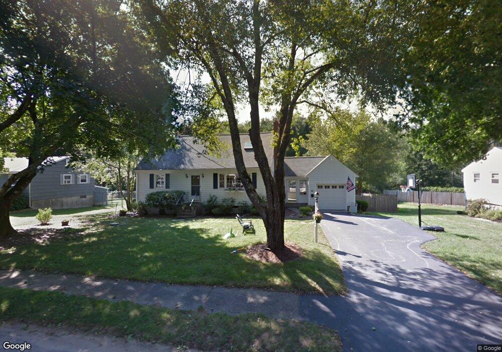
33 Pollard Dr Millis, MA 02054
Estimated Value: $615,430 - $764,000
3
Beds
2
Baths
1,642
Sq Ft
$406/Sq Ft
Est. Value
About This Home
This home is located at 33 Pollard Dr, Millis, MA 02054 and is currently estimated at $666,108, approximately $405 per square foot. 33 Pollard Dr is a home located in Norfolk County with nearby schools including Clyde F Brown, Millis Middle School, and Millis High School.
Ownership History
Date
Name
Owned For
Owner Type
Purchase Details
Closed on
Mar 9, 2000
Sold by
Post Lawrence M and Post Rhonda I
Bought by
Agostino Michael J and Agostino Susan E
Current Estimated Value
Home Financials for this Owner
Home Financials are based on the most recent Mortgage that was taken out on this home.
Original Mortgage
$170,250
Interest Rate
8.18%
Mortgage Type
Purchase Money Mortgage
Purchase Details
Closed on
Jun 14, 1993
Sold by
Mcdermott Scott F and Mcdermott Kelly H
Bought by
Post Lawrencem and Post Rhonda I
Home Financials for this Owner
Home Financials are based on the most recent Mortgage that was taken out on this home.
Original Mortgage
$145,350
Interest Rate
7.41%
Mortgage Type
Purchase Money Mortgage
Create a Home Valuation Report for This Property
The Home Valuation Report is an in-depth analysis detailing your home's value as well as a comparison with similar homes in the area
Home Values in the Area
Average Home Value in this Area
Purchase History
| Date | Buyer | Sale Price | Title Company |
|---|---|---|---|
| Agostino Michael J | $227,000 | -- | |
| Post Lawrencem | $161,500 | -- |
Source: Public Records
Mortgage History
| Date | Status | Borrower | Loan Amount |
|---|---|---|---|
| Closed | Post Lawrencem | $150,000 | |
| Closed | Post Lawrencem | $170,250 | |
| Previous Owner | Post Lawrencem | $13,959 | |
| Previous Owner | Post Lawrencem | $145,350 |
Source: Public Records
Tax History Compared to Growth
Tax History
| Year | Tax Paid | Tax Assessment Tax Assessment Total Assessment is a certain percentage of the fair market value that is determined by local assessors to be the total taxable value of land and additions on the property. | Land | Improvement |
|---|---|---|---|---|
| 2025 | $9,676 | $590,000 | $235,300 | $354,700 |
| 2024 | $8,875 | $540,500 | $217,200 | $323,300 |
| 2023 | $8,271 | $472,900 | $173,100 | $299,800 |
| 2022 | $8,288 | $439,000 | $185,700 | $253,300 |
| 2021 | $7,585 | $386,600 | $160,500 | $226,100 |
| 2020 | $7,843 | $389,400 | $150,000 | $239,400 |
| 2019 | $6,829 | $365,200 | $137,200 | $228,000 |
| 2018 | $6,581 | $365,200 | $137,200 | $228,000 |
| 2017 | $5,876 | $319,000 | $117,900 | $201,100 |
| 2016 | $5,563 | $319,000 | $117,900 | $201,100 |
| 2015 | $5,423 | $319,000 | $117,900 | $201,100 |
Source: Public Records
Map
Nearby Homes
- 27 Pollard Dr
- 22 May Rd
- 6 April Way
- 10 April Way
- 1380 Main St
- 2 Greenwood Dr
- 20 Hemlock Cir
- 25 Bayberry Cir Unit 25
- 2 Country Village Way Unit 2
- 33 Spencer St
- 64 Village St
- 6 Rivendell Ln
- 60 Spencer St
- 9 Bogastow Cir
- 2 Gerald Ave
- 50 Walnut St
- 119 Middlesex St
- 6 Glen Ellen Blvd Unit 6
- 73 Orchard St
- 18 Lansing Way Unit 18