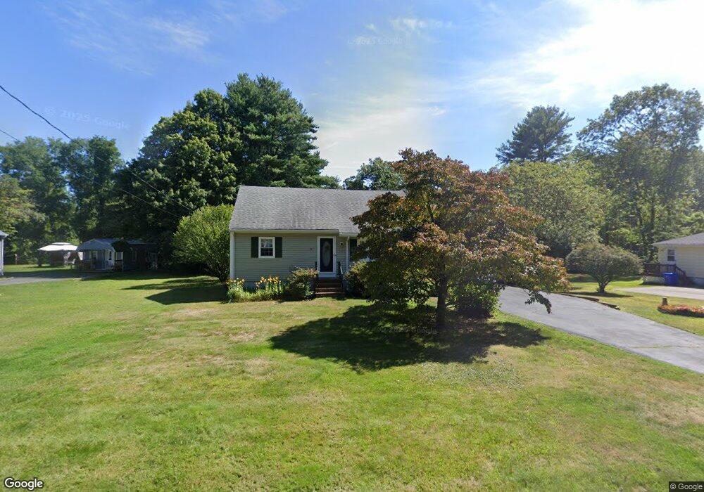
33 Range Ave Taunton, MA 02780
Wades Corner NeighborhoodEstimated Value: $498,522 - $567,000
3
Beds
2
Baths
1,306
Sq Ft
$413/Sq Ft
Est. Value
About This Home
This home is located at 33 Range Ave, Taunton, MA 02780 and is currently estimated at $539,881, approximately $413 per square foot. 33 Range Ave is a home located in Bristol County with nearby schools including Edmund Hatch Bennett School, Benjamin Friedman Middle School, and Taunton High School.
Ownership History
Date
Name
Owned For
Owner Type
Purchase Details
Closed on
May 14, 2008
Sold by
Pearson Robert A and Pearson Nancy F
Bought by
Pearson Jr Tr Robert A and Pearson Eric L
Current Estimated Value
Purchase Details
Closed on
Apr 3, 2008
Sold by
Pearson Nancy F and Pearson Robert A
Bought by
33 Range Avenue T and Pearson Brian C
Create a Home Valuation Report for This Property
The Home Valuation Report is an in-depth analysis detailing your home's value as well as a comparison with similar homes in the area
Home Values in the Area
Average Home Value in this Area
Purchase History
| Date | Buyer | Sale Price | Title Company |
|---|---|---|---|
| Pearson Jr Tr Robert A | -- | -- | |
| 33 Range Avenue T | -- | -- |
Source: Public Records
Tax History
| Year | Tax Paid | Tax Assessment Tax Assessment Total Assessment is a certain percentage of the fair market value that is determined by local assessors to be the total taxable value of land and additions on the property. | Land | Improvement |
|---|---|---|---|---|
| 2025 | $4,614 | $421,800 | $137,700 | $284,100 |
| 2024 | $4,201 | $375,400 | $137,700 | $237,700 |
| 2023 | $4,213 | $349,600 | $144,000 | $205,600 |
| 2022 | $3,839 | $291,300 | $111,600 | $179,700 |
| 2021 | $3,919 | $276,000 | $101,500 | $174,500 |
| 2020 | $3,767 | $253,500 | $101,500 | $152,000 |
| 2019 | $3,869 | $245,500 | $101,500 | $144,000 |
| 2018 | $22,428 | $233,500 | $102,500 | $131,000 |
| 2017 | $3,386 | $215,500 | $90,800 | $124,700 |
| 2016 | $3,265 | $208,200 | $88,200 | $120,000 |
| 2015 | $3,208 | $213,700 | $87,900 | $125,800 |
| 2014 | $3,027 | $207,200 | $87,900 | $119,300 |
Source: Public Records
Map
Nearby Homes
- 29 Range Ave
- Lot 3 Rocky Woods St
- 0 Range Ave Unit 72771508
- 0 Range Ave Unit 72771509
- 0 Kimberly Rd
- Lot A Glebe St
- 620 Burt St
- 88 Morgan Dr
- 140 N Walker St Unit 511
- 985 Glebe St
- 2201 Wheeler St
- Lot 6 Tremont St
- 321 Winthrop St Unit 106
- 233-R Summer St
- 168 Run Brook Cir
- 1421 Tremont St
- 263 Summer St
- 305 Shag Bark Rd
- 170 Highland St Unit 115
- 810 Tremont St
Your Personal Tour Guide
Ask me questions while you tour the home.