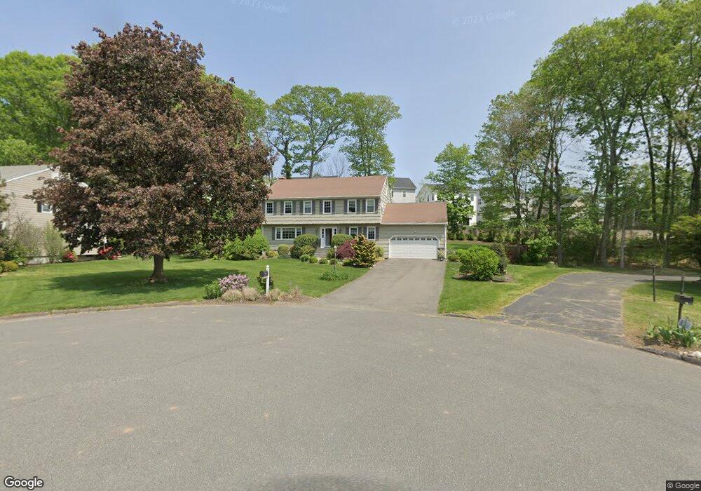
33 River Bend Rd Trumbull, CT 06611
Trumbull Center NeighborhoodEstimated Value: $709,042 - $840,000
4
Beds
3
Baths
2,554
Sq Ft
$304/Sq Ft
Est. Value
About This Home
This home is located at 33 River Bend Rd, Trumbull, CT 06611 and is currently estimated at $775,761, approximately $303 per square foot. 33 River Bend Rd is a home located in Fairfield County with nearby schools including Daniels Farm School, Hillcrest Middle School, and Trumbull High School.
Ownership History
Date
Name
Owned For
Owner Type
Purchase Details
Closed on
Jan 11, 2017
Sold by
Carley Joel
Bought by
Carley Joel and Carley Janean
Current Estimated Value
Home Financials for this Owner
Home Financials are based on the most recent Mortgage that was taken out on this home.
Original Mortgage
$156,000
Outstanding Balance
$69,411
Interest Rate
4.08%
Mortgage Type
Purchase Money Mortgage
Estimated Equity
$706,350
Purchase Details
Closed on
Dec 3, 2013
Sold by
Carley Danielle
Bought by
Carley Joel
Purchase Details
Closed on
Jan 9, 2004
Sold by
Wortz Kenneth E and Wortz Lori A
Bought by
Carley Joel T and Carley Danielle
Purchase Details
Closed on
Oct 1, 1999
Sold by
Tumilty Keith and Tumilty Phyllis
Bought by
Wortz Kenneth Eric and Wortz Lori A
Create a Home Valuation Report for This Property
The Home Valuation Report is an in-depth analysis detailing your home's value as well as a comparison with similar homes in the area
Home Values in the Area
Average Home Value in this Area
Purchase History
| Date | Buyer | Sale Price | Title Company |
|---|---|---|---|
| Carley Joel | -- | -- | |
| Carley Joel | -- | -- | |
| Carley Joel T | $469,225 | -- | |
| Wortz Kenneth Eric | $349,900 | -- |
Source: Public Records
Mortgage History
| Date | Status | Borrower | Loan Amount |
|---|---|---|---|
| Open | Wortz Kenneth Eric | $156,000 | |
| Previous Owner | Wortz Kenneth Eric | $177,000 | |
| Previous Owner | Wortz Kenneth Eric | $180,000 |
Source: Public Records
Tax History
| Year | Tax Paid | Tax Assessment Tax Assessment Total Assessment is a certain percentage of the fair market value that is determined by local assessors to be the total taxable value of land and additions on the property. | Land | Improvement |
|---|---|---|---|---|
| 2025 | $11,555 | $312,970 | $133,490 | $179,480 |
| 2024 | $11,239 | $312,970 | $133,490 | $179,480 |
| 2022 | $10,880 | $312,970 | $133,490 | $179,480 |
| 2021 | $10,872 | $297,500 | $121,380 | $176,120 |
| 2020 | $10,665 | $297,500 | $121,380 | $176,120 |
| 2018 | $10,402 | $297,500 | $121,380 | $176,120 |
| 2017 | $10,192 | $297,500 | $121,380 | $176,120 |
| 2016 | $9,987 | $297,500 | $121,380 | $176,120 |
| 2015 | $10,304 | $303,400 | $127,300 | $176,100 |
| 2014 | $10,082 | $303,400 | $127,300 | $176,100 |
Source: Public Records
Map
Nearby Homes
- 546 Church Hill Rd
- 58 Daniels Farm Rd
- Lot 31 Valley View Rd
- 30 Windy Ridge
- 877 White Plains Rd
- 75 Middlebrooks Ave
- 15 Glenarden Rd
- 71 Cider Mill Ln
- 1 Village Dr
- 26 Grove St
- 43 Woodmere Dr
- 699 Daniels Farm Rd
- 215 Fernwood Rd
- 40 Rose Terrace
- 184 Putting Green Rd
- 2 Doe Hollow Dr
- 176 Strobel Rd
- 7 Hemlock Trail
- 45 Frenchtown Rd
- 0 Pinewood Trail
- 27 River Bend Rd
- 25 Enclave Dr Unit 13
- 40 River Bend Rd
- 27 Enclave Dr Unit 14
- 27 Enclave Dr Unit 9
- 21 River Bend Rd
- 32 River Bend Rd
- 31 Enclave Dr Unit 16
- 51 Enclave Dr Unit 26
- 33 Enclave Dr Unit 17
- 53 Enclave Dr Unit 27
- 26 River Bend Rd
- 17 River Bend Rd
- 44 Tait Rd
- 40 Tait Rd
- 49 Enclave Dr Unit 25
- 48 Tait Rd
- 34 Tait Rd
- 35 Enclave Dr Unit 18
- 15 Enclave Dr Unit 8
Your Personal Tour Guide
Ask me questions while you tour the home.