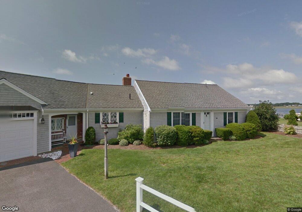
33 Riverside Way West Dennis, MA 02670
West Dennis NeighborhoodEstimated Value: $1,343,000 - $2,844,971
2
Beds
2
Baths
2,063
Sq Ft
$1,015/Sq Ft
Est. Value
About This Home
This home is located at 33 Riverside Way, West Dennis, MA 02670 and is currently estimated at $2,093,986, approximately $1,015 per square foot. 33 Riverside Way is a home located in Barnstable County with nearby schools including Dennis-Yarmouth Regional High School and St. Pius X. School.
Ownership History
Date
Name
Owned For
Owner Type
Purchase Details
Closed on
Dec 28, 2021
Sold by
Ryan William A
Bought by
33 Riverside T
Current Estimated Value
Purchase Details
Closed on
Jan 12, 2015
Sold by
Ryan William A
Bought by
Ryan William A and Ryan Maureen A
Purchase Details
Closed on
Apr 28, 1995
Sold by
Abbott Elsa K
Bought by
Ryan William A
Home Financials for this Owner
Home Financials are based on the most recent Mortgage that was taken out on this home.
Original Mortgage
$200,000
Interest Rate
8.33%
Mortgage Type
Purchase Money Mortgage
Create a Home Valuation Report for This Property
The Home Valuation Report is an in-depth analysis detailing your home's value as well as a comparison with similar homes in the area
Home Values in the Area
Average Home Value in this Area
Purchase History
| Date | Buyer | Sale Price | Title Company |
|---|---|---|---|
| 33 Riverside T | -- | None Available | |
| Ryan William A | -- | -- | |
| Ryan William A | $386,300 | -- |
Source: Public Records
Mortgage History
| Date | Status | Borrower | Loan Amount |
|---|---|---|---|
| Previous Owner | Ryan William A | $100,000 | |
| Previous Owner | Ryan William A | $200,000 |
Source: Public Records
Tax History Compared to Growth
Tax History
| Year | Tax Paid | Tax Assessment Tax Assessment Total Assessment is a certain percentage of the fair market value that is determined by local assessors to be the total taxable value of land and additions on the property. | Land | Improvement |
|---|---|---|---|---|
| 2025 | $15,176 | $3,504,800 | $2,817,700 | $687,100 |
| 2024 | $14,792 | $3,369,500 | $2,709,700 | $659,800 |
| 2023 | $14,332 | $3,069,000 | $2,463,300 | $605,700 |
| 2022 | $13,540 | $2,417,900 | $1,952,800 | $465,100 |
| 2021 | $14,022 | $2,325,400 | $1,914,400 | $411,000 |
| 2020 | $14,064 | $2,305,600 | $1,914,400 | $391,200 |
| 2019 | $13,795 | $2,235,800 | $1,877,000 | $358,800 |
| 2018 | $12,485 | $1,969,300 | $1,620,300 | $349,000 |
| 2017 | $9,976 | $1,622,100 | $1,273,100 | $349,000 |
| 2016 | $10,908 | $1,670,400 | $1,363,100 | $307,300 |
| 2015 | $10,691 | $1,670,400 | $1,363,100 | $307,300 |
| 2014 | $10,559 | $1,662,800 | $1,363,100 | $299,700 |
Source: Public Records
Map
Nearby Homes
- 2 Rita Mary Way
- 181 Pleasant St
- 745 Willow St
- 14 Schoolhouse Ln
- 308 Old Main St
- 17 South St
- 178 School St
- 209 Main St Unit 3
- 209 Main St Unit 6
- 209 Main St Unit 1
- 209 Main St Unit 2
- 209 Main St Unit 4
- 209 Main St Unit 5
- 4 Braddock St
- 9 Cedar St
- 23 Doric Ave
- 45 Seth Ln
- 40 Kelley Rd
- 22 Powhatan Rd
- 9 Victory Ln
- 31 Riverside Way
- 23 Riverside Way
- 24 Riverside Way
- 28 Riverside Way
- 20 Riverside Way
- 19 Riverside Way
- 18 Riverside Way
- 0 Riverside Way
- 15 Riverside Way
- 14 Riverside Way
- 25 Captain Keavy Way
- 29 Captain Keavy Way
- 21 Captain Keavy Way
- 11 Riverside Way
- 21 Captain Keavy Way
- 17 Captain Keavy Way
- 10 Riverside Way
- 15 Captain Keavy Way
- 7 Riverside Way
- 8 Riverside Way