Estimated Value: $549,324 - $581,000
4
Beds
2
Baths
1,404
Sq Ft
$405/Sq Ft
Est. Value
About This Home
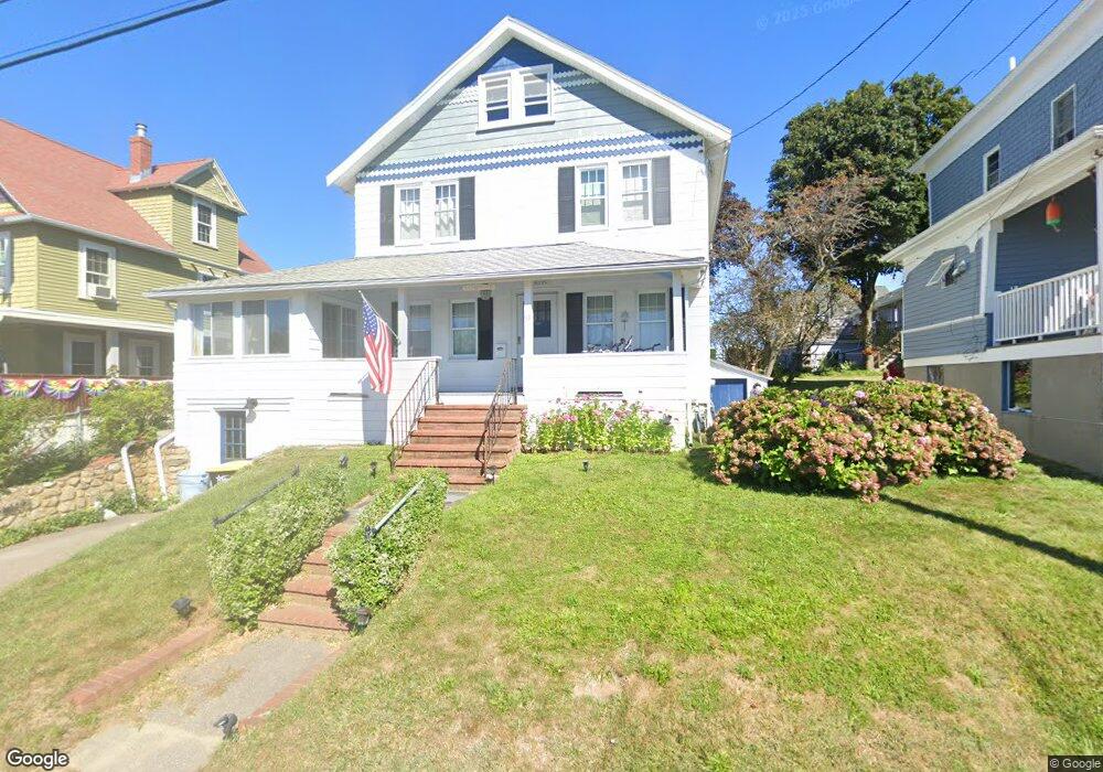
This home is located at 33 Roosevelt Ave Unit 1, Hull, MA 02045 and is currently estimated at $568,081, approximately $404 per square foot. 33 Roosevelt Ave Unit 1 is a home located in Plymouth County with nearby schools including Lillian M. Jacobs Elementary School, Memorial Middle School, and Hull High School.
Ownership History
Date
Name
Owned For
Owner Type
Purchase Details
Closed on
Oct 30, 2012
Sold by
Griffin John J and Griffin Sheila W
Bought by
Griffin Irt and Griffin
Current Estimated Value
Purchase Details
Closed on
Jun 30, 2005
Sold by
Chase Alice M
Bought by
Griffin John J and Griffin Sheila W
Home Financials for this Owner
Home Financials are based on the most recent Mortgage that was taken out on this home.
Original Mortgage
$134,000
Interest Rate
5.73%
Mortgage Type
Purchase Money Mortgage
Create a Home Valuation Report for This Property
The Home Valuation Report is an in-depth analysis detailing your home's value as well as a comparison with similar homes in the area
Home Values in the Area
Average Home Value in this Area
Purchase History
| Date | Buyer | Sale Price | Title Company |
|---|---|---|---|
| Griffin Irt | -- | -- | |
| Griffin John J | $340,000 | -- |
Source: Public Records
Mortgage History
| Date | Status | Borrower | Loan Amount |
|---|---|---|---|
| Previous Owner | Griffin John J | $134,000 |
Source: Public Records
Tax History Compared to Growth
Tax History
| Year | Tax Paid | Tax Assessment Tax Assessment Total Assessment is a certain percentage of the fair market value that is determined by local assessors to be the total taxable value of land and additions on the property. | Land | Improvement |
|---|---|---|---|---|
| 2025 | $4,686 | $418,400 | $221,000 | $197,400 |
| 2024 | $4,711 | $404,400 | $214,500 | $189,900 |
| 2023 | $4,790 | $393,600 | $214,500 | $179,100 |
| 2022 | $4,818 | $384,200 | $214,500 | $169,700 |
| 2021 | $4,543 | $358,300 | $195,000 | $163,300 |
| 2020 | $4,474 | $349,000 | $188,500 | $160,500 |
| 2019 | $4,347 | $333,100 | $182,000 | $151,100 |
| 2018 | $4,282 | $319,100 | $182,000 | $137,100 |
| 2017 | $4,249 | $309,700 | $182,000 | $127,700 |
| 2016 | $4,350 | $322,700 | $195,000 | $127,700 |
| 2015 | $4,072 | $292,100 | $162,500 | $129,600 |
| 2014 | $4,051 | $292,100 | $162,500 | $129,600 |
Source: Public Records
Map
Nearby Homes
- 127 Hampton Cir
- 134 Hampton Cir
- 15 Lincoln Ave
- 53 Mountford Rd
- 15 2nd St
- 2 6th St
- 54 Salisbury St Waterfront
- 4 Atherton Rd
- 22 Berkley Rd Unit B
- 22 Berkley Rd Unit C
- 20 Rockland House Rd Unit 203
- 121 Nantasket Ave Unit 503
- 23 Wyola Rd
- 69 Beach Ave
- 25 Oceanside Dr
- 62 Oceanside Dr
- 6 State Park Rd Unit 2
- 31 Kenberma St
- 105 Warfield Ave
- 189 Kingsley Rd
- 33 Roosevelt Ave
- 31 Roosevelt Ave
- 35 Roosevelt Ave
- 29 Roosevelt Ave
- 32 Roosevelt Ave Unit R
- 32 Roosevelt Ave Unit L
- 32 Roosevelt Ave
- 32 Merrill Rd Unit 2-R
- 32 Merrill Rd
- 39 Roosevelt Ave
- 28 Merrill Rd
- 34 Roosevelt Ave
- 27 Roosevelt Ave
- 28 Roosevelt Ave
- 36 Merrill Rd
- 36 Merrill Rd Unit na
- 36 Roosevelt Ave
- 41 Roosevelt Ave
- 38 Roosevelt Ave
- 25 Roosevelt Ave