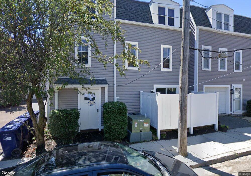
33 Stock St Dorchester, MA 02122
Lower Mills NeighborhoodEstimated Value: $619,000 - $686,000
2
Beds
2
Baths
1,278
Sq Ft
$505/Sq Ft
Est. Value
About This Home
This home is located at 33 Stock St, Dorchester, MA 02122 and is currently estimated at $646,006, approximately $505 per square foot. 33 Stock St is a home located in Suffolk County with nearby schools including Neighborhood House Charter School, Conservatory Lab Upper School, and St Brendan School.
Ownership History
Date
Name
Owned For
Owner Type
Purchase Details
Closed on
Mar 31, 2022
Sold by
Mclaughlin Ryan and Mclaughlin Kerriann M
Bought by
Hirth Kristin W and Clos Alex L
Current Estimated Value
Home Financials for this Owner
Home Financials are based on the most recent Mortgage that was taken out on this home.
Original Mortgage
$445,000
Outstanding Balance
$415,028
Interest Rate
3.92%
Mortgage Type
Purchase Money Mortgage
Estimated Equity
$230,978
Purchase Details
Closed on
Sep 26, 2019
Sold by
Mulhern Jillian B and Mulhern Mark C
Bought by
Mclaughlain Ryan and Mclaughlain Kerriann M
Home Financials for this Owner
Home Financials are based on the most recent Mortgage that was taken out on this home.
Original Mortgage
$550,000
Interest Rate
3.6%
Mortgage Type
New Conventional
Purchase Details
Closed on
Aug 7, 2015
Sold by
Hughes Joanne C
Bought by
Galdi Jillian B and Mulhern Mark C
Home Financials for this Owner
Home Financials are based on the most recent Mortgage that was taken out on this home.
Original Mortgage
$348,650
Interest Rate
4.03%
Mortgage Type
New Conventional
Purchase Details
Closed on
Sep 1, 2005
Sold by
Oconnor Michael F and Oconor Michael F
Bought by
Hughes Joanne C
Home Financials for this Owner
Home Financials are based on the most recent Mortgage that was taken out on this home.
Original Mortgage
$325,500
Interest Rate
5.81%
Mortgage Type
Purchase Money Mortgage
Purchase Details
Closed on
May 30, 2003
Sold by
Cooper Joseph F and Cooper Michele
Bought by
Lamanicca Traci and Oconor Michael F
Purchase Details
Closed on
May 21, 1999
Sold by
Alph Beta Rt and Athanasopoulos
Bought by
Cooper Joseph F and Cooper Michele
Purchase Details
Closed on
May 1, 1992
Sold by
Stock St Rt 33
Bought by
Alpha-Beta-Alpha Pr Rt
Purchase Details
Closed on
Feb 12, 1992
Sold by
Hite Daniel M
Bought by
Stock St Rt 33
Create a Home Valuation Report for This Property
The Home Valuation Report is an in-depth analysis detailing your home's value as well as a comparison with similar homes in the area
Home Values in the Area
Average Home Value in this Area
Purchase History
| Date | Buyer | Sale Price | Title Company |
|---|---|---|---|
| Hirth Kristin W | $595,000 | None Available | |
| Mclaughlain Ryan | $550,000 | -- | |
| Galdi Jillian B | $367,000 | -- | |
| Hughes Joanne C | $325,500 | -- | |
| Hughes Joanne C | $325,500 | -- | |
| Lamanicca Traci | $255,500 | -- | |
| Cooper Joseph F | $118,000 | -- | |
| Alpha-Beta-Alpha Pr Rt | $95,000 | -- | |
| Stock St Rt 33 | $110,000 | -- |
Source: Public Records
Mortgage History
| Date | Status | Borrower | Loan Amount |
|---|---|---|---|
| Open | Hirth Kristin W | $445,000 | |
| Previous Owner | Mclaughlain Ryan | $550,000 | |
| Previous Owner | Galdi Jillian B | $348,650 | |
| Previous Owner | Hughes Joanne C | $325,500 | |
| Previous Owner | Stock St Rt 33 | $16,000 |
Source: Public Records
Tax History Compared to Growth
Tax History
| Year | Tax Paid | Tax Assessment Tax Assessment Total Assessment is a certain percentage of the fair market value that is determined by local assessors to be the total taxable value of land and additions on the property. | Land | Improvement |
|---|---|---|---|---|
| 2025 | $6,734 | $581,500 | $0 | $581,500 |
| 2024 | $5,883 | $539,700 | $0 | $539,700 |
| 2023 | $5,627 | $523,900 | $0 | $523,900 |
| 2022 | $5,376 | $494,100 | $0 | $494,100 |
| 2021 | $5,119 | $479,800 | $0 | $479,800 |
| 2020 | $4,582 | $433,900 | $0 | $433,900 |
| 2019 | $4,313 | $409,200 | $0 | $409,200 |
| 2018 | $3,972 | $379,000 | $0 | $379,000 |
| 2017 | $3,683 | $347,800 | $0 | $347,800 |
| 2016 | $2,905 | $264,100 | $0 | $264,100 |
| 2015 | $3,141 | $259,400 | $0 | $259,400 |
| 2014 | $2,994 | $238,000 | $0 | $238,000 |
Source: Public Records
Map
Nearby Homes
- 103 Minot St
- 45 Chickatawbut St Unit 1
- 107 Minot St
- 43 Chickatawbut St
- 22 Chickatawbut St Unit 2
- 140 Minot St
- 378 Neponset Ave
- 400-412 Neponset Ave
- 51 Coffey St Unit 51C
- 56 Coffey St Unit 10
- 701 Adams St Unit 9
- 61 Hill Top St
- 102 Milton St
- 118-120 Granite Ave Unit 2
- 36 Mckone St Unit 2
- 36 Mckone St
- 36 Mckone St Unit 1
- 33 Westmoreland St
- 37 Westmoreland St
- 80 Beaumont St Unit 101