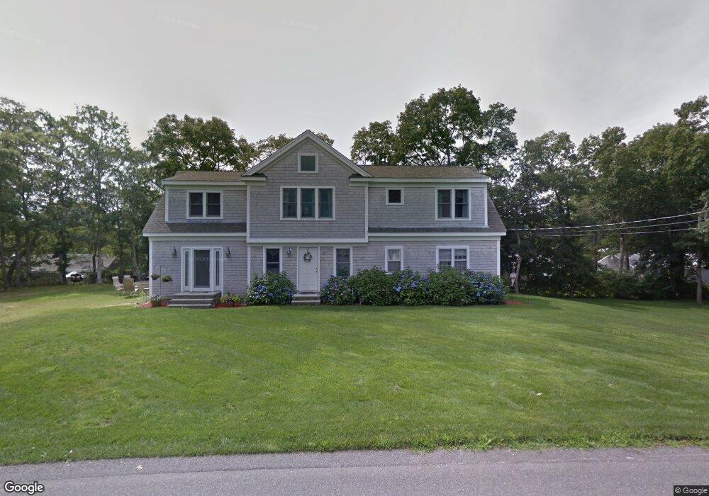
33 Uncle Stanleys Way South Dennis, MA 02660
South Dennis NeighborhoodEstimated Value: $818,000 - $1,021,000
6
Beds
3
Baths
2,513
Sq Ft
$355/Sq Ft
Est. Value
About This Home
This home is located at 33 Uncle Stanleys Way, South Dennis, MA 02660 and is currently estimated at $891,748, approximately $354 per square foot. 33 Uncle Stanleys Way is a home located in Barnstable County with nearby schools including Dennis-Yarmouth Regional High School.
Ownership History
Date
Name
Owned For
Owner Type
Purchase Details
Closed on
May 15, 1998
Sold by
Burchill Richard D and Burchill Debra
Bought by
Mcquinn Catherine A
Current Estimated Value
Home Financials for this Owner
Home Financials are based on the most recent Mortgage that was taken out on this home.
Original Mortgage
$92,800
Outstanding Balance
$18,101
Interest Rate
7.08%
Mortgage Type
Purchase Money Mortgage
Estimated Equity
$873,647
Create a Home Valuation Report for This Property
The Home Valuation Report is an in-depth analysis detailing your home's value as well as a comparison with similar homes in the area
Home Values in the Area
Average Home Value in this Area
Purchase History
| Date | Buyer | Sale Price | Title Company |
|---|---|---|---|
| Mcquinn Catherine A | $116,000 | -- |
Source: Public Records
Mortgage History
| Date | Status | Borrower | Loan Amount |
|---|---|---|---|
| Open | Mcquinn Catherine A | $92,800 |
Source: Public Records
Tax History Compared to Growth
Tax History
| Year | Tax Paid | Tax Assessment Tax Assessment Total Assessment is a certain percentage of the fair market value that is determined by local assessors to be the total taxable value of land and additions on the property. | Land | Improvement |
|---|---|---|---|---|
| 2025 | $3,804 | $878,500 | $132,200 | $746,300 |
| 2024 | $3,390 | $772,300 | $127,200 | $645,100 |
| 2023 | $3,311 | $708,900 | $115,600 | $593,300 |
| 2022 | $3,142 | $561,100 | $115,700 | $445,400 |
| 2021 | $3,168 | $525,400 | $113,400 | $412,000 |
| 2020 | $0 | $487,000 | $113,400 | $373,600 |
| 2019 | $0 | $490,800 | $122,300 | $368,500 |
| 2018 | $0 | $429,500 | $105,900 | $323,600 |
| 2017 | $2,641 | $429,500 | $105,900 | $323,600 |
| 2016 | $2,521 | $386,000 | $111,200 | $274,800 |
| 2015 | $2,470 | $386,000 | $111,200 | $274,800 |
| 2014 | $2,472 | $389,300 | $95,300 | $294,000 |
Source: Public Records
Map
Nearby Homes
- 11 Uncle Stanleys Way
- 15 Captain Jud Rd
- 153 Bayridge Dr
- 17 Margate Ln
- 4 Ebb Rd
- 13 Covey Dr
- 10 Joanne Dr
- 17 Fairmount Rd
- 118 Driftwood Ln
- 17 Fairmount Rd
- 25 Skerry Rd
- 111 Merchant Ave
- 7 Vinland Dr
- 129 Driftwood Ln
- 32 Captain Walsh Dr
- 1 Norseman Dr
- 6 Nimble Hill Dr
- 62 Old Fish House Rd
- 59 Main St Unit 19-2
- 59 Route 6a Unit 29-4
- 44 Uncle Stanley
- 34 Uncle Bobs Way
- 37 Uncle Stanleys Way
- 29 Uncle Stanleys Way
- 30 Uncle Bobs Way
- 34 Uncle Stanleys Way
- 38 Uncle Bob's
- 30 Uncle Stanleys Way
- 41 Uncle Stanleys Way
- 54 Uncle Stanley's
- 25 Uncle Stanleys Way
- 24 Uncle Bobs Way
- 40 Uncle Stanleys Way
- 44 Uncle Bobs Way
- 24 Uncle Bob's Way
- 26 Uncle Stanleys Way
- 31 Uncle Bobs Way
- 31 Uncle Bob's Way
- 27 Uncle Bobs Way
- 37 Uncle Bobs Way