T
Seller's Agent in 2025
The Mike Karras Team
William Raveis Real Estate & Home Services
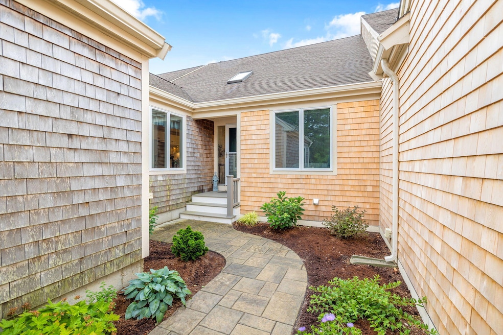

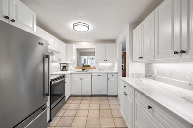
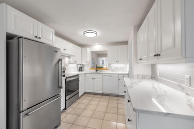
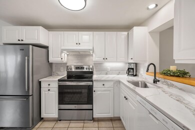
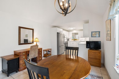
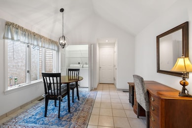
Private Courtyard Entrance & One-Floor Living in Popular Kings Way -Welcome to easy, elegant living in this desirable ''G'' floor plan, ideally situated in a private setting within the sought-after Kings Way community. Enjoy the convenience of a 2-car garage with direct access into a spacious, eat-in country kitchen, featuring tile flooring, updated appliances, full-size laundry, and a pantry closet. The kitchen shines with quartz countertops and a stylish backsplash, and offers a convenient pass-through to the dining area.The sunlit living room boasts beautiful bamboo flooring and opens to a large deck overlooking a wooded backyard--your own private paradise.Offering true one-floor living, the home includes a spacious guest room that can double as a den, office, or TV room, plus a full hall bath with tile and Corian countertops. The primary suite and living areas are on the same level for easy accessibility. Downstairs, the finished lower level adds generous living and storage space, a full bath, tile flooring, sliders to the private backyard, and a cedar closet--perfect for guests or a hobby room. Enjoy all the amenities Kings Way lifestyle opportunity awaits!
Last Agent to Sell the Property
The Mike Karras Team
William Raveis Real Estate & Home Services Listed on: 07/01/2025
Last Buyer's Agent
Gerry Coughlan
Kinlin Grover Compass License #68563
| Date | Type | Sale Price | Title Company |
|---|---|---|---|
| Quit Claim Deed | $665,000 | -- | |
| Quit Claim Deed | $440,000 | None Available | |
| Deed | -- | -- | |
| Land Court Massachusetts | $310,000 | -- | |
| Land Court Massachusetts | $310,000 | -- |
| Date | Status | Loan Amount | Loan Type |
|---|---|---|---|
| Open | $550,000 | New Conventional | |
| Previous Owner | $240,000 | New Conventional |
| Date | Event | Price | List to Sale | Price per Sq Ft |
|---|---|---|---|---|
| 09/16/2025 09/16/25 | Sold | $665,000 | -4.9% | $352 / Sq Ft |
| 08/01/2025 08/01/25 | Pending | -- | -- | -- |
| 07/21/2025 07/21/25 | Price Changed | $699,000 | -3.6% | $370 / Sq Ft |
| 07/01/2025 07/01/25 | For Sale | $725,000 | -- | $384 / Sq Ft |
| Year | Tax Paid | Tax Assessment Tax Assessment Total Assessment is a certain percentage of the fair market value that is determined by local assessors to be the total taxable value of land and additions on the property. | Land | Improvement |
|---|---|---|---|---|
| 2025 | $4,227 | $597,100 | $0 | $597,100 |
| 2024 | $4,465 | $605,000 | $0 | $605,000 |
| 2023 | $4,343 | $535,500 | $0 | $535,500 |
| 2022 | $4,242 | $462,100 | $0 | $462,100 |
| 2021 | $4,126 | $431,600 | $0 | $431,600 |
| 2020 | $4,164 | $416,400 | $0 | $416,400 |
| 2019 | $3,904 | $386,500 | $0 | $386,500 |
| 2018 | $3,669 | $356,600 | $0 | $356,600 |
| 2017 | $3,423 | $341,600 | $0 | $341,600 |
| 2016 | $3,260 | $326,700 | $0 | $326,700 |
| 2015 | $3,177 | $316,400 | $0 | $316,400 |
T
Seller's Agent in 2025
The Mike Karras Team
William Raveis Real Estate & Home Services
G
Buyer's Agent in 2025
Gerry Coughlan
Kinlin Grover Compass
Source: Cape Cod & Islands Association of REALTORS®
MLS Number: 22503269
APN: YARM-000142-000004-000033W-C000000
Disclaimer: Certain information contained herein is derived from information provided by parties other than Homes.com. All information provided is deemed reliable, but is not guaranteed to be accurate and should be independently verified.
![]() All data relating to real estate for sale on this page comes from the Broker Reciprocity (BR) of the Cape Cod & Islands Multiple Listing Service, Inc. Detailed information about real estate listings held by brokerage firms other than CC&I Assoc. of REALTORS®, Inc. includes the name of the listing company. Neither the listing company nor CC&I Assoc. of REALTORS®, Inc. shall be responsible for any typographical errors, misinformation, misprints and shall be held totally harmless. The Broker providing this data believes it to be correct, but advises interested parties to confirm any item before relying on it in a purchase decision. All properties are subject to prior sale, changes, or withdrawal. Copyright 2025 © Cape Cod & Islands Multiple Listing Service, Inc. All rights reserved.
All data relating to real estate for sale on this page comes from the Broker Reciprocity (BR) of the Cape Cod & Islands Multiple Listing Service, Inc. Detailed information about real estate listings held by brokerage firms other than CC&I Assoc. of REALTORS®, Inc. includes the name of the listing company. Neither the listing company nor CC&I Assoc. of REALTORS®, Inc. shall be responsible for any typographical errors, misinformation, misprints and shall be held totally harmless. The Broker providing this data believes it to be correct, but advises interested parties to confirm any item before relying on it in a purchase decision. All properties are subject to prior sale, changes, or withdrawal. Copyright 2025 © Cape Cod & Islands Multiple Listing Service, Inc. All rights reserved.