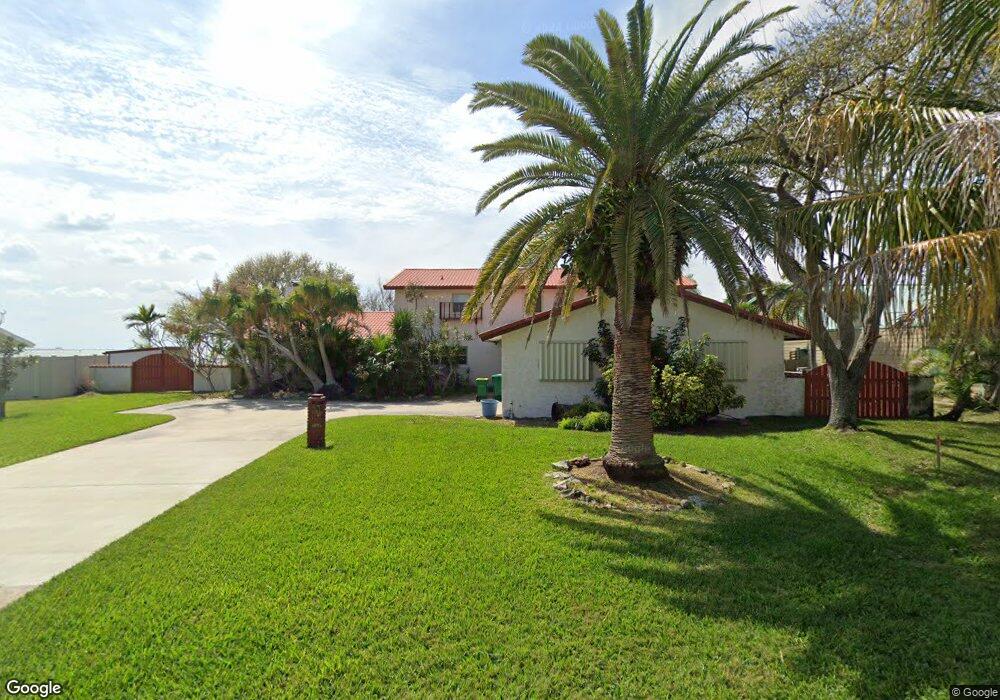
33 West Point Dr Cocoa Beach, FL 32931
Estimated Value: $1,231,000 - $1,816,000
4
Beds
2
Baths
2,870
Sq Ft
$512/Sq Ft
Est. Value
About This Home
This home is located at 33 West Point Dr, Cocoa Beach, FL 32931 and is currently estimated at $1,469,678, approximately $512 per square foot. 33 West Point Dr is a home located in Brevard County with nearby schools including Theodore Roosevelt Elementary School, Cocoa Beach Junior/Senior High School, and Cocoa Beach Christian School.
Ownership History
Date
Name
Owned For
Owner Type
Purchase Details
Closed on
Dec 4, 2023
Sold by
Cannon Patricia O
Bought by
Cannon Patricia O
Current Estimated Value
Purchase Details
Closed on
Nov 2, 2022
Sold by
William L Cannon Trust
Bought by
Cannon Patricia O
Purchase Details
Closed on
Oct 12, 2017
Sold by
Cannon William L and Cannon Patricia O
Bought by
Cannon William L and Cannon Patricia O
Purchase Details
Closed on
Oct 1, 2016
Bought by
William L Cannon Trust
Purchase Details
Closed on
Sep 23, 1994
Sold by
Cannon William L and Cannon Colette
Bought by
Cannon William L and Cannon Colette
Create a Home Valuation Report for This Property
The Home Valuation Report is an in-depth analysis detailing your home's value as well as a comparison with similar homes in the area
Home Values in the Area
Average Home Value in this Area
Purchase History
| Date | Buyer | Sale Price | Title Company |
|---|---|---|---|
| Cannon Patricia O | $100 | None Listed On Document | |
| Cannon Patricia O | $100 | None Listed On Document | |
| Cannon William L | -- | Attorney | |
| William L Cannon Trust | -- | -- | |
| Cannon William L | -- | -- |
Source: Public Records
Tax History Compared to Growth
Tax History
| Year | Tax Paid | Tax Assessment Tax Assessment Total Assessment is a certain percentage of the fair market value that is determined by local assessors to be the total taxable value of land and additions on the property. | Land | Improvement |
|---|---|---|---|---|
| 2025 | $16,960 | $1,364,070 | -- | -- |
| 2024 | $16,602 | $1,402,760 | -- | -- |
| 2023 | $16,602 | $1,339,900 | $975,000 | $364,900 |
| 2022 | $4,986 | $409,320 | $0 | $0 |
| 2021 | $5,148 | $397,400 | $0 | $0 |
| 2020 | $5,009 | $385,700 | $0 | $0 |
| 2019 | $4,974 | $377,030 | $0 | $0 |
| 2018 | $5,005 | $370,000 | $0 | $0 |
| 2017 | $5,085 | $362,390 | $0 | $0 |
| 2016 | $5,208 | $354,940 | $335,000 | $19,940 |
| 2015 | $5,386 | $352,480 | $265,000 | $87,480 |
| 2014 | $5,436 | $349,690 | $265,000 | $84,690 |
Source: Public Records
Map
Nearby Homes
- 1529 Bayshore Dr
- 30 Indian Village Trail
- 1790 Bayshore Dr
- 1441 Bayshore Dr
- 1630 S Atlantic Ave
- 1700 S Atlantic Ave Unit 104
- 2050 S Atlantic Ave
- 1525 S Atlantic Ave Unit 401
- 1527 S Atlantic Ave Unit 201
- 1563 S Atlantic Ave Unit 13
- 2001 Julep Dr Unit 206- 3rd Floor
- 2021 S Orlando Ave
- 2022 Julep Dr Unit 304
- 1279 S Orlando Ave Unit 4A
- 1277 S Orlando Ave Unit 4B
- 1305 S Atlantic Ave Unit 350
- 1305 S Atlantic Ave Unit 450
- 1251 S Atlantic Ave Unit 403
- 11 Ocean River Dr
- 9 Ocean River Dr
- 32 West Point Dr
- 34 W Point Dr
- 34 West Point Dr
- 31 West Point Dr
- 35 West Point Dr
- 35 W Point Dr
- 3 W Point Dr
- 31 W Point Dr
- 3 West Point Dr
- 4 W Point Dr
- 4 West Point Dr
- 2 West Point Dr
- 2 W Point Dr
- 36 West Point Dr
- 30 West Point Dr
- 5 West Point Dr
- 30 W Point Dr
- 35 Indian Village Trail
- 1 West Point Dr
- 1 W Point Dr